
Route description
1st stage:
Starting in Lohberg, take trail Goldsteig (golden S) until you see the direction sign. Now turn into hiking trail LO5. Past Lohberg, continue via Perlesbach and further to the right towards the hamlet Oberhaidberg.
2nd stage:
In Oberhaidberg, turn right at the first house, into the forest. Continue until you reach a junction where you turn left. You will cross the street Straße zum Großen Arber. Follow LO5 and keep right. A steep path leads upwards to Zwercheck, the hike's first stage.
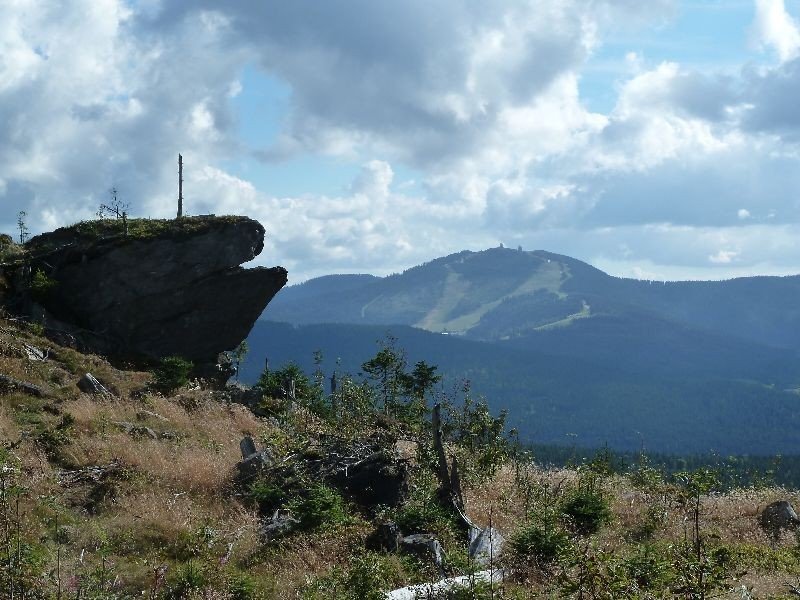
From the top you have a great view on the 'King of the Bavarian Forest', mountain Arber, and others. Follow the path alongside the Czech border slightly to the right and discover the remainings of hut Juranek, which was the first guesthouse hosting skiers in this area.
3rd stage:
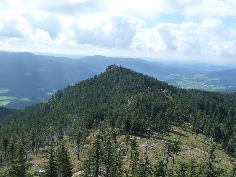
Follow the white and blue boundary posts for guidance. You will have a constant view over both countries and on the Czech side you can see lake Nyrsko. Before you reach the peaks Ossergipfel, turn right at a junction. Steeply ascend a few more meters and you will have reached Großer Osser at 1293m hight.
4th stage:
Take a rest at guesthouse Osserschutzhaus. A detour to the smaller mountain Kleiner Osser is definitely worth the trouble. There you can enjoy a great view across the Bavarian Forest. Kleiner Osser is easy to reach, simply follow the signs.
5th stage:
Start descending below the peak, follow the trails Goldsteig and L01. Now continue downwards on rocky paths and keep following the signs until you reach the parking lot Osserparkplatz. Now walk through Lohberg and you are back where you started the tour.
Interesting facts
- With an overall length of 22 km the hike is among the 10 longest hikes in Bavaria available on TouriSpo.
- Großer Osser via Zwercheck is among the 5 best rated Hikes in Germany.
- You shouldn’t forget to bring your hiking boots. There are some sections on the trail where sturdy footwear is required. There are places to buy beverages and food along the track. However it’s always recommended to bring enough water and food along with you.
Getting here
- Public transport: take the bus from Lam, Furth im Wald or Bayerisch Eisenstein towards Lohberg.
- By car: drive to Lohberg and leave your car at Bräustüberl car park.