Contents
Route description
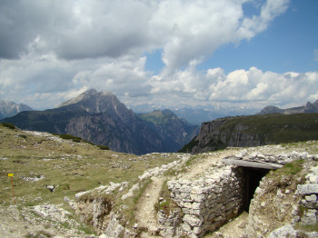
On the Monte Piano is located an Open Air Museum of the First World War. There you can see trench warfares, tunnels and emplacements located.
The summer-hiking tour starts at Carbonin. The hike starts 400 m after the crossroad in direction to Misurina at the left side. The path no. 6A crosses a streambed and goes uphill in the middle of the pine forest. Then it crosses a ditch with a wooden bridge and goes forward to the summit.
Sturdy shoes necessary
Overnight stay available
Eating options available
Interesting facts
- You're traveling a distance of 3 km on this strenuous trail. The hike is therefore not too long. Average length of all hikes in South Tyrol is 12 km.
- You're facing an uphill climb of 888 vertical meters on this hike. The high point of the hike is located at an elevation of 2,314 m.
- Sturdy hiking boots are recommended on this track. If you get hungry along the way, there are places to rest and get food. Nevertheless it’s recommended to also have enough water and food in your backpack when hiking or biking.


