Route description
The trip starts off at the football ground Campo Municipal de Fútbol in the town of Lajares. Cross the country road FV-109 to reach the Calle Los Quemados from which you will see the little community “Mimos” to your left – a plantation with yellow flowers from South America.
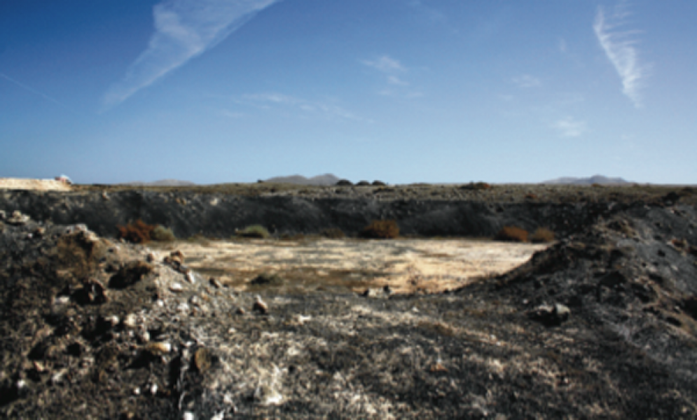
After a few bends on the road you will reach the end of the road. Turn left here. Next, you will pass the Casas de Arriba, the “houses at lofty height”, for 800 meters and get to the El Quemado. Make sure to also look at your left to gaze at the landscpae and the colors it got from the El Roque, a volcanic formation of the Calderón Hondo and the Colorada mountains. About 700 meters further you approach a gravy road and will see a group of deserted agaves that were traditionally used by the agricultural sector of the island. Their main function is to insert the draining off water of the terrain to supply the total water content for the seeds. You will also get to see many Maretas, big excavated ponds that are used to save rainwater. Both are typical methods to fight against the characteristic shortage of rain in Fuerteventura.
Meanwhile, continue on the road to see a water reservoir after approximately 400 meters. In a distance you can see the Escanfraga mountain, the biggest volcano of Fuerteventura with a height of 529 meters. After another 1.7 kilometers on the road you will reach a junction. Further away to your right is the Montaña de la Arena mountain whose streams of lava created a crater into the ground of the region. Remains of the lava streams are for example the lava field in the sand that was preserved well and covers an area of 12 square meters. Turn left over the Calle Llano de la Cueva and you will get to a paved street. Next pass the Centro de Interpretación de la Cueva de Llano to get to yet another junction after a turn. Turn left here and follow the Calle Cerco de Don Pable to the end. This marks the end of the tour.
Interesting facts
- With an overall length of 20 km the bike trail is among the 3 longest bike Trails in Spain available on TouriSpo.
- If you get hungry along the way, there are places to rest and get food. Nevertheless it’s recommended to also have enough water and food in your backpack when hiking or biking.
Highlights of the tour
Definite highlights of the tour are the South American plantations and agaves, as well as the view on the volcanesque world of mountains in Fuerteventura.
Getting here
With public transportation
You can easily explore Fuerteventura with public transportation. Check out the website of the bus company Tiadhe where you will find the most recent timetables.
By car
You can also rent a car on the island at numerous local providers.