


Route description
Start point in the middle of green
The actual starting point of your hike is at the bridge over the Caras, where you leave the city behind you and start your tour in a small forest area. On this first stage you can orientate yourself particularly well along the course of the river, because you always stay parallel to it and cross its path several times. Already after the initial kilometers you encounter the first cave called Pestera da după Cărșă, which should be on your right at the edge of the forest. From here you can slowly but steadily climb the slope and reach the so-called Pestera Liliecilor, which translates as "bat cave".
On the way to the cave Comarnic
You can also reach a small clearing at the cave, so that you can also orientate yourself well at it. After this you should already find the first signs in the direction of the Comarnic cave. In the following you have to do a small ascent, but still keep parallel to the river Caras. Shortly afterwards you cross it twice and then run continuously up the mountain, soon leaving the wooded area. You always move along the edge of the forest on the following kilometres before you run into the green again and thus directly reach your goal at the Cave Comarnic.
Where to eat
As there are no places to stop for refreshments on the actual route, you should take your own food with you in any case .
Interesting facts
- With an overall length of 19 km the hike is among the 3 longest hikes in Romania available on TouriSpo.
- Make sure to bring sturdy footwear on this track. Hiking boots are highly recommended.
Video
Highlights of the tour
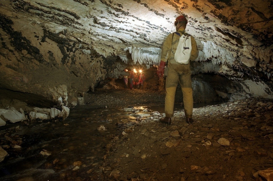
The clear highlight of your tour lies at the end of your hike at the Comarnic Cave. The dripstone cave is located in the so-called Anina Mountains and has a total length of 6300 m. You can visit only 1780 m of these, but they are worthwhile to get an impression of the impressive interior of the cave. This unique nature portrait is distributed on three levels. The first is relatively dry and is known as the "fossil floor". This can also be visited by you, as it has been made completely accessible for tourist traffic. On a middle level, the water collects from snow and other precipitation, so that you can only enter some of them with special clothing. The last level is known as the active level because it is permanently under water and therefore inaccessible. There are a lot of things to discover during a tour through the cave, so you should always look around carefully, because here you will find the most unusual structures such as organs or crocodiles.
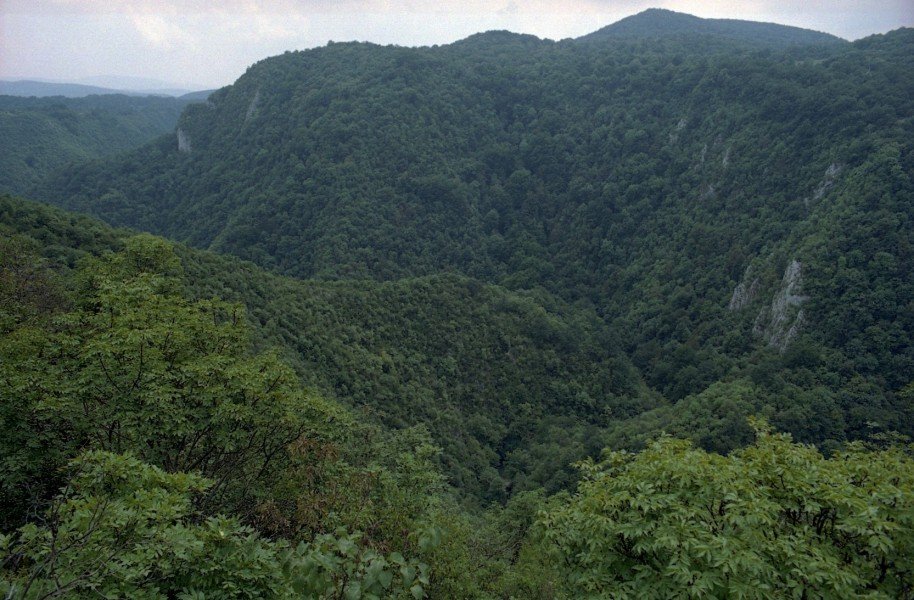
Another highlight is the unique landscape of the National Park Semenic-Cheile Carașului. This covers an area of around 36,200 hectares, on which it presents a diverse and unique natural landscape. So there is here the only beech-bannwald in the European area, which is already over 300 years old and thus already almost a historical natural property of Romania.
Equipment
On this hike you should wear sturdy shoes in any case, because the ground can be relatively slippery both on the route and during a visit to the cave, so that you need support in your feet.
Getting here
By car
From Lugoj
You first leave the city via the DN58A in the direction of Victor Vlad Delamarina and follow the road for approximately 41 km. Then you reach the junction with the DN58, where you turn right and cross the road through the last foothills of Resita. You continue to follow the DN58 until you reach Carașova and thus the starting point of your hike.
From Timisoara
On the E70 in the direction of Şag you first get out of the city centre of the big city and then change to the DN59, which you follow for about the next 53 km. When you arrive at Moravița, turn left onto DN57 and stay there for about 36 km until you can turn left onto DJ581. After some time you will see a sharp right turn on the DC75, which you follow to Carașova.
From Orșova
With the Strada Porțile de Fier and the DN57 you first drive a little bit along the Golful cema before you change to the DN6. Follow the road until you reach a fork where you turn left onto DC31. After a short time you will come to DN57B, where you turn left and follow the main road for about the next 68 km. After this the road makes a sharp left turn, where you turn right onto DN58 and after about 26 km you reach the junction to Carașova.
Unfortunately, parking is only possible on the side of the road, but behind the bridge at the river Caras.
With public transport
A bus departs from Resita to Carașova at regular intervals.