Route description
Kungsleden is also known as the King's Path in Sweden. It is divided into two major sections, the northern and southern sections. The northern route is about 440 km long and runs from Abisko to Hemavan. The southern part begins in Sälen and goes as far as Storlien. The distance is about 350 km.
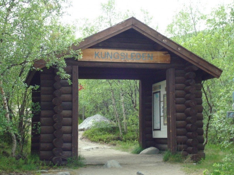
Since the northern part is the best known, a section is described here. Starting in Abisko, the trail leads you for one week over 106 km to Nikkaluokta.
Day 1: Abisko to Abiskojaure
The first stage of the day is mainly through a birch forest. You start at the gate behind the railway station in Abisko and go on a 14 km long hike to Abiskojaure. The mountain lake lies in the Swedish Abisko National Park and covers a total area of 279 ha. On your way to the lake you will notice that the forest is clearing more and more. In the national park it is not possible to stay overnight to protect the soil. However, there is a so-called Fjällstation at both the start and the finish point, where you can stay overnight for a fee. The national park ends about 3 km behind the lake. There are also free campsites.
Day 2: Abiskojaure to Alesjaure
On the second day a distance of about 22 km is planned. Behind the Abiskojaure the path leads steeply up to the tree line. Before descent, you should take the time to look at the landscape, otherwise the route is often described as very varied. Before you make your way to the huts for the overnight stay, you will hike along the lake Alisjavri for a while. In winter the route crosses the lake.
Day 3: Alesjaure to Tjäktja
The third day leads you to Tjäktja Fjällstuga, a hut just before the pass, which you will cross the following day. The way there is always uphill and that is 13 km. Already after about 3 to 4 km you can see the huts. In the area of the huts you can already come across snow in summer.
Day 4: Tjäktja to Sälka
The route to the next mountain hut, the Sälka, leads you first over the highest point of the Kungsleden - the pass between Tjäktavagge and Stuor Rältavagge in the Kebnekaise massif. If you have memory photos planned, then this is the perfect place to take them. Summer and winter the view from up there is indescribable. The destination hut is not visible from the path, so you cannot orientate yourself on it.
Tag 5: Sälka to Singi
The day trip of about 12 km takes you through hilly areas along the river. You will always get a good view of the surrounding valleys. If the weather is good, you may have the chance to see Kebnekaise. At 2,104 m, it is Sweden's highest mountain. After covering about 50% of the distance, you will come across a windscreen. From there it is only a few kilometres to Singi-Fjällstuga.
Day 6: Singi to Kebnekaise
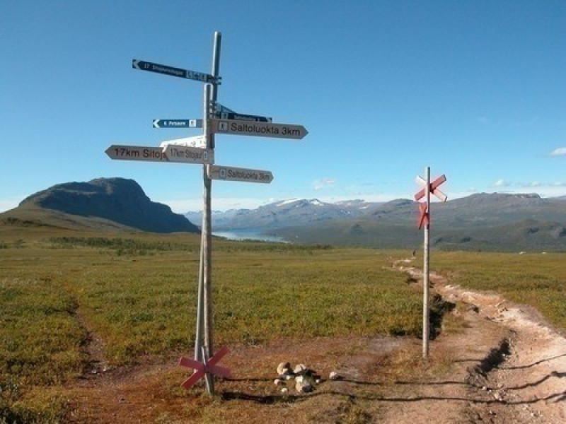
In itself the tour in Singi would be over. However, there is no way to return to the starting point from there. Therefore, many hikers continue via Kebnekaise Fjällstation to Nikkaluokta. This is about 14 km. You'll move over a pass again this way and you'll feel like you're diving into a wilderness. The most important thing there is that there is no mobile phone reception.
Day 7: Kebnekaise to Nikkaluokta
For the last stage you should plan four to six hours of hiking and take regular breaks. On the way there are many streams and most of them you can see the mountain Tuolpagorni. The mountain is situated in front of Kebnekaise and is characterised by a snow-filled cauldron, which is an interesting sight especially in summer. However, you should not forget to keep your eyes on the ground, as it is very narrow and uneven there.
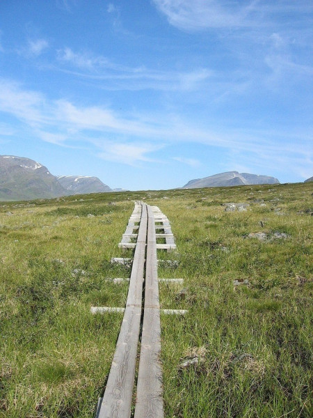
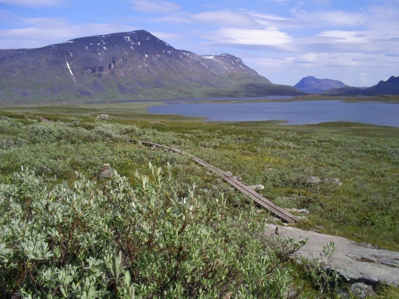
Shortly before Nikkaluokta the path runs through a birch forest and through moors, which you cross with footbridges.
Nikkaluokta is called the coldest place in Europe in winter. It is a village near Kebnekaise and is therefore often used as a starting point for hikes to Kebnekaise.
Where to eat
On the track there are only places to stop for refreshments at the start and at or shortly before the finish, so that you are responsible for your provisions yourself. However, there are numerous huts on the way, so there are cooking opportunities.
The Abiskojaure Fjällstuga lies on the lake of the same name, which you reach at the end of the first stage.
The Alesjaure Fjällstuga is one of several huts on Lake Alisjavri. It lies on a hill and therefore offers a good panoramic view.
The Sälka huts offer you not only the possibility of staying overnight but also the possibility of replenishing your provisions.
About six kilometres before the finish in Nikkaluokta you reach the Kaffekåta and the Lap Dånalds. With coffee and cake or a reindeer burger you can review the whole hike once more.
Interesting facts
- You're facing an uphill climb of 2143 vertical meters on this hike. This is quite much. You should be fit to do this track. The high point of the hike is located at an elevation of 1,146 m.
- Sturdy hiking boots are recommended on this track. If you get hungry along the way, there are places to rest and get food. Nevertheless it’s recommended to also have enough water and food in your backpack when hiking or biking.
Videos
Highlights of the tour
If you like to go to the sauna, you can also enjoy this on the highest point of the hike. In addition to ordinary mountain huts and a storage room, the Sälka huts also offer a sauna.
At the huts as well as shortly after on the pass, you have the best View on the surroundings and should therefore not forget to capture this moment with a camera.
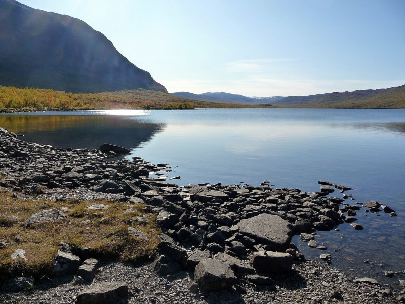
You will also pass some lakes on your way. The Abiskojaure hut, for example, offers a beach that you can use.
Variations
The walk can also be done in reverse order. However, the described direction is to be recommended, since the sun always shines in your face like this.
If you are running the hike in winter, you can, for example, shorten the route on day 1 by skiing at Alesjaure.
The second stage can be shortened in summer by covering the last 7 km by boat. However, this service is subject to a charge.
At stage five a windbreak was mentioned which you will reach on the track. From there you can take a shortcut to the Kebnekaise-Berghütte. You shorten the distance by about 3 km.
Equipment
For the hike you should definitely think of warm clothes, as the weather can always change. You should also have hiking shoes or at least waterproof shoes with a good profile. As the tour lasts several days, you should also think of a tent or sleeping bag as well as provisions.
It is important, the less the better, because you will notice the weight on your back over time.
Getting here
Travelling by plane
The nearest airport near Abisko is Kiruna Airport. It is about 100 km from Abisko.
Other possibilities would be the airport in Bardufoss and the airport Harstad/Narvik. Both are located in Norway and are between 120 and 160 km away from Abisko.
Arrival by train
If you want to travel by train, the station in Stordalen is the best place to go. This is about 9 km away from Abisko. Alternatives would be the stations in Björkliden, Kopparåsen and Kaisepakte. These are between 10 and 20 km from the starting point.
Arrival by car
The vehicle, be it your own or rented, is the best way to get around Sweden and, above all, to get to the starting point.
From Kiruna to Abisko and from Harstad/Narvik to Abisko the road E10 leads. From the airport in Kiruna Flygfältsvägen-Straße leads directly to the E10, from the airport in Harstad it is 833. It is important that Harvik is located north and Kiruna south of Abisko.
The airport in Bardufoss is located north of Abisko. First you have to take the E6, but change to the E10 at Haersletta Camping.
All railway stations mentioned above are also located on the E10. All you have to do is find out if you have to stay east or west.