
Description
The Kakadu National Park is the largest of its kind in Australia and encompasses a surface of almost 20,000 km² (2,000,000 ha), presenting an astonishing range of flora and fauna.
Various Landscapes
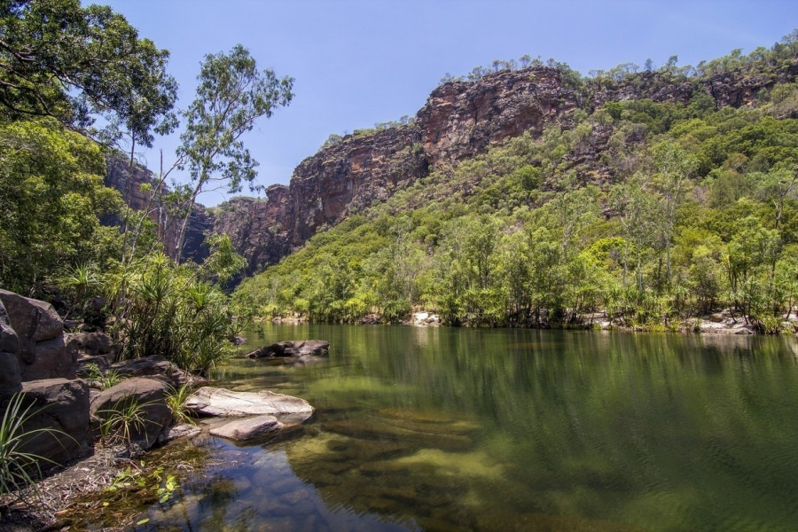
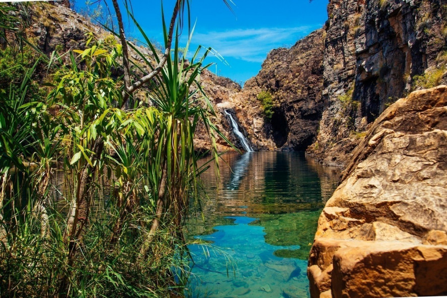
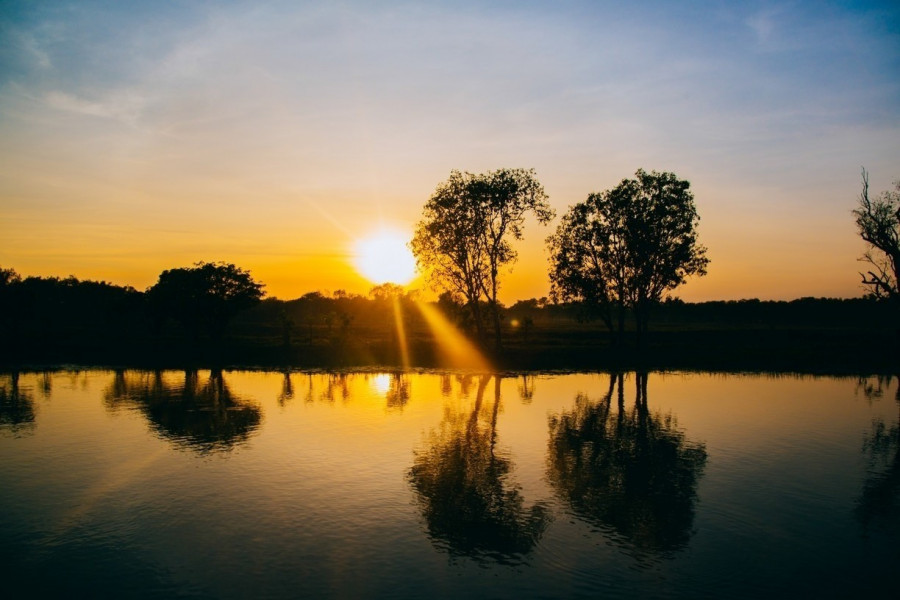
If you keep driving through the entire park all the way to the end, you'll discover the miraculously changing landscapes. The northern part is a coastline characterised by flat plains and tides. The area is hard to reach as it is surrounded by mangrove forests. The best access point is “West Alligator Head”. Further inland, the planes are predominantly characterised by marshland. At some places you see rainforests with waterfalls.
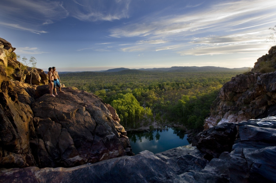
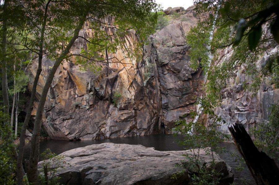
The following part of the park can actually be best seen from the air. If you're not up in the air, you might come to benefit from a cosy bus ride. Comfortably sitting in the bus, you may observe a rocky landscape where the rocks can reach a height of up to 984 ft (300 m) as it becomes obvious with the Arnhem Land Plateau. The plateau's summit belongs to the drier areas. The ground is rugged and the water dries up quickly. In the dry season, animals that have their habitat here find shelter in the rainforests surrounding this area. If you like to go on a hike, the best places to start at are Ubirr and Nourlangie, both offering stunning views over the entire area and the forests.
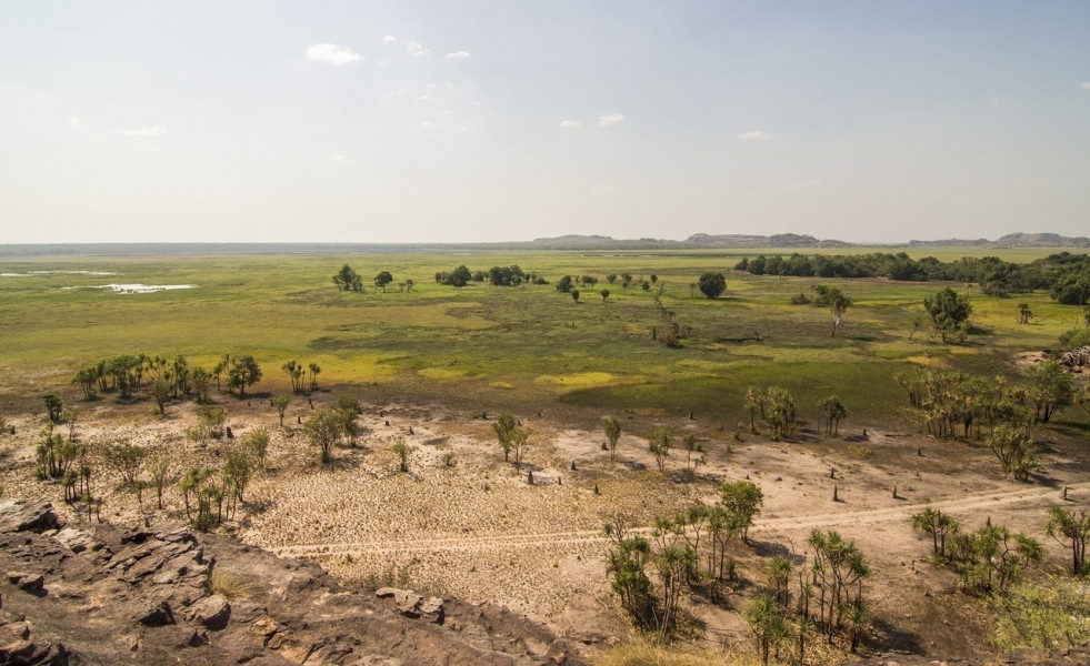
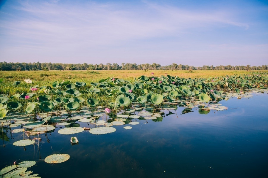
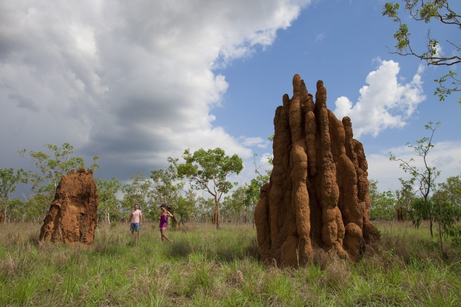
Almost 80 per cent of the National Park consist of savannah, also called “lowlands”. Apart from eucalyptus forests and high grasses, a wide range of plants and animals are home to this area. You may get to see animals such as dingos, wallabies or parrots. With a bit of luck you might spot a sand goanna, a large Australian monitor lizard that has nowadays become a rarity. A very special highlight of this area, as you'll discover, are the termite mounds that might reach a height of up to 20 ft (6 m) and up to 60 years of age. Contrary to the rocky landscapes, the marshlands around Yellow Water and Mamukala are humid and muddy throughout the year so that many animals can seek refuge here during the dry months of the year. It's recommended to explore the area by boat.
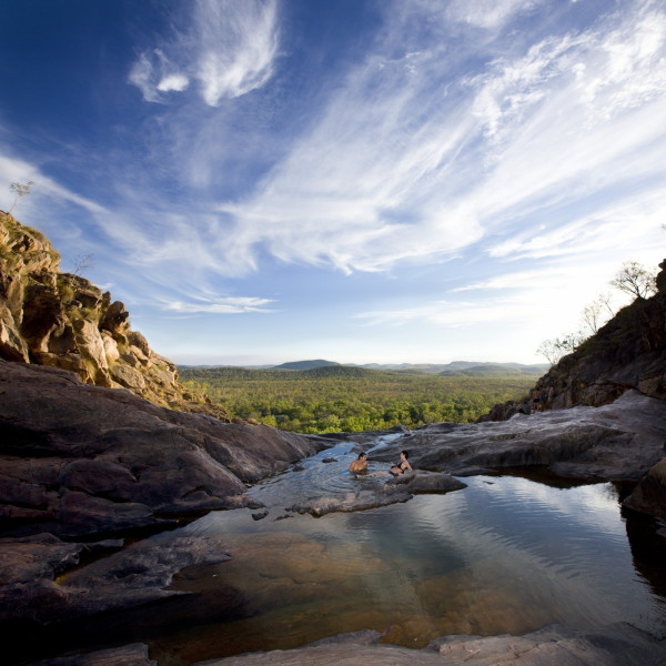
A mountain landscape can be found in the southern parts of the park that can be well seen from the Gunlom Waterfall and Yurmikmik. Apart from the antilopine kangaroo and the black-breasted buzzard kite, you may also get to see rare birds such as the Gouldian finch which belongs to the species of estrildid finches and red goshawk that are home to this region.
Six Different Seasons
Australia's rainy season starts in November and lasts until April, followed by the dry season from May to October. The area around the Kakadu National Park has remarkable six different seasons. The time of the monsoon is from December to March, also known as Gudjewg. Temperatures are between 24° and 34°C (75.2° and 93.2°F) and severe weather conditions prevail. The area is then dominated by storms, heavy rain and floods and thus has an incredible growth. Here you can observe torrent waterfalls and bright lightnings.
April is the month of storms. This time of the year is called Banggerreng and temperatures are between 23° and 34°C (73.4° and 93.2°F). While the floods continue going back and the sky clears up, gales lash the area. The blossoming paper-bark maple that is a home to numerous water birds is a feast for the eye.
The period between May and the middle of July is described as a relatively cool, but humid season and is called Yegge. Under the existing average temperatures between 21° and 33° C (69.8° and 91.4° F), the area is haunted by strong winds drying out the land. According to aboriginal believe it is this time of the year that the cleansing of the land starts.
From the middle of July to the middle of August a cold front comes up in the area, called Wurrgeng. Temperatures start at 17°C (62.6°F) at night and go up to a maximum of 32°C (89.6°F) at daytime. Most rivers dry up during this period as much as the flooded plains do.
The actual dry season starts around mid-August, lasting till October and reaches temperatures from around 23°C (73.4°F) up to 37°C (98.6°F).
The pre-monsoon time, also known as Gunumeleng, starts after the dry season that lasts up to just before the end of December with temperatures ranging from 24°C (75.2°F) up to 37°C (98.6°F). This season seems to be quite flexible in time as it may last only few weeks or up to several months. You never know! Even though it's the time before the real monsoons start, one can already feel that the air becomes more humid, the dried riverbeds start getting their water back, the flat plains are flooded again and the weather is quite stormy in the afternoons.
Exploring the National Park
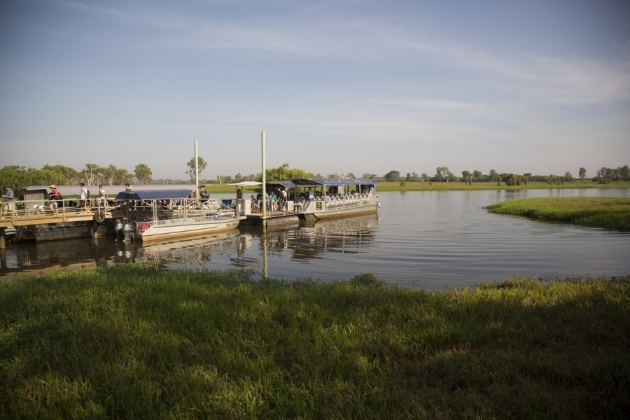
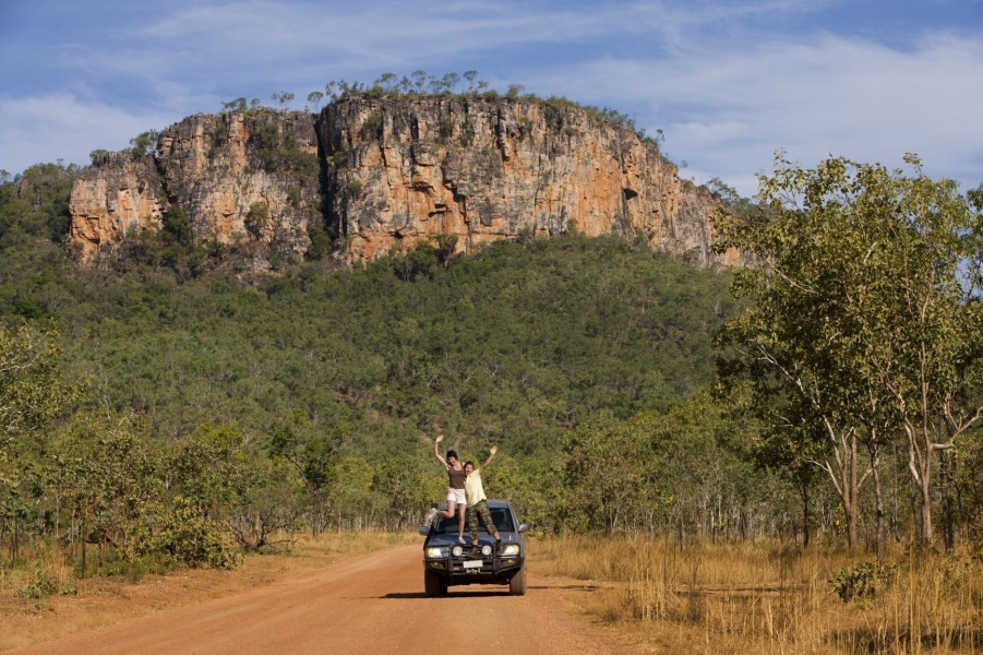
The park can be explored in so many ways, by car, by boat or simply on foot. You rent an off-road vehicle and drive to the Koolpin Gorge or you visit the spectacular Jim Jim Falls during the rainy season. It's recommended to explore the “East Alligator River” only by boat. You may grab a canoe and paddle to the “Twin Falls” or explore the rain forest on foot.
If you intend to stay for a longer period, you shouldn't miss walking along “Nature's Way”, beginning in Darwin. The way covers the original wetland and allows anyone walking it to learn more about aboriginal culture. The Kakadu National Park accommodates the world's largest collection on rock art. As a real adventurer it's a must to follow the traces of Crocodile Dundee walking to the Gunlom Falls. If you wish to learn more about the Aborigines, their rock art and discover the park's flora and fauna, there are plenty of information panels helping you do so. Guided tours are also offered.
Historical Information
The Kakadu National Park was listed a “World Heritage Park” in 1981 and thus declared a world heritage and natural site. The process of becoming a listed national park took place in the period between 1979 and 1991. Meanwhile, the park has grown to an astonishing 20,000 km² (2,000,000 ha) of total surface. The aboriginal language uses the word Gagadju for the national park.
The Australian aboriginal language uses the term Gagadju for the national park. It is assumed that the settlement of the Aborigines was founded in this area during the Dreamtime, which is a mythological term that describes how the “Now” has developed in a universe free of time and space.
More than half of the park is owned by the Bininj/Mungguy Aborigines. The entire park is managed in co-operation with “Parks Australia”.
Interesting facts
- Kakadu National Park is among the 3 best rated Tourist Attractions in Australia.
- The day pass at Kakadu National Park is AUD40 making it the cheapest tourist attraction in Australia.
How to get there
By Plane
To make sure you land as close as possible to the Kadadu National Park, it's best if you fly to Darwin Airport, an international airport located only 250 mi (400 km) away from the national park. From Darwin you may fly to the national airport Jabiru that is way closer to the park than Darwin International Airport.
By Car
Once in Darwin, you have two possibilities to continue your journey to the national park. You may opt for either Arnhem Highway or Stuart Highway. While the first one leads towards the east with changing to the Kakadu Highway at Jabiru, the other takes you further south. As soon as you arrive at Pine Creek, you need to change to the Kakadu Highway as well, with the only difference that you carry on towards the north. You find the national park located half way of Kakadu Highway.
Please note:
The Stuart and Arnhem Highways are both used as a traffic line for so-called road trains, trucks that can be up to 55 yd (50 m) long. Due to their length, breaking is tough work for the lorries. If they have to break, they are only able to do so very slowly. This is why it is recommended to drive most cautiously and carefully when on Stuart or Arnhem Highway as you might quickly face the danger of a collision with road trains. If you intend to pay a visit to the national park during the rainy season, you might encounter some closed roads due to the floods.
Starting your journey at Jabiru, there is only one possible way to take the Kakadu Highway towards the south.