Route description
From Sinaia to Bolboci Lake
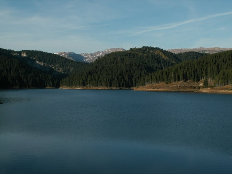
You start your bike tour just outside Sinaia at the foot of Vânturiș, where the DJ713 meets the next junction. Turn left at this road and follow the main fortified road, which runs mostly through the forest. The route is relatively flat during the first stage of the tour and sometimes leads you a little downhill, so that you can relax here. You continue to follow the course of the road and soon meet the course of the river Ialomița, which you follow until it flows into Lake Bolboci. At this point you can also take your first break, because the view over the lake can really be seen and is always a nice scenery for a few souvenir photos, especially in good weather.
An outlook in a class of its own
To really enjoy the landscape around the lake, the path will continue to lead you along it. Shortly before the beginning of the lake the path forks, where you choose the left branch and always cycle along the foot of the mountains. At the beginning, the route takes you through the forest before you reach a clearing on a side arm of the lake, where you again have a beautiful view over the water. In the following the cycle path leads you further along the lake, until it ends together with the valley and you can orientate yourself again at the river. After a short time the course of the river forks and the paved path on which you still move, following the road.
About the ridges back to the valley
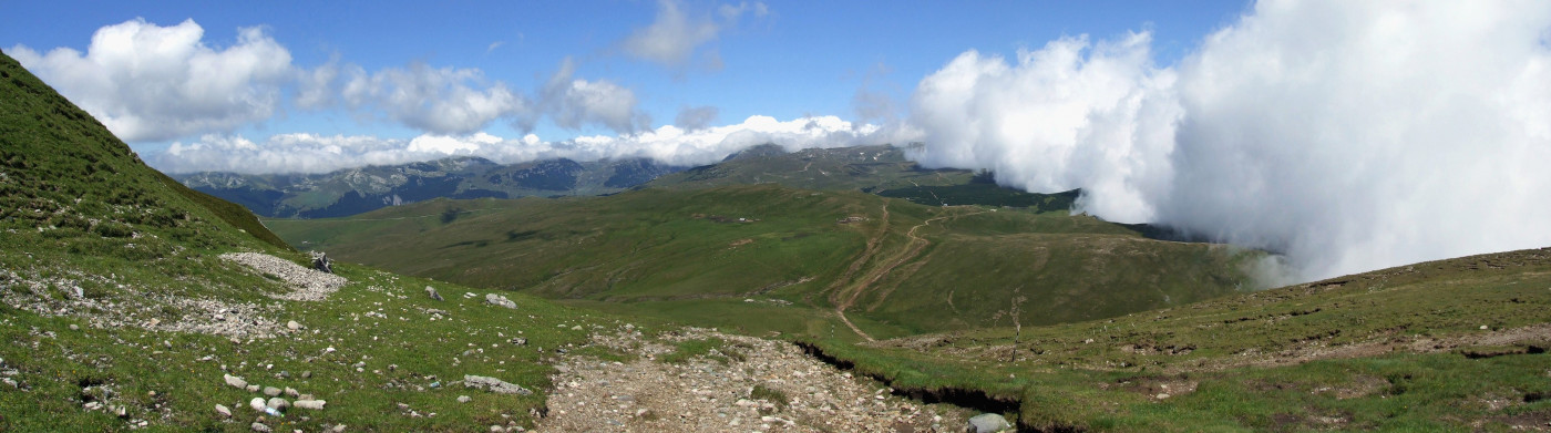
In the following you now leave the flat part of the route behind you and start slowly but steadily to the first ascent of the tour. So you reach the highest point of your bike tour at over 2000 meters between the Baba Mare and the Cocora, so that you get here the next panoramic view. After this further stopover, you will have completed the strenuous part of the tour, because from here the path leads you only downhill, so that you can no longer invest much romping work. You continue over the mountain ridges until the path leads you back to the valley and you automatically reach the starting point of the tour.
Where to eat
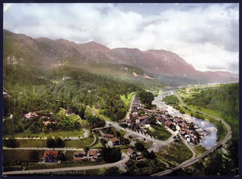
On the round trip itself there are no significant places to stop for refreshments, so you should definitely take food with you for the actual route . Before and after the tour you can eat in the nearby town of Sinaia, where you should find some cafes and restaurants.
Interesting facts
- You're traveling a distance of 32 km on this moderate trail. Average length of all bike Trails in Romania is 73 km.
- Elevated between 1,371 m and 2,207 m, the bike trail is the highest elevated bike Trails in Romania. You're facing an uphill climb of 1262 vertical meters on this bike trail.
Highlights of the tour
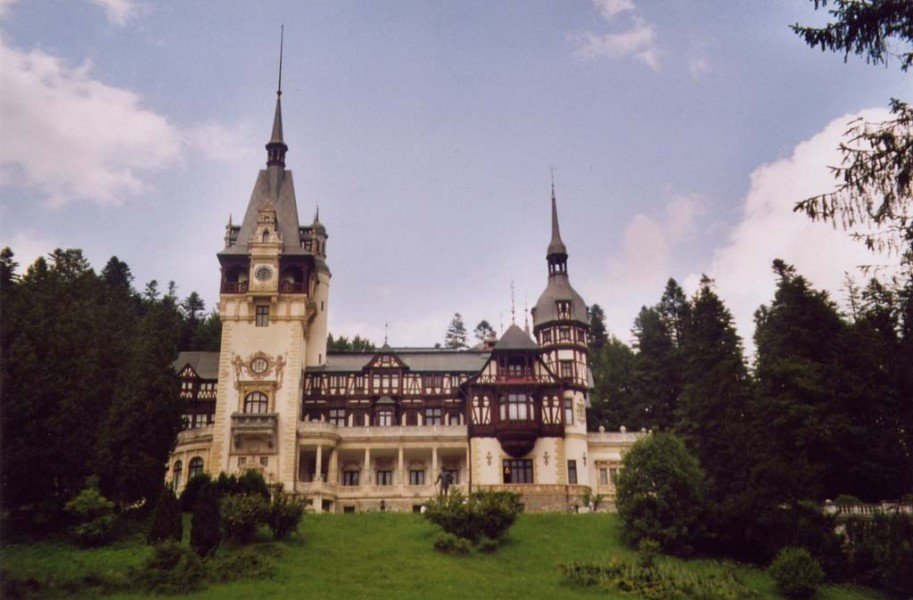
Landscape-wise the Bolboci Lake is a clear highlight, so that you should take a little more time especially for the stages at this water. The exertions on the bike tour are also worth it, as you will be rewarded with a a great panoramic view. If you want to discover more sights, you can also combine your bike tour with a visit to Sinaia, because there is a lot to see here, especially with regard to historical buildings. In any case, the castle Peleș is recommended, which stands out especially due to its lovingly designed appearance. You can also visit the monastery of Sinaia, where you will not only get to know another historical building, but also get more information about the origins of the city.
Video
Variations
Since this is a circular route, you can of course also drive the tour in the opposite direction without any problems.
Getting here
By car
From Brașov
You leave the city via Strada Timișul Sec and continue to follow the road until you can switch to DN1. Follow the main road for about the next 40 km and keep right if you can turn off onto Strada Badea Cârțan This will take you to DN71, where you turn right and follow the road until you reach DJ713 via a sharp right turn. This will take you directly to the starting point of your bike tour.
From Târgoviște
You first take the DN71 in the direction of Aninoasa and follow it for a few kilometres to Pucioasa. Here you take the second exit at the roundabout to stay on the DN71 and follow it for another 22 km. Then turn left onto DJ714 and then follow DJ713A, which will take you directly to the starting point of your bike tour.
From Ploiești
You leave the city via Bulevardul Republicii and then change to DN1, which you follow for about the next 54 km. The road takes you to Sinaia, where you keep left and then continue on DN71. This will lead you to a sharp right turn, via which you switch to the DJ713. This will take you directly to the starting point of your bike tour.
With public transport
Sinaia can be reached from almost all directions by various long-distance buses. The remaining kilometres to the starting point you have to cover by bike.