 in the Black Forest: Position on map")


Route description
Starting at the train station in Waldshut, bike towards the boardwalk of the river Rhine. Along your way you will pass many sights of Waldshut. Now follow the river downstream until you reach Dogern, where you cross the river and enter Switzerland.
The trail leads further along the south side of the river through the Swiss canton Aargau, where you will have many opportunities to stop and take a break. You will eventually get to a hamlet called Rheinsulz, from where you should follow the trail towards the Jura Mountains of Aargau. Continuously ascending, the trail now leads through woods and meadows and becomes significantly more challenging than the first part. On your tour you will get to various hamlets and observation points with a great panorama. Definitely worth a visit is the grotto of Lourdes, which you will get to on your way to Leuggern.
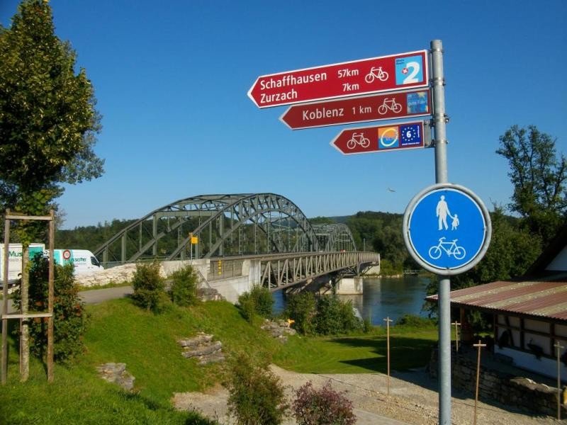
At this point the challenging part of the tour will be over. You'll reach the hamlet Klingnau and its reservoir, which is known for its biodiversity. The trail continues past the reservoir along the river Rhine until you reach Koblenz, where you cross the river to get back to Germany. Now continue until you get back to where you started.
Notes
During the tour you will have to cross busy roads, please be careful.
Since the tour leads through Germany and Switzerland you should have your ID on you.
Interesting facts
- You're traveling a distance of 46 km on this moderate trail. Average length of all bike Trails in Baden-Württemberg is 106 km.
- If you get hungry along the way, there are places to rest and get food. Nevertheless it’s recommended to also have enough water and food in your backpack when hiking or biking.
Highlights of the tour
The observation points, where you can take a rest and enjoy the beautiful scenery, are particular highlights.
Getting here
By car:
Take either B500 or B34 to Waldshut. Parking is available at the Kornhaus in Waldshut.
By public transportation:
Take the train to Waldshut, which is convenient because the train station is the starting point of the tour, or take the bus and get out at the central bus station in Waldshut.
Starting point is the train station in Waldshut.
