

Route description
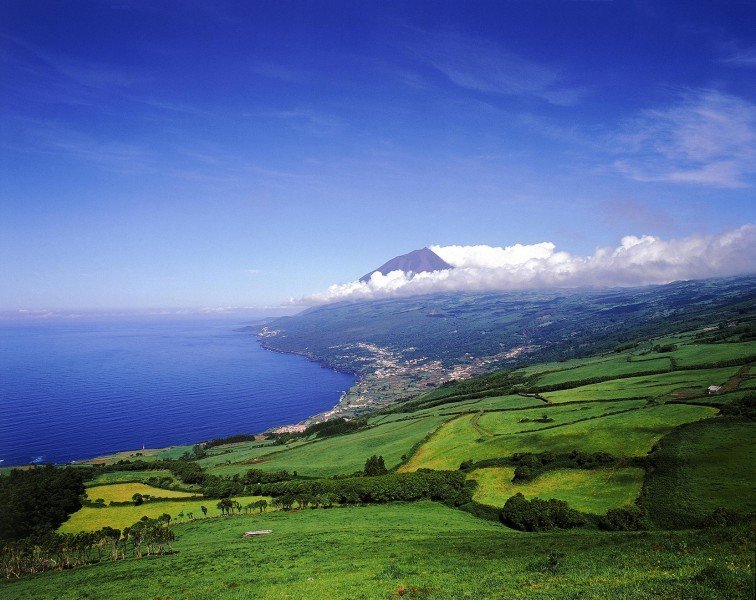
The Caminho the Voltas is located on Pico, the second largest island of the Portuguese Azores. The island was named after the 2,351 meter high volcano Ponta de Pico, which is the highest mountain in Portugal. The hike is 6.3 km long and can be walked in round two hours.
From Terra Alta vantage point to Santo Amaro
You start at Terra Alta viewpoint, located between the two municipalities of Ribeirinha and Santo Amaro. The destination of the hike is the center of Santo Amaro. First you walk along a small footpath that leads you downhill through a forest. You pass by the remains of vineyards and cross small stone bridges, which still today bear witness to the former importance of this path. The line used to be the main connection to Ponta da Ilha.
After leaving the forest, you cross an area with small fields used to grow small vineyards, which is typical for the island. On the left side you can see an abandoned building which was once a small local butter factory. Even today you can see the equipment used to make the butter.
Little by little you approach the coast. You leave the main road and go to Baía do Canto, a small leisure area by the sea surrounded by wine cellars. Then you return to the main path and follow the coast. The Tarmac Road leads you to the center of Santo Amaro. On your way you will pass the Parque da Furada, a picnic area. In Santo Amaro itself the old shipbuilding yard, the Maritime Museum and the crafts school are worth seeing.
Where to eat
At Baía do Canto you pass some wine cellars where you can take a break. The Parque da Furada invites you to a cozy picnic. In the destination Santo Amaro there are other places to stop for refreshments.
Interesting facts
- The hike is one of the family friendly trails in the region. The hike is also perfect if the kid’s wanna bring their dog on the trip.
- Hiking boots are not required, but the hike might be more enjoyable with sturdy footwear (especially in wet conditions).
Equipment
The hike is quite easy, so comfortable shoes are sufficient. You should also take something to drink and a little bit food.
Getting here

The best way to get to the Azores is by plane. There is a airport in Ponta Delgada, the capital of the Azores, which is located on the island of São Miguel. From there, there is ferry traffic to the other Azore islands. The island of Pico can be reached via the port Cais do Pico. The road ER1 always runs along the coast around the island. You can use them to get to the starting point of the hike.