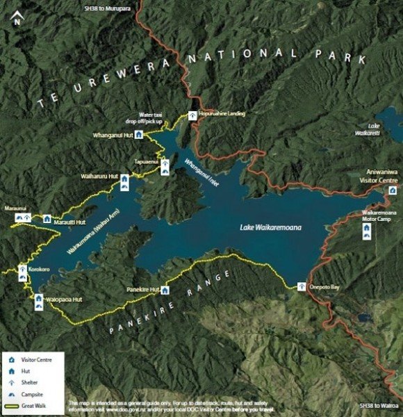
Hike Lake Waikaremoana Track at Lake Waikaremoana: Position on map

Hike Lake Waikaremoana Track

Lake Waikaremoana Track

Elevation

Min: 591 m
Max: 1,179 m
Uphill: 1,873 m
Downhill: 1,736 m
  • Upload GPS data
About the author
last update on 12 Sep 2016
Rate the Hike
0
(3)
Travel Deals & Tips
Advertisement
Advertisement
Advertisement
Facts
Difficulty
Moderate
Distance: 41.49 km
Duration:4 days
Min: 591 m
Max: 1,179 m
Uphill: 1,873 m
Downhill: 1,736 m

Trail characteristics

Dirt road
Forest track
Hiking trail

Webcams

Unfortunately, there is no webcam available yet!

Interesting facts

Read more
  • With an overall length of 41 km the hike is among the 3 longest hikes in New Zealand available on TouriSpo.
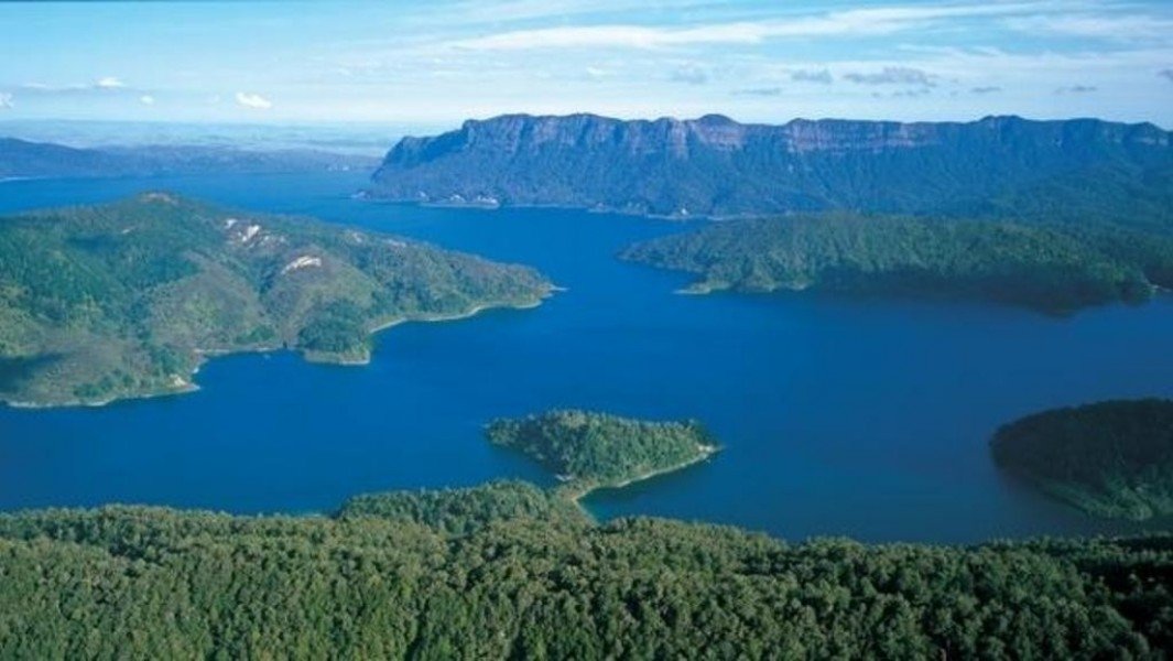
  • Lake Waikaremoana Track is the the best rated hike in New Zealand.
  • Elevated between 591 m and 1,179 m, the hike is among the 3 highest elevated hikes in New Zealand. You're facing an uphill climb of 1873 vertical meters on this hike. This is quite much. You should be fit to do this track. This makes the hike one of the 3 hikes with the most ascent in New Zealand.
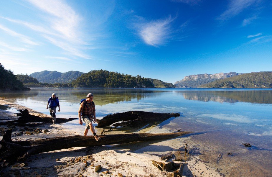
  • Sturdy hiking boots are recommended on this track.

Contact

Te Urewera Visitor Centre
House 2 Aniwaniwa Aniwaniwa Corner of SH38 and Aniwaniwa Road
4195
Te Urewera National Park
E-Mail
%74%65%75%72%65%77%65%72%61%76%63%40%64%6f%63%2e%67%6f%76%74%2e%6e%7a
Phone+64 6 837 3803
Fax+64 6 837 3722
Travel Deals & Tips
Advertisement

Comments

Rate the Hike
No posts available yet:
  • Nobody has posted on the wall of the Hike "Lake Waikaremoana Track" yet
  • Be the first to comment!
Login with Google+
  • Share your personal insider tip and create new entries
  • Explore fantastic outdoor destinations when and where you want
  • Find your dream destination or discover the world on the interactive map