Route description
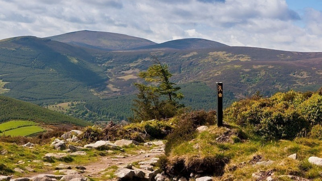
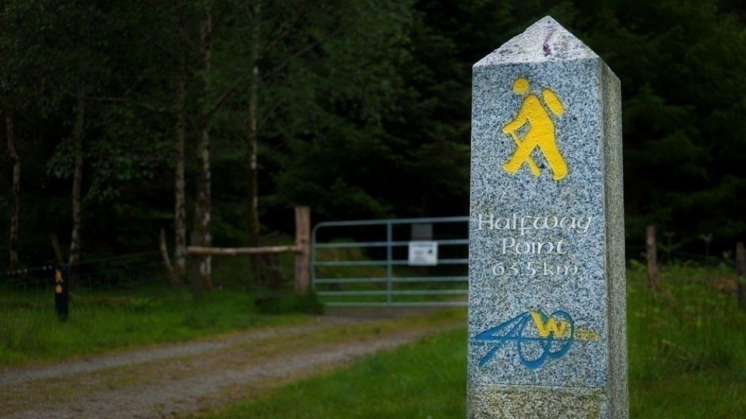
The Wicklow Way is one of Ireland's oldest, and most popular hiking trails. Traditionally the trail – which is part of the E8 European Long Distance Walking Trail – is hiked from north to south, but hiking it in the reverse way is also an option. The trail entails seven stages, which you can adapt according to your fitness. The trails are well signposted by the typically Irish hiking trail symbols – the small yellow hiker and an arrow.
The First Leg: Marlay Park – Knockree (21 km)
The Wicklow Way starts at the carpark beside Marlay House, with its courtyard full of craft producers and a nice little café. The way leads you through the beautiful parkway of the small suburb to the tunnel of the motorway M50. Here begins your first ascent south through a forest towards the Dublin Mountains. You pass Kilmashogue Mountain and the Moorlands of Fairy Castle (536 m), where you walk between the Two Rock and Tibradden Mountain and after about 9 km reach Glencullen road near Ballybrack. Along this road you go east until you get to the Glencullen River, where the trail turns south again. A slight ascension on country roads leads you to Prince William Seat, from where you continue downwards on winding roads. You will then find yourself on the Enniskerry road, north of the destination Knockree.
The Second Leg: Knockree – Roundwood (18 km)
The second leg of the hike leads you over the valley of the Glencree River, east of Knockree, to the Crone Wood parking area. From here, you steadily ascend with a great view over the impressive Powerscourt Waterfall, which - with an altitude of 121 m - is the tallest in Ireland. Soon the trail leads you through an open pasture landscape, where you cross the River Dargle and tackle an ascent of about 600 meters on the east side of the Djouce Mountain. The way leads you over the White Hill – that marks the highest point of your journey at 635 m– to an elevated path through the bog. After passing through Ballinastoe forest, you will have already arrived at the nice little place named Roundwood.
The Third Leg: Roundwood – Glendalough (12 km)
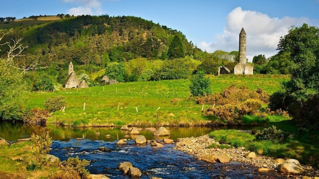
As this lap takes only about four hours to complete, it is often combined with the fourth leg. To the north of Roundwood you walk for about 3 km along a public road to Drumray where you turn right onto another field track, north of mount Paddock. After having passed this hill, you reach the Glenmacnass road, which you follow until Brockagh forest. At the forest, you will find signposted a nice forest trail and follow this for a good while. As soon as you arrive in Glendalough, you will find yourself in the heart of the Wicklow highlands at the junction of four major glacier valleys: Avonmore, Glenmacnass, Glendasan and Glendalough.
The Fourth Leg: Glendalough – Glenmalure (14 km)
The Wicklow Way now leads you past the visitor centre to a huge valley where you cross the River Glendasan and walk up to the fascinating Waterfall Poulanass. At this beautiful spot, the way leads to the Lugduff Valley and what follows is a 5 km long ascent at the shoulder of Mount Mullacor. On your descent, you will then have a wonderful panorama view over Glenmalure Valley and its mountains.
The Fifth Leg: Glenmalure – Moyne (21 km)
This is now a longer phase of the Wicklow Way, leading you through the southern highlands. The leg begins with a slight ascension along the idyllic, forested hillsides of Slieve Maan. For about 6 km you walk along an old military road until the road circles the upper slopes of the Carrickashane Mountain. After a short descent to the railroad bridge in the valley of the River Ow, a leisurely ascent over the Ballyteige Bridge follows. The leg ends with a quiet road at the tiny but picturesque village Moyne.
The Sixth Leg: Moyne – Shillelagh (21 km)
After many legs through the mountains, this stage is distinguished by soft hillsides and meadowlands. Coming from Moyne, you hike on an easy trail around Mount Ballycumber to Tinahely. There, you will reach the lively road of Hacketstown, which is in high-contrast to the next environment you will walk through. After passing meadows with colourful palettes of wild growing flowers, your hike continues for about 6 km along a busy road (R725) to Shillelagh.
The Seventh Leg: Shillelagh – Clonegal (19 km)
The last stage of the Wicklow Way begins with a hike through the Raheenakit woods, which offers you shade on a hot summer's day. Afterwards, you circle the Stokeen, Moylisha and Urelands hills, that are in great contrast to the previous landscape. The last kilometers lead through the valley of the River Derry, where the Wicklow bridge marks the border between Wicklow and Carlow. The Wicklow Way ends in the scenic park of Clonegal.
Where to eat

In Ireland it is generally allowed to camp wildly outside of private properties and nature reserves. However, the Wicklow Mountains National Park offers diverse exceptions which are signposted, so that a night amidst nature is no problem. Additionally, the different stages have special shelters for hikers.
Each leg of the journey provides possibilities for stopping for refreshments, however it is indispensable to take a care packet with you for the way. These small meals as well as your luggage can also, against a small charge, be transported by the Wicklow Way bus.
Tallon's Pub is very much recommended for refreshments. The pub – better known as The Dying Cow Pub – is at the Stranakelly Crossroad in the last leg of the way. The story goes that the former owner of the pub had been paid a visit by the police one night, who accused her of serving drinks until late in the night. The owner argued that she only offered her neighbours – who were helping her with a dying cow – a drink. Since then, the pub is well-known for its large selection of tasty beverages.
Interesting facts
- You shouldn’t forget to bring your hiking boots. There are some sections on the trail where sturdy footwear is required. If you get hungry along the way, there are places to rest and get food. Nevertheless it’s recommended to also have enough water and food in your backpack when hiking or biking.
Video
Highlights of the tour
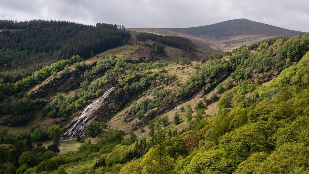
The impressive Powerscourt Waterfall is with its 121 meters the tallest in Ireland. It is idyllically embedded into the Deerpark landscape at Djouce Mountain.
Glendalough Valley is well-known for its historic monastic site, one of the most famous of the Emerald Isle. Probably the most significant monument is the 33 meter high round tower that, in 1066, was used as a protection for religious items.
Variations
It is of course no problem to shorten the Wicklow Way and turn it into, for example, a four day tour. For this alternative you hike the described three legs, but instead of staying overnight in Glendalough, you continue to Glenmalure Valley.
Getting here
By car
Coming from Dublin Airport
Described here is the route via the ring road (30 km) – alternatively you can also drive through Dublin (20 km), for which though you need to plan about an hour of your time, as traffic in the city is problematic. You are on the M50 direction Ó Dheas/Southbound. After about 20 km you take the exit 12 towards Cnoc Lín/Knocklyon/ R113 and keep left. At the following three roundabouts you each take the second exit, and at St. Endas Park turn right onto Whitechurch Road. After about 1 km Marlay Park will be on your right side.
By bus
Coming from the airport you walk around 100 meters to the stop Great Southern Hotel. There, you take the line 16 (Dublin Bus) direction Ballinteer, which goes through Dublin city. After about 1,5 hours, you arrive at the stop Grange Road (Highfield Avenue). From there, it is two minutes by foot to Marlay Park.