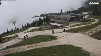
Webcam located at mid station of Jenner Mountain.
4 minutes ago
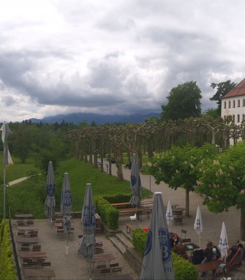
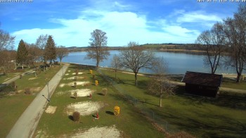
Webcam located at Seeblick Hotel near Lake Thumsee in Bad Reichenhall
5 minutes ago
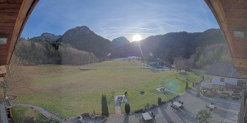
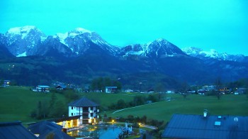
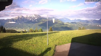
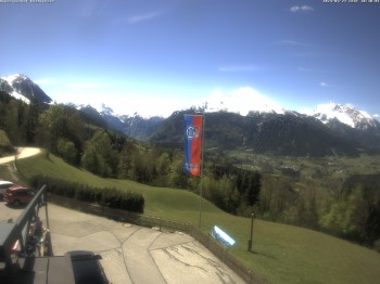
View from apartments Renoth at Obersalzberg mountain near Berchtesgaden.
5 minutes ago
View from camping site Allweglehen near Berchtesgaden
5 minutes ago
View of Oberau village near Berchtesgaden, Upper Bavaria
6 minutes ago
View from Guest House Urban in Ramsau near Berchtesgaden. You can see the famous panoramic street.
5 minutes ago
View of Hotel Zechmeisterlehen near Berchtesgaden and Schönau, Upper Bavaria.
5 minutes ago
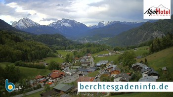
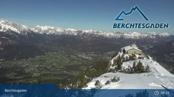
View of Berchtesgaden city center and Watzmann mountain.
6 minutes ago
Valley view at Jenner Cable Car near Schönau at Lake Königssee.
4 hours ago
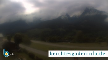
The webcam is located at the Rossfeld panoramic road near Berchtesgaden. The pass road is the highest panoramic road in Germany.
3 hours ago
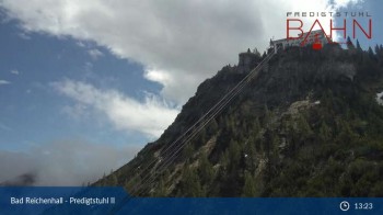
You can see the cable car at the Predigtstuhl in Bad Reichenhall. The Predigtstuhlbahn is the oldest cable car in the world that has been...
5 hours ago
The camera is located at the top station of the cable car Predigtstuhlbahn in Bad Reichenhall. The hiking trails lead to the summit at 1,614 meters.
5 hours ago
Enjoy the view from the top station of the Predigtstuhl cable car over Bad Reichenhall in Berchtesgadener Land.
5 hours ago
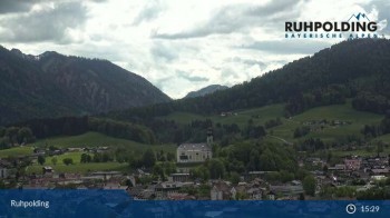
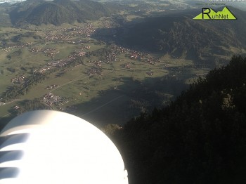
Webcam located in Ruhpolding, Upper Bavaria. You can see the village and the Chiemgau mountains surrounding.
37 minutes ago
View from top station of Jennerbahn near Lake Königssee.
24 minutes ago
View from Carl von Stahl Mountain Hut near Jenner mountain and Scheibenstein mountain.
5 minutes ago
Valley view from midway station of Jennerbahn near Lake Königssee.
4 hours ago
The webcam is located in Bad Dürrnberg near Salzburg. You can see the ski lifts of the Hallein Bad Dürrnberg ski resort.
1 minute ago
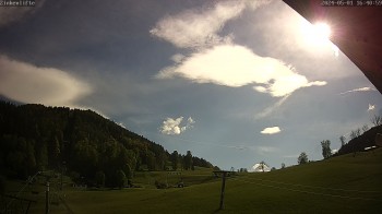
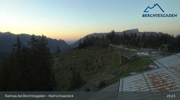
View from Hochschwarzeck in Ramsau bei Berchtesgaden and the surrounding Alpine panorama.
6 hours ago
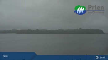
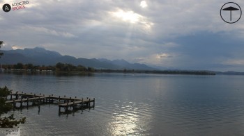
This webcam shows the shipping pier in Prien as well as Lake Chiemsee.
5 hours ago
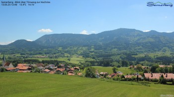
Have a look to Törwang and Grainbach in Bavaria. In the background you can see the Hochries mountain.
6 minutes ago
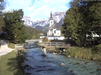
From Malerwinkel in Ramsau near Berchtesgaden you can see the Ramsauer Ache and the local church of St. Sebastian in the background.
3 minutes ago
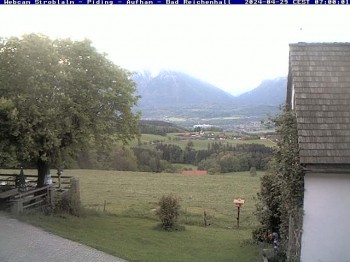
From top of the Strobalm you have a great view of Piding and Bad Reichenhall.
7 hours ago
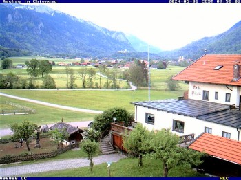
The webcam is located at Cafe Pauli in Aschau (Chiemgau) and points south.
7 hours ago
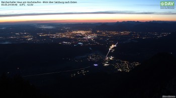
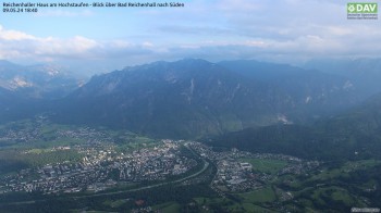
The webcam is located at Reichenhaller Haus and offers a great view to the east. In the middle you can see Salzburg with its suburbs, to the left...
5 minutes ago
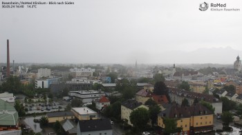
Have a look from the roof of RoMed Hospital in Rosenheim to the southwest.
5 minutes ago
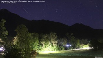
Enjoy the view from Oed in the south of Marquartstein (Chiemgau) to Hochlerch and Rechenberg.
temporarily unavailable
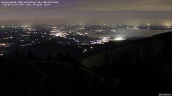
Enjoy the view from the ridge between the top station of the lift and the summit of the Kampenwand into Chiemgau.
6 minutes ago
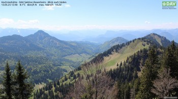
Enjoy the view from Hochrieshütte to Kufstein and the Kaisergebirge in the south.
5 minutes ago
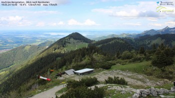
The webcam is located at Hochries and offers a great view to the northeast to the Riesenberg and the Kampenwand.
5 minutes ago
From the Reichenhaller house (Staufenhaus) at the Hochstaufen you have a great view to the south towards the Lattengebirge. In the background you...
6 minutes ago
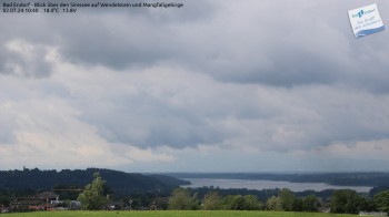
This webcam located northeast from Bad Endorf offers a great view to lake Simssee and the Wendelstein in the background.
5 minutes ago
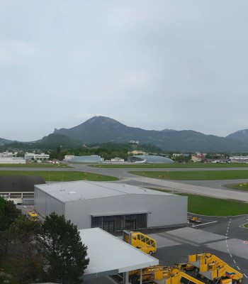
Panoramic view over Salzburg Airport.
1 minute ago
View of flying field in Unterwoesse. The webcam is located at the rooftop of gliding school.
6 minutes ago
View over the roofs of Oberwoessen, Chiemgau.
temporarily unavailable
View over the roofs ob Unterwoessen, upper bavaria.
temporarily unavailable
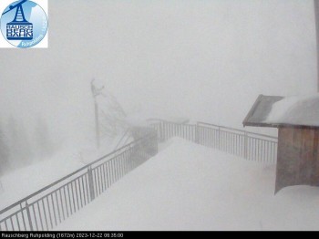
The webcam shows the top station at the mount Rauschberg near Ruhpolding, where a small christmas market takes place at the first two Advents...
4 minutes ago
Webcam located Jackl Tower in Traunstein. You can see the town square.
4 hours ago
Webcam located at the restaurant on Herreninsel a island of Lake Chiemsee. Enjoy the panoramic view.
5 hours ago
Check out the view from the Hotel Chiemgauhof in Übersee towards the famous lake Chiemsee in Bavaria.
temporarily unavailable
Webcam located at Krautenberg, a small village near Waging am See. You can see the two swimming lakes: Waginger See and Tachinger See.
5 hours ago
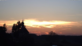
Webcam located at the pilgrimage church 'Maria Mühlberg' in Waging.
1 minute ago
Webcam located at sailing harbor of Waginger See, a lake in upper bavaria near Traunstein.
6 minutes ago
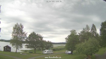
Webcam located at Campsite 'Hainz am See' at lakeside of Waginger See.
temporarily unavailable
Webcam located at campsite in Waging am See. You can see the lake Waginger See.
temporarily unavailable
This webcam shows you the surroundings of the Gasthof Zillreith in Adnet, Austria.
2 minutes ago
Webcam at the western mountain in ruhpolding. you can see the area of ski pistes and the t-bar-lift.
5 hours ago
Located at Marquartstein you look in an easterly direction on Hochlerch and Rechenberg mountain.
5 minutes ago
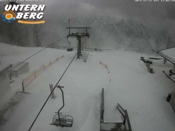
View from the top station of the Unternberg lift in Ruhpolding
5 minutes ago
Located at Hochries mountain hut you face west.
5 minutes ago
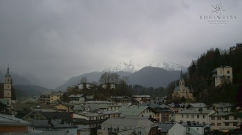
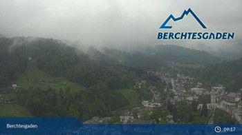
The webcam shows the city Berchtesgaden which forms part of the popular holiday region Berchtesgaden-Königssee.
5 hours ago
Here you can see the dry toboggan at Märchenpark Marquartstein in Chiemgau.
15 minutes ago
The webcam shows the Miesenbacher valley from the mountain inn Steinberg Alm.
1 minute ago
View from Rauschberg summit towards Ruhpolding in the Chiemgau region.
1 minute ago
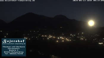
View towards Ruhpolding from the accommodation "Bojernhof".
1 minute ago
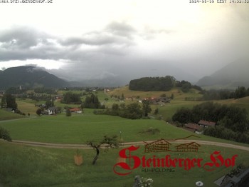
South view from Hotel Steinbergerhof towards Ruhpolding, Chiemgau.
6 hours ago
Live pictures from Zeller Hof accommodation in the holiday region Chiemgau.
1 minute ago
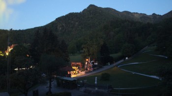
Live pictures from Chiemgau Arena where the IBU Biatholn Worldcup takes place every year.
5 hours ago
Enjoy the view of Vorderloiplsau looking southwest. You can spot Hochkalter and Reiteralm.
4 minutes ago
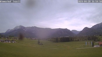
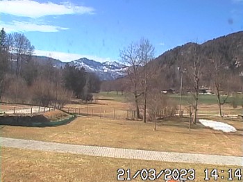
Enjoy the view of the Inzell valley
1 week ago
Have a look at the village Schönau am Königssee which is located in Bavaria, Germany.
6 minutes ago
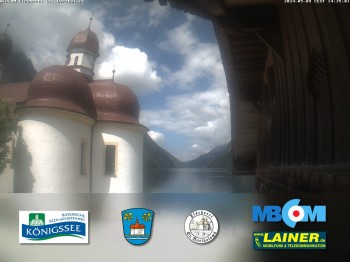
Live pictures from the pilgrimage church St. Bartholomae situated at the peninsula Hirschau in the Koenigssee region.
4 days ago
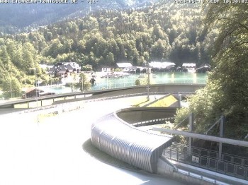
The webcam is located at the bob run and shows the "Koenigsee" lake in the background.
5 hours ago
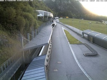
View to parts of the bobsled run of "Deutsche Post Eisarena" in the holiday region Berchtesgadener Land.
5 hours ago
You can see parts of the golf course Obersalzberg in the popular holiday region Königssee - Berchtesgadener Land.
5 minutes ago
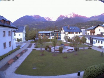
The webcam is located at the town hall building of Schoneau and shows the Tourist Information (Haus des Gastes) and the courtyard.
4 hours ago
Your view at the Zirkenstüberl near Bad Dürrnberg in Hallein, Austria.
17 hours ago
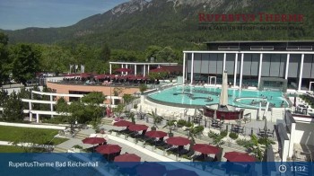
Outdoor pool of 'Rupertus Therme' in Bad Reichenhall, Upper Bavaria, small town near Salzburg.
5 hours ago
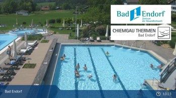
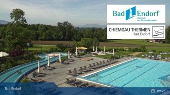
View of the outdoor pools of the thermal bath Chiemgau Thermen in Bad Endorf.
54 minutes ago
The webcam show the 125m long lazy river, one of the highlights of the thermal bath.
5 hours ago
View to the leita stu`m, a restaurant at the western mountain in ruhpolding
1 minute ago
The webcam is located at Rossfeld in the popular holiday region Berchtesgadener Land.
3 hours ago
Have a look at the nature bath Aschauerreiher in Berchtesgaden
6 minutes ago
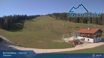
Located at the base the webcam faces Götschenkopf.
5 hours ago
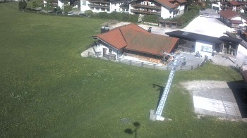
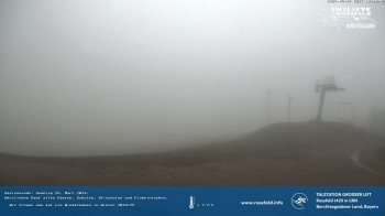
Here you can see the "Große Lift" T-Bar at Rossfeld ski resort in Austria.
3 hours ago
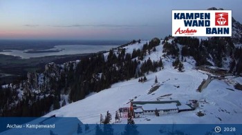
Located at the top of Kampenwandbahn you can enjoy the vista towards the alp SonnenAlm and the lift Roßleiten.
6 hours ago
Have a look at Teisendorf in the Berchtesgadener Land.
5 hours ago
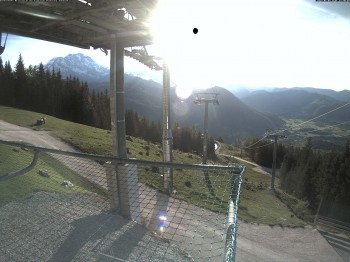
Located at ski resort Jenner near Berchtesgaden you can see direction south on Hagen mountain range and Steinernes Meer mountain
3 minutes ago
Located at the Kehlstein the webcam shows the Kehlsteinhaus and surroundings in the hiking region Berchtesgaden-Königssee.
43 minutes ago