
Route description
NaturRADtour Karlsruhe is a nature bike route inside the city that brings together exercise, fun, and nature, and connects Karlsruhe's five natural spheres as well as seven other reserves. The tour is 48km/30mi long, suitable for families, plane and accessible. If you don't want to do the whole tour in one day, you can divide it into different stages. Another advantage: you can start the tour at any point of the trail, which makes it suitable also for spontaneous and flexible bikers.
Hardtwald - Old Airfield - Rhine - Hochgestande
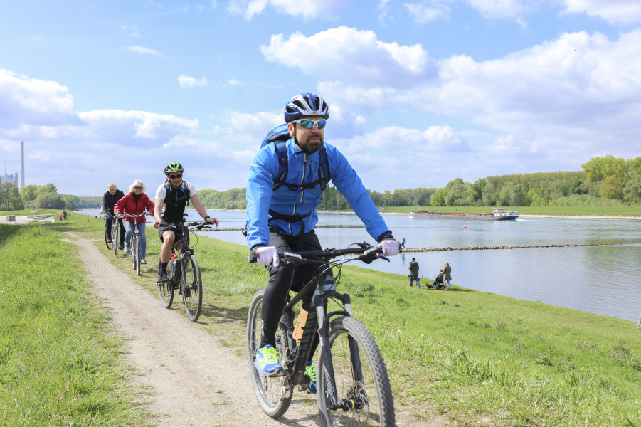
The designated start and end point of the tour is Karlsruhe Palace, where bikders go clock-wise towards the west. From Hardtwald forest, which goes from the palace to the town of Graben-Neudorf, and is home to endangered plants and animals, over the sandy, dry and hot nature reserve Old Airfield, the route leads you first to the Rhine. Afterwards, a relatively striking geländesprung to Hochgestade follows with a 10m/33ft ascent at the east of the area.
Rheinauenwald - Alb at Appenmühle - Alb at Günter-Klotz-Anlage
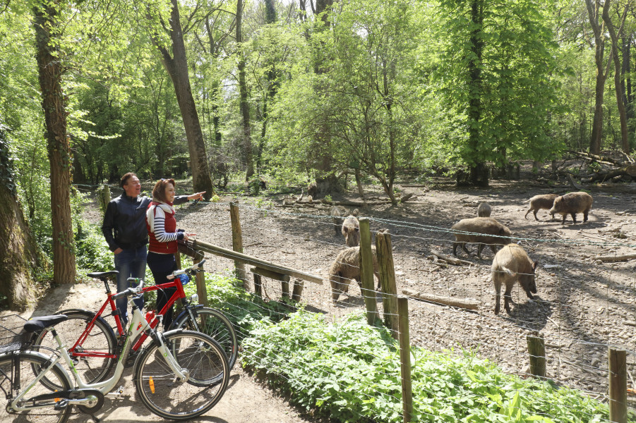
Nature conservation centre Rappenwört is located at an old Rhine loop in Rheinauenwald forest. Stop here for some education: a permanent exhibition informs about the nature of the Rhine meadows. The next destination is the Alb at Appenmühle mill, which flows inside its original riverbed deep inside Hardtebene plane here. At Günter-Klotz-Anlage, visitors can take a closer look at the efforts that are made to bring this area closer to nature.
Oberwald - Durlach - Elfmorgenbruch
Oberwald forest, the third natural sphere of the Rhine plane, and a recreational forest close to the city, offers a mix of deep, damp areas and higher gravel areas. The centre of Durlach is also located on such a gravel island. To finish, bikers can have a look at the typical fen wood trees, such as alder and poplar, as they ride through the forest near Elfmorgenbruch.
Where to eat
Numerous restaurants and beergardens are located along NaturRADtour. Home-brewed beer, regional cuisine, and sustainable products make for a good culinary addition to your day.
Brauhaus 2.0 features organic beer, Alsatian tarte flambée, and steak. Landgasthaus Hofgut Maxau, surrounded by meadows and fields, serves its own products: straight from the farm onto the table. Between home-made Maultaschen (typical stuffed turnovers) and salad with goat cheese and honey, every biker will find something to their taste.
Interesting facts
- You're traveling a distance of 49 km on this easy trail. The average length of all bike Trails in Baden-Württemberg is 106 km.
- The bike trail is one of the family friendly trails in the region. What’s even better: You can also bring the family’s best friend on this dog friendly bike trail.
- There are places to buy beverages and food along the track. However it’s always recommended to bring enough water and food along with you.
Videos
Variations
Real sporting aces can go from NaturRADtour to a longer route called 'Große Route', extending over Karlsruhe and the surrounding region. Instead of five, you can find nine nature reserves, and another two extensions here.
- Ettlingen - Grünwettersbach - Turmberg extension: this way leads over fields and meadows through the reserve Pfinzgau West and to Turmberg mountain.
- Durlach - Turmberg extension: this extension goes to Turmberg mountain via Geigersberg and Rittnerhof.
Getting here
Karlsruhe Palace is located south of the palace gardens (Schlossgarten). From Karlsruhe main railway station, you can get there in a 10 minutes' bike ride on Bahnhofstraße.
If you travel by car, you can get to Karlsruhe via motorway A5 towards Frankfurt/Basel or A8 towards Stuttgart/Mannheim. After exit 'Zentrum', the white signs pointing to 'Schloss' leads you to Badisches Landesmuseum. The underground car park at Schlossplatz square is open 24 hours.