

Route description
Know before you go
Ball Pass Crossing is a spectacular route crossing the Mt. Cook range, the highest mountain range in New Zealand. It is however a route only, NOT A MARKED TRAIL! Anyone planning to do this crossing in snowy conditions should be experienced in the use of crampons and ice axes. You need to be in very good shape and be able to hike up to 11 hours in alpine terrain. GPS devices are very helpful to stay on track.
Where to start
The crossing can be started in both valleys either at Whitehorse Hill carpark or at Tasman Glacier carpark. The recommended direction is to cross from west to east, so the following sections are describing the west-east crossing.
Durations
Extremely experienced and fit mountaineers have completed the crossing on a single day. It is recommended to do the trip in two days however
Day 1: Whitehorse Hill carpark to Caroline Hut (or ’Playing Field’ camp side if you don’t make it up to Caroline Hut)
Day 2: Caroline Hut via Tasman valley back to Blue Lakes carpark
Consider hiring a guide
If you are unconfident with your mountaineering skills, you should consider hiring a guide in Aoraki/Mt Cook village. The owner of Caroline Hut, Alpine Recreation Ltd, offers guided trips during summer season (November-May).
Section 1: Whitehorse Hill carpark to East Hooker valley camping site (approx. 3,5h)
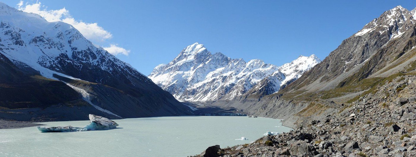
Starting at the carpark you can easily follow Hooker Valley Track which crosses Hooker River and takes you along the westside of Mueller Lake northwards to Hooker Lake. The path continues right on the edge where the glacier used to be, offering a great view across Hooker Lake. At the end of Hooker Lake you need to turn right into a small trail taking you up to the Ball Pass route until you reach the large shingle fan at Copland Hut and Hooker Hut. There is a camping ground at the shingle fan and fresh drinking water is available at a nearby waterfall.
Section 2: East Hooker valley camping site to Caroline Hut (approx. 7h)
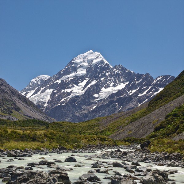
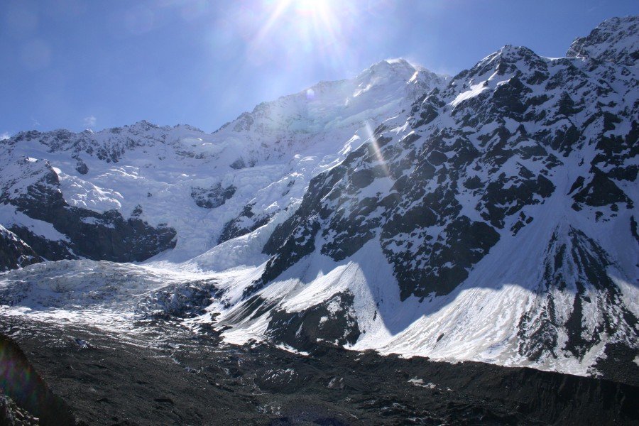
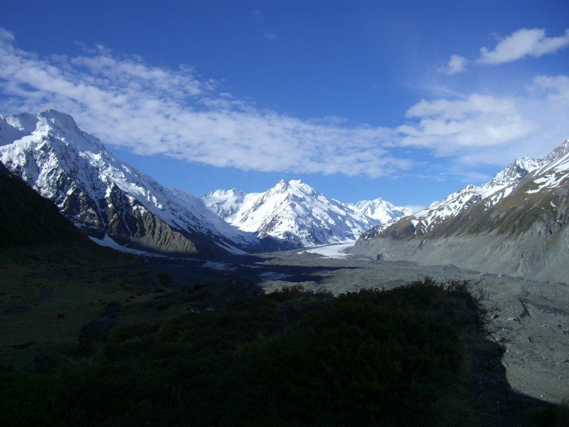
From the camping site walk to the north-west and follow the distinct gully until you reach a small plain area underneath Mt Mabel, known as the 'playing field’. After leaving the ‘playing field’ behind, the track is getting steeper taking you to a steep cliff. Head further north to begin descending past Mt Rosa on a shingle slope taking you right to Ball Pass. You could be facing snowy conditions in spring or fall on this section. Plan to stay a few minutes at Ball Pass to enjoy the stunning views at Mt Tasman (3.497 m) and Mt Cook (3.724 m), the two highest mountains of New Zealand. After crossing Ball Pass you need to descend Ball Glacier for 100m before turning right, following Ball Ridge to the privately owned Caroline Hut.
Section3: Caroline Hut to Blue Lakes Carpark (approx. 5h)
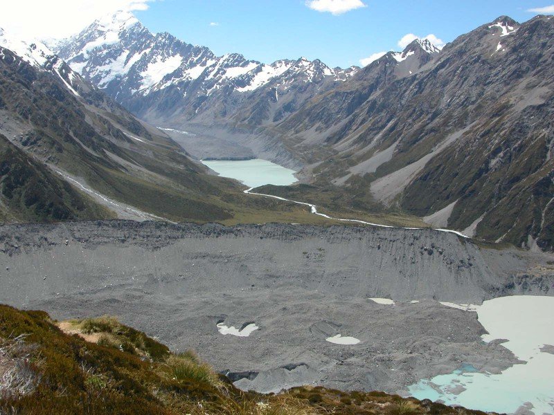
Starting at Caroline Hut, the track follows the ridge crest and you need to climb down several rocky passages. You can bypass the most demanding sections if you follow the markers to the level part of the track on the eastern side down to the old Ball Hut and further to Ball Flat. From now on you can simply follow Ball Hut road all the way down Tasman Valley. Make sure to enjoy the view of the melting and more and more disappearing Tasman Glacier and Tasman Lake at the and of the moraine. Leaving Ball Flat, the track is changing to a gravel road leading towards Blue Lakes carpark. It is an 8 km drive from the carpark back to Aoraki/Mt Cook village. You should call the Aoraki / Mt Cook National Park Visitor Centre to check if a shuttle can be arranged or if you have to walk back to the village (which would take another 2,5 h).
Where to eat
There are no places to get food on the trail. Make sure to bring enough food in your backpack. Drinking water can be refilled at the waterfall near East Hooker Valley camping site.
Interesting facts
- You're traveling a distance of 35 km on this strenuous trail. This makes it a relatively long hike. The average length of all hikes in Canterbury is 43 km.
- Elevated between 675 m and 2,160 m, the hike is the highest elevated hikes in New Zealand. You're facing an uphill climb of 1513 vertical meters on this hike.
- Make sure to bring sturdy footwear on this track. Hiking boots are highly recommended.
Video
Highlights of the tour
- Panoramic view to the two highest mountains of New Zealand: Mt Cook (3.724 m) and Mt Tasman (3.497 m)
- Walk along the ridge of the moraine of the once majestic Tasman Glacier on the way back through Tasman Valley
