

Route description
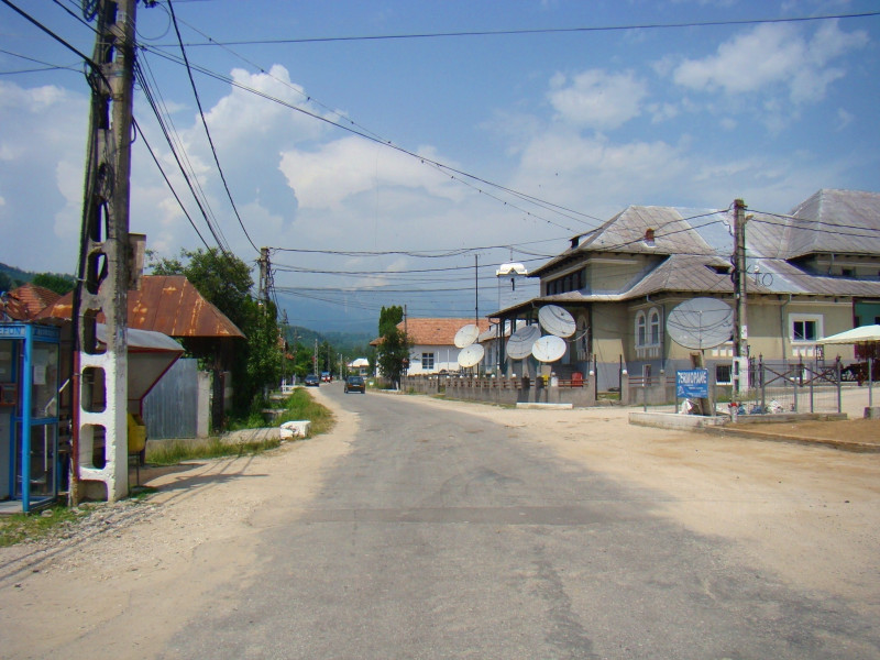
Start in Bărbătești
The starting point of your hike is in the small village Bărbătești, which you cross and thus reach the end of the village. The beginning of the route is congruent with the hiking trails number 7 and 8, which first take you to the entrance of the Otăsău valley. However, you don't run into it, but rather follow the side valley between Otăsău and Costeşti. At the beginning of the hike you follow smaller signs and reach the bridge over the Otăsău , after which you descend a steeper slope and then follow the right bank of the river up the small hill again. After a short time you will reach a very idyllically situated forest, which stands out especially because of its sea of flowers and its many animal species on the hike, so that you can make a small stop here or at least walk through the forest at a moderate pace.
Scărişoara
You now continue your tour in a northeasterly direction, crossing a small village and then the trail is a bit wider. He will now lead you further up the ridge and you will reach a narrow pass. From here you can also see the forest road below, which connects Pietreni and Valea Morii. You continue to follow the path and after some ups and downs you reach the junction with path number 5, where you also reach the border of the national park. You will now reach Scărişoara, where you will also find shelters and campsites , so you should either take a longer break or even plan an overnight stay.
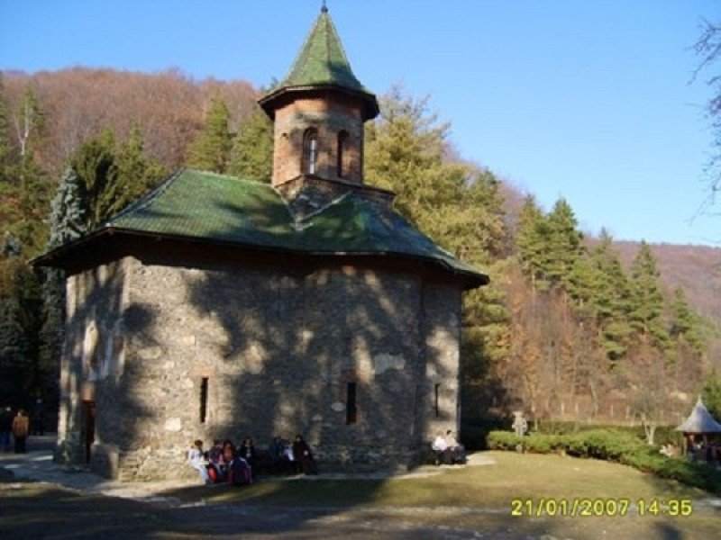
Through the valleys to Pătrunsa Hermitage
Afterwards you climb a steeper ascent again and soon have a unique view over Mount Cozia and Mount Narăţ. You now walk further north to leave your vantage point and enter the wooded area again. This way you will circumnavigate the stony landscape and reach another valley, where you will leave path number 5 and continue in the direction of the Pătrunsa Hermitage. Now you cross several small valleys and climb up a steep slope again. From here the trail runs eastwards, where you will come across trail number 7, which leads directly back to Bărbăteşti . Shortly thereafter you will reach the Pătrunsa Hermitage and have reached a stage of your hike.
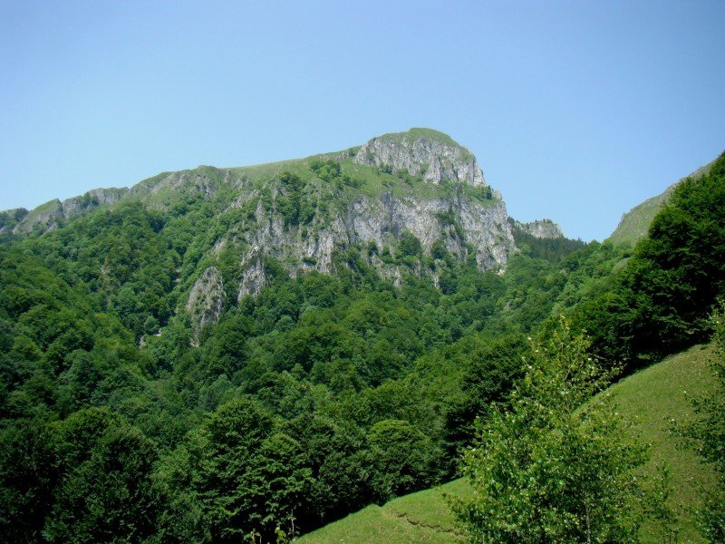
All around the Curmătura Builei
From here you follow the signs and walk downhill a little bit. So you reach a small limestone cottage, which is located between two cliffs and thus provides a really impressive picture. You now circle the cliffs on the left side and reach a large area of alpine meadows. From here you should continue your hike with some more attention, because here you can overlook the marking of the path despite its conspicuous color. As an additional orientation you should therefore take the wooden cross, which should usually be on your right, until you get another great panoramic view of the Curmătura Builei and the Ţucla Peak. The same Curmătura Builei is also your next stage destination, for which you will go up to 1450 m.
Down to Prislop
After taking a longer break, walk downhill for the next 10 minutes and then cross the path again with the number 5. Follow the mark with the yellow dot and the red triangle for a while and leave the path number 5 after another 15 minutes. Slowly but surely the path meanders down until you reach the Prislop valley at Costeşti, where the end point of your hike is located.
Where to eat
There are no opportunities for refreshments on the hike, so in any case you must take your own provisions with you. Although there is a camping site and a hut along the way, which offers the opportunity to spend the night, these are rather the exception. There are water sources in Scărişoara, at Pătrunsa Hermitage, at Curmătura Builei and at the stone cross.
Interesting facts
- You're traveling a distance of 17 km on this moderate trail. The average length of all hikes in Romania is 18 km.
- The highest point of the track is 1,552 m above sea level.
- Make sure to bring sturdy footwear on this track. Hiking boots are highly recommended.
Video
Highlights of the tour
The hike is characterized in particular by its variety . You hike through several valleys, but also over high mountain ridges, which promise you unique views. Although this hike is clearly on a high level, this is exactly what makes it so attractive, so that experienced hikers will have fun here. As the walk takes you through the Buila Vanturarita National Park, which is known in Romania for its beautiful landscapes, the surroundings are also a clear highlight that you can enjoy throughout your tour. In addition to these scenic highlights, you will also come across small buildings along the way, which make the tour something very special. The monastery Pătrunsa Hermitage is particularly worth mentioning here.
Getting here
By car
From Sibiu
You first leave the city centre of Sibiu in a southerly direction via DN1 and then change to DN7 in the direction of Tălmaciu, which you will follow for about the next 80 km. At the roundabout take the second exit and continue in the direction of Calea lui Traian. Via the DN64 you reach the DN67 at a fork in the road, which you follow for another 30 km. Then turn right onto the 646E in the direction of Bodești and reach the starting point of your hike in Bărbătești.
From Târgu Jiu
via Strada Unirii you get to DN67 and turn right at it, following it for the next 80 km. Continue along the road until you reach the left turn on the 646E in the direction of Bodesti and reach the starting point of your hike in Bărbătești.
From Craiova
In the city centre turn right onto Strada Bariera Vâlcii and you will reach DN65C, which you will follow for about 55 km. At the next intersection, keep slightly to the left to stay on this road. In the following you continue on the main road until you reach the junction with DN67. Turn right at this and after about 11 km take the left turn-off towards Bodesti to finally reach the starting point of your hike in Bărbătești.