Route description
Stage 1: Planken – Sücka
15,5km (9,6 mi), time: 7h
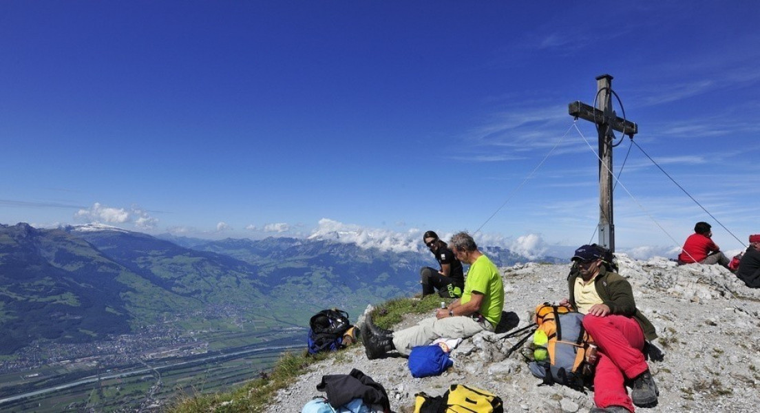
The first stage starts in Planken. From the bus station at hotel Saroja hike up to hut Gafadurahütte. There you are welcome to rest at a 1428m hight and a great view. Then you can start your hike over the steep track Drei-Schwestern-Steig and the steep track Fürstensteig, with a short thightrope walk connecting those two. At Kuhgrat (the highest point of the tour) you will have a great view on Rätikon and the swiss alps. You can overlook the villages along the river Rhein and even Lake Constance.
Passed Silum continue via Steg, the final destination of stage 1. You can stay at the guest house Sücka or at hotel Steg.
Variation: If you do not want to take the challenging steep track Fürstensteig you can also take Bärgällasattel to reach Silum.
Stage 2: Sücka – Malbun
17,5km (10,9mi), time: 7h
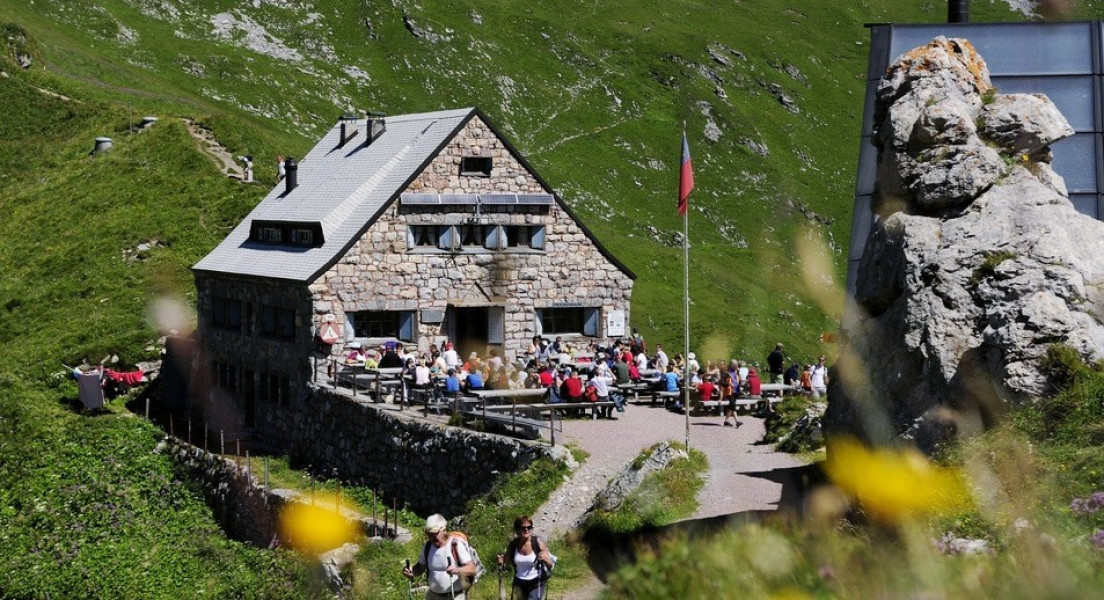
From Sücka the first destination of the second stage is Rappenstein (2222m). Hikers usually do not take the path leading up to the peak but they hike a narrow trail towards Alp Gapfahl. From there the trail leads passed Undersäss towards hut Pfälzer Hütte, which is ideal to rest.
You can also spend the night there and use the following day to hike up Naafkopf (462m difference in altitude).
Now start the last descend of the tour. A narrow path leads passed Malbuner Täli to Malbun.
Variation: Trained hikers can squezze in an additional hike up to Rappenstein (151m difference of altitude). From Pfälzer Hütte passed Augstenberg and Sareishoch back to Malbun.
You can also make the tour easier and hike from Malbun to Planken.
Kids should hold on to the rope at Fürstensteig.
Interesting facts
- With an overall length of 34 km the hike is among the 3 longest hikes in Liechtenstein available on TouriSpo.
- Elevated between 786 m and 2,123 m, the hike is among the 5 highest elevated hikes in Liechtenstein. You're facing an uphill climb of 1337 vertical meters on this hike. This makes the hike one of the 3 hikes with the most ascent in Liechtenstein.
- You shouldn’t forget to bring your hiking boots. There are some sections on the trail where sturdy footwear is required. If you get hungry along the way, there are places to rest and get food. Nevertheless it’s recommended to also have enough water and food in your backpack when hiking or biking.
Getting here
By car:
Starting in Austria take highway A14 and exit Feldkirch-Frastanz. Keep right and turn into B190. Then turn left into Hirschgraben, B191. Continue on that road and finally turn left into Plankner Strasse .
Starting in Switzerland take highway A13 and exit Buchs, continue towards Schaan. By the postal office turn left into Feldkircher Strasse then right onto Plankner Strasse.
There you'll find parking spots.
By public transport:
You can also take bus 26 from Schaan to Planken. (stop at Hotel Saroja)