Route description

Rothaarsteig is a 154km/96mi long-distance walking trail going from the northern edge of the Rothaar mountains over the Hesse Lahn-Dill mountainscape all the way to the foothills of Westerwald. It can be hiked in six, eight, or twelve stages. We describe the original Rothaarsteig hike in eight stages.
Stage 1: Brilon - Bruchhausen
The tour starts at the market square in the eastern Sauerland town of Brilon. Hike through the historic centre northbound to the natural reserve 'Am Drübel'. Continue to the first of many famous springs at Rothaarsteig, Möhnequelle, at the east face of Poppenberg mountain (605m/1,985ft). The ascent to Borberg (670m/2,198ft), the highest point of Brilon plateau, is rewarded with a view over Ruhr valley. Before getting to the town of Bruchhausen after around 17km/11mi), you pass the information centre of Bruchhauser Steine foundation, where visitors can learn more about the impressive mountain formation on Istenberg.
Stage 2: Bruchhausen - Winterberg
The second stage of Rothaarsteig leads from Bruchhausen to Winterberg in 26km/16mi. The path goes from Richtplatz square over Rothaar crest on the Hesse border. The highlight of the second leg is the ascent of Langenberg mountain (843m/2,766ft), the thighest mountain in North Rhine-Westphalia. Across the mountain crest, you hike to Neuer Hagen natural reserve with its moorlands, and on via Clemensberg (839m/2,753ft) and Hillekopf (805m/2,641ft) mountains to the town of Küstelberg. The trail continues westbound until you reach the source of river Ruhr. Just before you get to the winter sports town Winterberg, Rothaarsteig crosses the idyllic Helletal gorge.
Stage 3: Winterberg - Schanze
From Winterberg, the trail leads you to the most famous mountain on Rothaarsteig, Kahler Asten (842m/2,762ft). Thanks to the open heaths, you can enjoy a 360 degree view from its peak. Afterwards, you wark to the source of Lenne, the highest spring in North Rhine-Westphalia. Continue to Kühhude via Albrechtsberg and Heidenstock, and through Hartmecke valley to the town onf Schanze, the destination of this 19km/12mi leg.
Stage 4: Schanze - Rhein-Weser Tower
From Schanze, cross Grubental valley to the town of Latrop past 'Millionenbank', an area where a free herd of European bison (wisent) lives since 2013. Afterwards, cross Heidkopf mountain (666m/2,185ft) to get to Jagdhaus and to the nature experience centre Wisent-Welt. The hike continues on Westerberg (685m/2,247ft), at the summit of which you can find Rhein-Weser viewing tower. After having walked for 23km/14mi, you can enjoy a beautiful panoramic views of the Sauerland and Siegerland regions from the 24m/79ft viewing platform.
Stage 5: Rhein-Weser Tower - Lützel
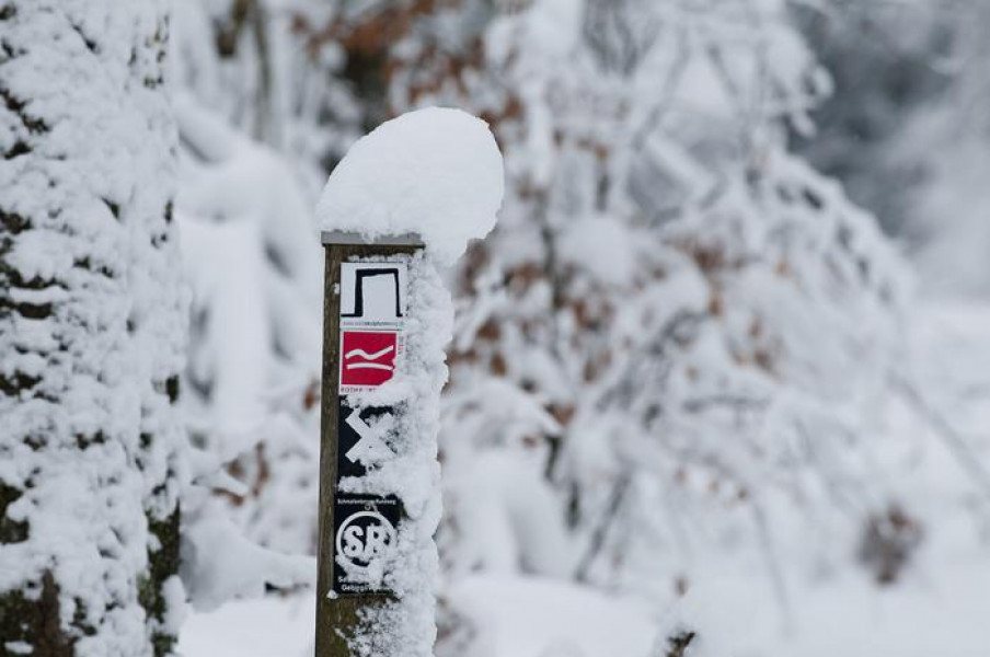
From Rhein-Weser tower, walk past PanoramaPark Wildpark Sauerland, and downhill to the natural reserve Schwarzbachtal. Walk back uphill to Heinsberger Hochheide, and past Heinsberg aqueduct. The path continues through Ginsberger Heide and onto Ginsburg castle. Before reaching this leg's destination, Hilchenbach's Lützel quarter, after 18km/11mi, you have to climb Giller mountain (653m/2,142ft). This stage can be walked even during the winter.
Stage 6: Lützel - Lahnhof
The sixth stage goes 14km/9mi from Lützel to Lanhof, and leads you into the source area of the three rivers Lahn, Sieg, and Eder. First, follow the valley of Eder upstream to the high moor at the source. Continue to the source of Sieg, and on to the spring of Lahn at Lahnhof, the destination of this leg of the trail.
Stage 7: Lahnhof - Wilgersdorf
From Lahnhof, this 18km/11mi long leg of the path, which is accessible year-round, first goes to Ilsequelle spring in Wittgensteiner Bergland, and on over the 674m/2,211ft high Jagdberg mountain to Dillquelel spring. The summits of Haincher and Gernsbacher mountains (523m/1,716ft) as well as Tiefenrother Höhe (551m/1,808ft) feature beautiful views of the surrounding landscape. Eventually, the tour leads along Hausbergpfad trail all the way to Wilgersdorf.
Stage 8: Wilgersdorf - Dillenburg
The last leg of Rothaarsteig is 20km/12.4mi long, and goes from Wilgersdorf am Rothaarkamm over Galgeberg (302m/991ft) to Dillenburg im Dilltal. There you can either go straight to the centre and enjoy a cold drink, or alternatively hike on to Bismarcktempel. From there, you have a nice view over the city with Wilhelmsturm tower on the opposite side. Dillenburg railway station is the official end of the hike. This leg of the trail can be walked also between November and March without problems.
Where to eat
There are several huts along Rothaarsteig trail. Furthermore, all the villages and cities along the long-distance way feature restaurants and cafés. Nevertheless, you should bring enough provisions and water on the hike.
Interesting facts
- With an overall length of 151 km the hike is among the 15 longest hikes in Germany available on TouriSpo.
- Hike Rothaar is among the 3 best rated Hikes in North Rhine-Westphalia.
- Elevated between 226 m and 838 m, the hike is among the 5 highest elevated hikes in North Rhine-Westphalia. You're facing an uphill climb of 2584 vertical meters on this hike. This is quite much. You should be fit to do this track. This makes the hike one of the 15 hikes with the most ascent in Germany.
- You can easily take your dog on this trail.
- Sturdy hiking boots are recommended on this track. If you get hungry along the way, there are places to rest and get food. Nevertheless it’s recommended to also have enough water and food in your backpack when hiking or biking.
Video
Highlights of the tour
- Rothaarsteig crosses Wald SkulpturenWeg Wittgenstein-Sauerland near Kühlhude. This themed trail features eleven sculptures that illustrate the history between the protestant Wittgenstein and the catholic Sauerland.
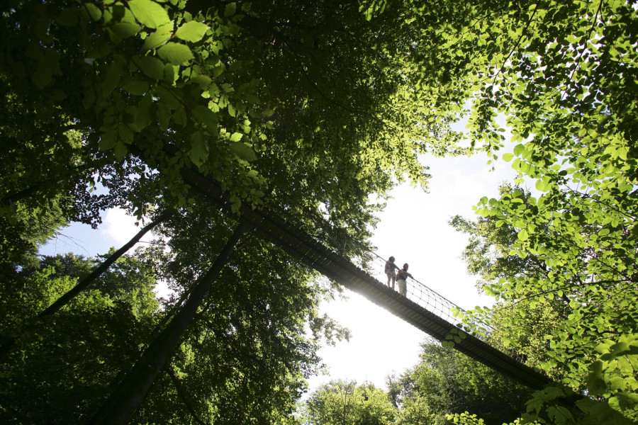
- About 300 metres behind the monument Stein-Zeit, the educational path 'Ökosystem Wald' ('eco system forest') begins. Visitors can learn about the forest as a habitat. Moreover, you can walk over a 40m/131ft long and 12m/39ft high pendant bridge.
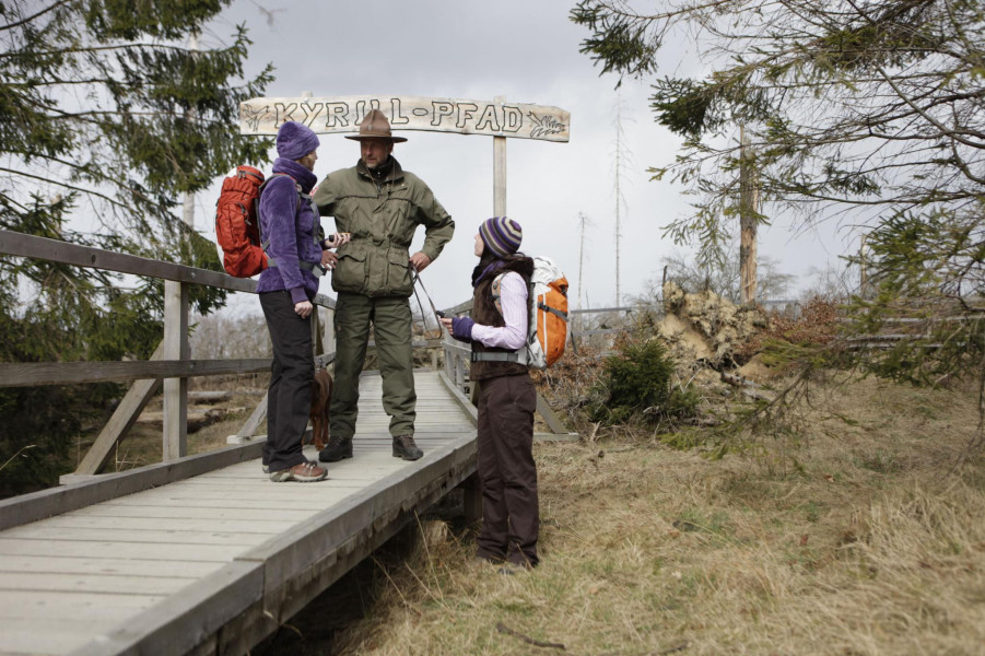
- At the town of Schanze, hikers find the Kyrill path, where you can experience the chaos storm Kyrill caused in 2007.
Variations
- The Westerwald variation of Rothaarsteig leads you on a loop through the low mountain range. This variation starts either at Kalteiche junction after Hausbergweg, or at the town of Dillenburg.
- There are 93 official entrances to Rothaarsteig, marked with a black R on a yellow background. They are ideal to explore the surroundings.
Getting here
By car:
Brilon can be reached from north or east via motorway A44, or from the south or west via motorway A445/A46. In pBrilon, car parks are available at krummen Straße or by the Kreishaus (Am Rothaarsteig 1) free of charge.
Dillenburg is accessible via motorway A45. Leave the road at exit 25 Dillenburg. Free car parks are available at the stadium in Dillenburg.
Public transportation:
Brilon and Dillenburg are easily accessible by train. Moreover, numerous other towns along Rothaarsteig are well-connected by bus and railway.