Route description
First stage to Burnt Rock Falls
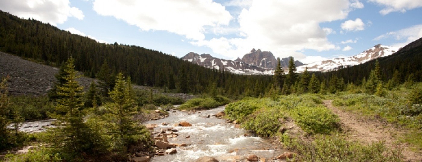
After taking the ferry to the actual starting point of the tour, start hiking on serpentines through forest. Soon you'll leave the woods and a view across mountain sides will emerge. Now pass the north side of Crypt Valley and after approximately 5,6km/3.5mi you'll get to Burnt Rock Falls. This beautiful waterfall is a great opportunity to take a rest and enjoy the nature.
Waterfalls everywhere
After leaving Brunt Rock Falls the trail becomes more challenging by leading continuously uphill. This steep ascent however is worth the trouble since you'll get awarded with a great view across Crypt Falls, once you reached the top. Above the waterfall you will also see the valley, which is home of Crypt Lake. The view up there is simply incredible.
Adventurous climbing
Afterwards you'll pass an old campsite, which is unfortunately closed since 2008 therefore you can't use it to stay overnight. Soon you'll follow a small path that seems like a dead-end at first but really is the beginning of some tunnels along the way. An iron ladder leads down into a 40m deep tunnel. Continue now on a rocky path, on which you mainly orientate yourself with a steel rope. Admittedly you should be careful during this stage but you'll be suprised this part is saver than it first seems.
Pure beauty awaits
After this rather adventurous stage you continue hiking along the upper part of Crypt Falls and eventually get to Crypt Lake, which is a perfect opportunity to take a rest and enjoy the incredible backdrop. Continue your tour by hiking around the lake and then walk in opposite direction back to the port to catch the ferry back to Waterton.
Where to eat
Neither on the ferry nor along the way there will be any possibility to buy food or drinks therefore you should make sure to bring enough with you.
Interesting facts
- You're traveling a distance of 17 km on this moderate trail. Average length of all hikes in Alberta is 19 km.
- Elevated between 1,284 m and 1,947 m, the hike is among the 10 highest elevated hikes in Canada. You're facing an uphill climb of 644 vertical meters on this hike. This makes the hike one of the 10 hikes with the most ascent in Canada.
- It’s ok to bring your best friend on this dog friendly hike.
- Make sure to bring sturdy footwear on this track. Hiking boots are highly recommended.
Highlights of the tour
Various waterfalls along the way as well as Crypt Lake are definitly highlights of this tour. Also the big rock formations around the lake, which may still be frozen at some spots, in combination with the ice blue water are total eyecatchers.
Getting here
By car:
From Calgary
To get to Waterton take highway 2 south towards Fort MacLeod. When you get there continue on highway 3 west and further on Highway 6 through Pincher Creek, before you get to Waterton.
In case you prefer a longer road with a nicer view you should take highway 7, right after highway 2 and drive towards Black Diamond. Continue on highway 22 south and eventually via highway 3 and 6, through Pincher Creek to Waterton.
From Glacier National Park / Kalispell
During summer you may drive on highway 2 towards West Glacier. Via Going-to-the-Sun road you'll soon reach St. Mary, where you change to highway 89 and cross the Chief Mountain Border. Afterwards take highway 6 and highway 5 west to get to Waterton.
All year round you'll get to the starting point via highway 2. Simply drive through Fathead National Forest to East Glacier Village, take highway 49 to get onto highway 89, on which you continue towards the border to Carway. Afterwards take Alberta highway 2 to Cardston. Eventually on highway 5 west you'll get to Waterton.
By public transportation
There is a Greyhound bus running from Pincher Creek to Waterton, which you may use.
By plane:
Closest airports are Fall Calgary International and Kalispell (Montana), which are both a 3-4h drive away from Waterton. Lethbridge also has an airport, which is smaller but only 1.5h away from Waterton.
In Waterton itself, which is located northwest of Upper Waterton Lake, continue towards the port. Boats will get you to Crypt Lake. Adults pay $20, children $10 for the ferry, which leaves daily at 9am and 10am and comes back at 4pm and 5.30pm.