

Description
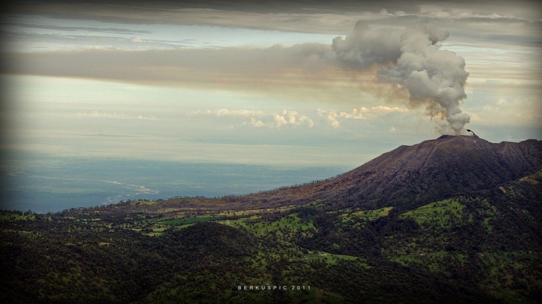
The Turrialba is the second highest volcano of Costa Rica with 3.325 meters and is located in the center of the Central American country. Since July 30, 1955, it has been part of the Turrialba National Park, which covers about 1,250 hectares and is intended to protect the volcano and the surrounding rain and cloud forests.
The Turrialba Volcano
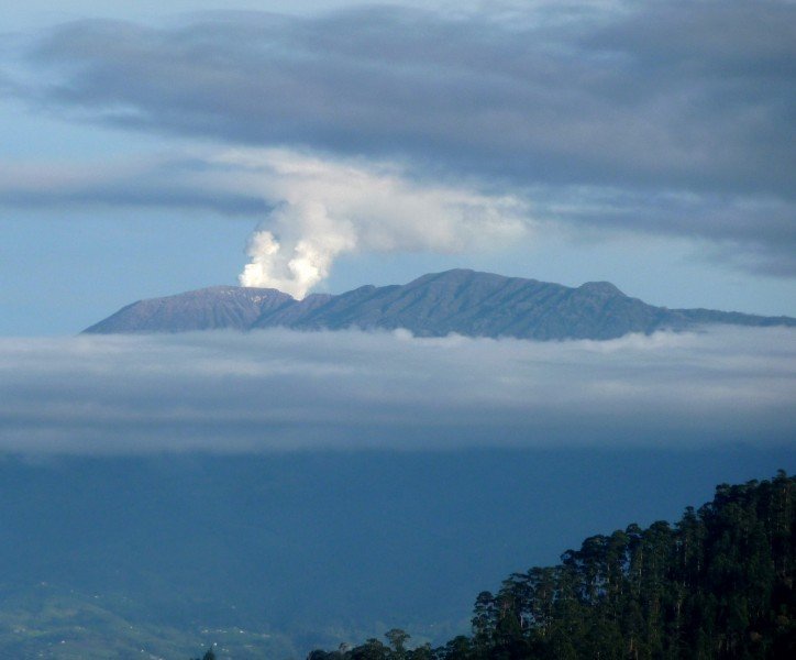
The Turrialba is located in the north of the Irazú Massif right next to the Irazú Volcano, the largest volcano in Costa Rica. The two share the same foundation, which is why they are often called twin volcanoes. Scientists assume that they are also fed by only one magma channel. Turrialba volcano has three clearly identifiable craters: the central crater, Cerro Tiendilla (2791 meters) and Cerro Armando (2750 meters). Other craters have been rendered unrecognizable by the volcanic activity or are more difficult to identify due to the constant release of gases and sulphur water vapours.
The flora and fauna of the national park
The park is divided into the two ecosystems of tropical wet rainforest and foothill rainforest. In the lower part the vegetation is dominated by ferns, orchids, bromeliads and bamboo. You will also discover trees up to 40 meters high, many of which have the unusual buttress roots typical of the rainforest. Although the flanks of the volcano appear lush green and are densely forested, the area around the craters is very karstic and resembles more a lunar landscape. In addition to the diverse flora, you can discover over 80 species of birds and eleven species of mammals in the national park. These include the bell bird, the toucan, the armadillo, the Central American aguti, the coati, as well as howler monkeys and coyotes.
Hiking in Turrialba National Park
Various nature trails and hiking paths lead through the national park, which offer views of magnificent panoramas at several vantage points. The main hike of the park leads to the crater of the Turrialba. You should plan four to six hours for the sometimes strenuous ascent. If the volcano is not active, there is even the possibility to descend to the main crater and observe fumaroles (steam emission points). On a clear day you can enjoy a wonderful view when you arrive in the crater landscape. The 360-degree panoramic view is breathtaking: you can see the Irazú volcano, the Caribbean coast including the Tortuguero and the Poas and Barva volcanoes. If you don't want to do the strenuous hike, you can book a tour with a local tour operator. Then you will be taken to the viewpoint in small vehicles of maximum 12 people. Since the access to the Turrialba is often made difficult by huge masses of stone, the last few meters have to be taken on foot.
Important information for your visit
Due to the long ascent, the National Park Turrialba is not suitable for a day trip from San José. If you want to visit it, you should plan an overnight stay nearby. You can also explore the volcano during a stopover on your way to the Caribbean coast or on your way back to San José. The visit is possible all year round, but it can get very humid and cool during the rainy season. In addition, the view from the crater to the surrounding nature is then limited due to fog. If you want to climb the crater on foot, you should always get a weather forecast and get suitable clothing. As the park is still quite unknown to tourists, you should also pay attention to your own safety during the hikes.
How to get there
The Turrialba National Park is located about 70 kilometers east of San José in the province of Cartago and can only be reached by car. There are two possible access routes:
Route 1: You take the highway (Florencio del Castillo / Ochomongo) from San José in eastern direction to Cartago. From there you continue to Pacayas. Then you drive in northern direction to the village Pastora. After about ten kilometers you will arrive at the Café of the National Park, from where the ascent to the crater (over the southwest slope) begins.
Route 2: North of Santa Cruz, which is about 12 kilometres from Turrialba, the official route leads to the National Park. It is quite curvy and uneven, which is why you will definitely need a four-wheel drive vehicle. At the end of the road you will find the Finca Central, from where you can start your tour to the crater.