Bike Trail Lenggries via Wegscheid to Leger in the Tölzer Land: Position on map

Webcams along the Bike Trail Lenggries via Wegscheid to Leger

Lenggries via Wegscheid to Leger
Advertisement
Lenggries-Brauneck: Bayern Hütte
Elevation: 1,341 m
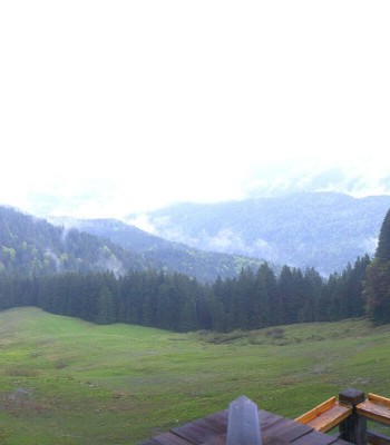
Enjoy the panoramic view from the terrace of the BayernHütte at Brauneck in Lenggries.
23 minutes ago
Brauneck Lenggries Top Station
Elevation: 1,441 m
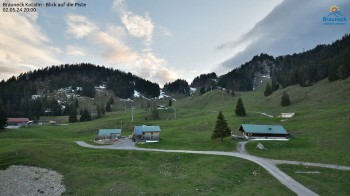
This webcam is located at Tölzer Hütte near Brauneck Lenggries.
56 minutes ago
Webcam Isar in Bad Tölz
Elevation: 646 m
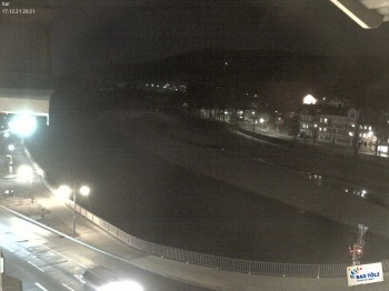
This webcam is located at the Isar in Bad Tölz. The Isar is a river in Tyrol and Bavaria and is more than 290 kilometers long.
20 minutes ago
Marienbrunnen - Bad Tölz
Elevation: 650 m
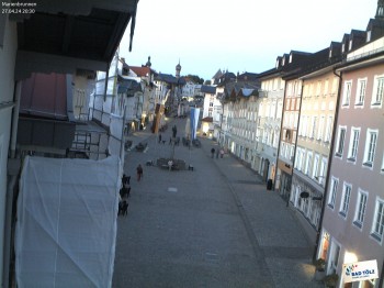
Have a look at Marienbrunnen in the city of Bad Tölz in Bavaria.
29 minutes ago
Bad Tölz - Kalvarienberg
Elevation: 704 m
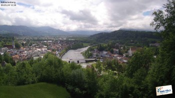
From top of the Kalvarienberg you look down to the city of Bad Tölz and to the river Isar.
29 minutes ago
Bad Tölz - Marktstraße
Elevation: 670 m
This webcam is located in Bad Tölz in Bavaria in the district of Bad Tolz-Wolfratshausen. You can see the Marktstraße where the Tölzer...
29 minutes ago
Brauneck, Self-catering cottage
Elevation: 1,581 m
Enjoy the view of Brauneck and the self-catering cottage at Idealhang.
22 minutes ago
Streidlhang slope, Brauneck
Elevation: 721 m
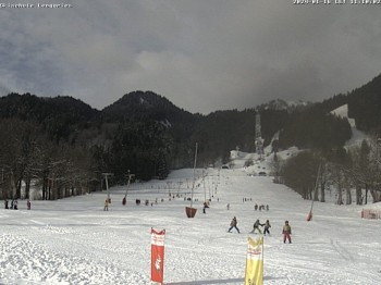
Here you can spot Streidlhang slope at ski resort Brauneck in the south of Bavaria.
temporarily unavailable
Tegernseer Hut - Southern View
Elevation: 1,336 m
28 minutes ago
Panoramic View Blomberg
Elevation: 1,155 m
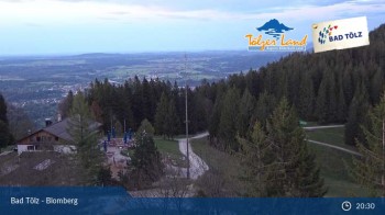
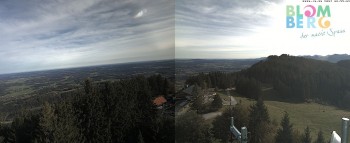
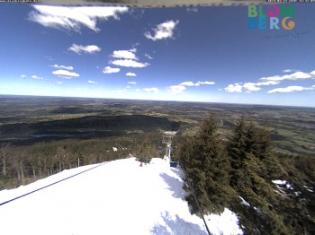
Live-Cam located on Blomberg, a mountain in Bavaria near Bad Tölz.
26 minutes ago
Mountain station Brauneck
Elevation: 1,470 m
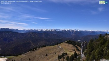
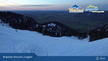
This webcam looks upon the top station Brauneck in Lenggries, the valley as well as the surrounding mountain-scape.
31 minutes ago
Benediktenwand (Bavaria)
Elevation: 1,512 m
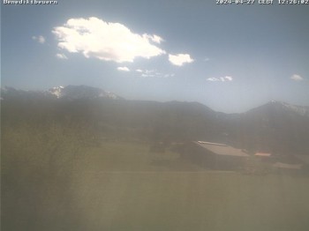
Enjoy the view to Benediktbeuern.
28 minutes ago
Blomberghaus (Bavaria)
Elevation: 1,126 m
Enjoy the view of the Blomberghaus.
temporarily unavailable
Blomberglift (Bavaria)
Elevation: 747 m
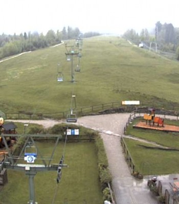
View of Chair Lift Blomberg near Bad Tölz.
28 minutes ago
Blomberg (Bavaria)
Elevation: 751 m
Have a look at Blomberg's base station.
29 minutes ago
mountain station chairlift "Gaistal", "Ehrwalder Alm"
Elevation: 938 m
You can see the view from the mountain station of chairlift "Gaistal"
32 minutes ago
Golf Course in Ehrwald
Elevation: 967 m
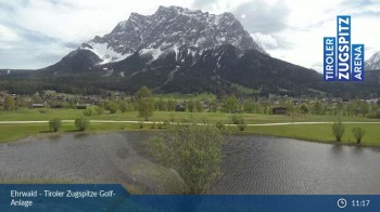
Here you can see the golf course at Tiroler Zugspitze.
18 minutes ago
Tiroler Zugspitzbahn Top Station
Elevation: 2,888 m
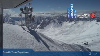
This webcam looks down from the top station of Tiroler Zugspitzbahn.
23 minutes ago
View of Ehrwalder Alm
Elevation: 1,491 m
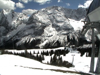
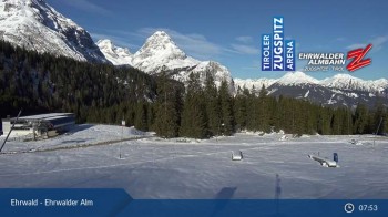
View of the mountain-scape surrounding Ehrwalder Alm
15 minutes ago
Stiealm alp
Elevation: 1,465 m
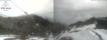
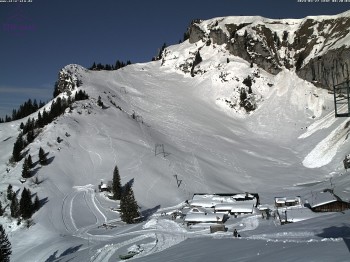
Located at the top station of Zirkuslift you can spot the Stiealm alp on the Idealhang.
temporarily unavailable
View on Draxlhang ski run
Elevation: 731 m
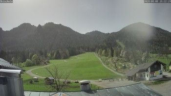
Located at skiing school Lenggries you can look towards the ski slope "Draxlhang"
temporarily unavailable

Webcam is Missing

A webcam is missing? Do you know the source of another one?

All Webcams on the map

Webcam Information

  • 21 webcams are located close to the Bike Trail Lenggries via Wegscheid to Leger. The webcams fall into three groups, namely 5 live streaming webcams, 2 panoramic webcams und 14 further webcams.
  • The highest webcam (Tiroler Zugspitzbahn Top Station) is located at an altitude of 2888 metres, while the lowest one (Webcam Isar in Bad Tölz) is situated at an altitude of 646 metres.
  • Most popular and most viewed/visited webcam: Lenggries-Brauneck: Bayern Hütte.
Travel Deals & Tips
Advertisement
Advertisement
Advertisement
Login with Google+
  • Share your personal insider tip and create new entries
  • Explore fantastic outdoor destinations when and where you want
  • Find your dream destination or discover the world on the interactive map