Hike Circuit Trail Oberweißburg at the Lungau: Position on map

Webcams around the Hike Circuit Trail Oberweißburg (Lungau)

Circuit Trail Oberweißburg
Silverjet, Katschberg
Elevation: 7155.5 ft
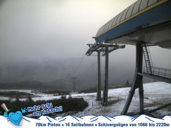
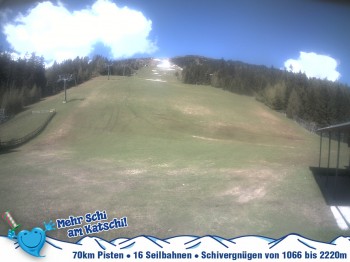
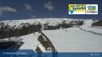
Have a look at the Silverjet 2 at the Katschberg in Austria.
4 hours ago
St. Margarethen: Silverjet Base station
Elevation: 5023 ft
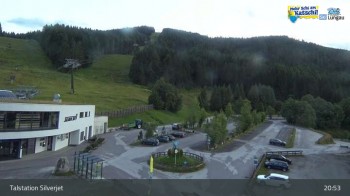
Have a look at the base station of the Silverjet gondola in St. Margarethen at the Katschberg in Austria.
5 hours ago
Fanningberg - Samson Chairlift
Elevation: 4947.5 ft
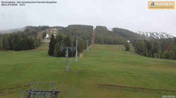
This is the view from the base station of the 6-seater chairlift Samsonbahn on the Fanningberg in Lungau. The lift leads up to the Frischinghöhe...
5 hours ago
St. Michael - View Top Station Sonnenbahn
Elevation: 6299.2 ft
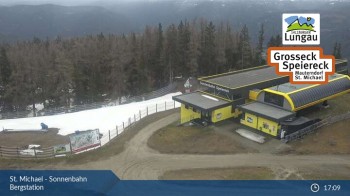
View at top station of Sonnenbahn Gondola in St. Michael.
5 hours ago
Rennweg: Katschberghöhe Centre
Elevation: 5495.4 ft
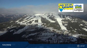
From Katschberghöhe centre, this webcam looks upon the surrounding mountains.
5 hours ago
Hotel Binngl in Mauterndorf
Elevation: 3694.2 ft
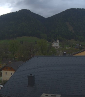
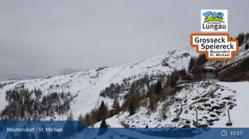
The webcam is located at the hotel Binggl in Mauterndorf in the Lungau region.
4 hours ago
Fanningberg - View from top station
Elevation: 6466.5 ft
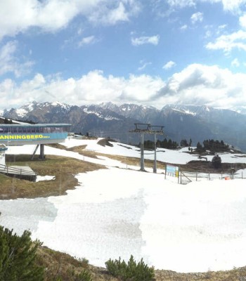
Enjoy the view from the top station of the Sasmonbahn chairlift on the Frischinghöhe at the family mountain Fanningberg in Lungau.
4 hours ago
Tschaneck Chairlift
Elevation: 5364.2 ft
Have a look at the the valley station of Tschaneck at Katschberg, Austria.
4 hours ago
St. Michael: Golf Course
Elevation: 3444.9 ft
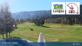
Here you can see the golf course of the golfclub Lungau near St. Michael
5 hours ago
Grosseckbahn Sender Top Station
Elevation: 6371.4 ft
Located at the top station of Grosseckbahn,this webcam casts its look around the surrounding mountains
5 hours ago
Fanningberg - Top Station
Elevation: 6561.7 ft
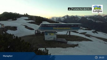
Panoramic view from the Samson top station on Fanningberg mountain in Mariapfarr.
5 hours ago
Mid station Aineck
Elevation: 4986.9 ft
View from the mid station at Aineck (1520m)
5 hours ago
Aineck: Katschberghöhe
Elevation: 6069.6 ft
Your view of Katschberghoehe Aineck.
5 hours ago

Webcam is Missing

A webcam is missing? Do you know the source of another one?
Advertisement

All Webcams on the map

Webcam Information

  • Around the Hike Circuit Trail Oberweißburg, there are 13 webcams. The webcams fall into three groups, namely 8 live streaming webcams, 2 panoramic webcams und 3 further webcams.
  • The highest webcam (Silverjet, Katschberg) is situated 2181 metres above sea level, wheras the lowest webcam (St. Michael: Golf Course) is situated 1050 metres above sea level.
  • According to its visits, the webcam Fanningberg - Samson Chairlift is the most popular one in the vicinity.