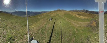
Hike From Dolomiten Hut to Karlsbader Hut - Lienz Dolomites in East Tyrol: Position on map

Webcams around the Hike From Dolomiten Hut to Karlsbader Hut - Lienz Dolomites (East Tyrol)

From Dolomiten Hut to Karlsbader Hut - Lienz...
Advertisement
Lienz - Hochstein ski resort
Elevation: 1,016 m
29 minutes ago
Lienz - Webcam Zettersfeld
Elevation: 2,214 m
29 minutes ago
Lesachtal Webcam
Elevation: 1,283 m
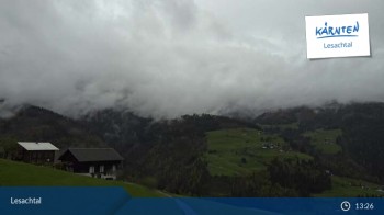
Here you can spot the panorama of Lesachtal valley.
36 minutes ago
Zettersfeld / Lienz
Elevation: 1,646 m
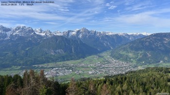
Located at Zettersfeld you can see Lienz and the Lienzer Dolomite Alps
28 minutes ago
View of the Tristachersee
Elevation: 833 m
Look over the Tristachersee - Parkhotel view
24 minutes ago
"Hochstein" mountain hut
Elevation: 2,003 m
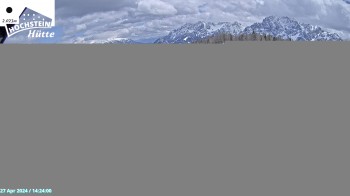
Enjoy the view of the "Hochsteinhütte" down the valley
22 minutes ago
View of the Mecki's Alm mountain hut
Elevation: 1,795 m
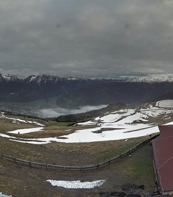
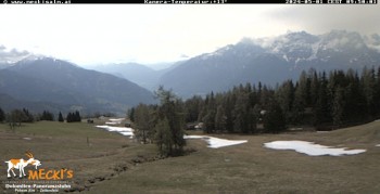
From the Mecki's Alm you can look straight to Kärnten and the nearby slopes
28 minutes ago
City of Lienz
Elevation: 672 m
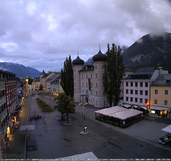
Look at the main place of Lienz - "Eck" hotel view
30 minutes ago
Lesachtal View over the valley
Elevation: 1,104 m
30 minutes ago

Webcam is Missing

A webcam is missing? Do you know the source of another one?

All Webcams on the map

Webcam Information

  • Around the Hike From Dolomiten Hut to Karlsbader Hut - Lienz Dolomites, there are 9 webcams. The webcams fall into three groups, namely one live streaming webcam, 2 panoramic webcams und 6 further webcams.
  • The highest webcam (Lienz - Webcam Zettersfeld) is situated 2214 metres above sea level, wheras the lowest webcam (City of Lienz) is situated 672 metres above sea level.
  • According to its visits, the webcam Lienz - Hochstein ski resort is the most popular one in the vicinity.
Travel Deals & Tips
Advertisement
Advertisement
Advertisement
Login with Google+
  • Share your personal insider tip and create new entries
  • Explore fantastic outdoor destinations when and where you want
  • Find your dream destination or discover the world on the interactive map