

Route description
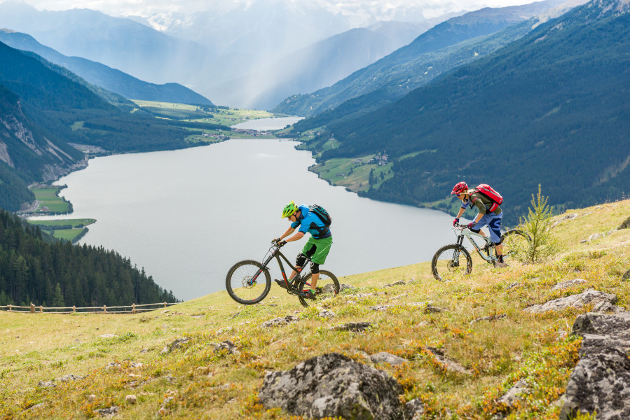
One of THE trail classics in the Upper Venosta Valley - a dream view from the famous viewing rock
From Resia/Reschen you walk northward across the border to our Austrian neighbours and 500 m before the valley station of the Bergkastel (Nauders in Austria) cableway, sharp right across a fairly steep gravel road up to the mountain station. Rest point in the mountain restaurant bearing the same name. Now the most beautiful part of the tour begins. Via the same way back to the Bergkastel apline pasture and then left to the wonderful Plamortböden moor as well as the tank barriers which are well-known far beyond the borders. Here you can use the forest road or the beautifully laid trails (S2). After passing the barriers, the view over the Venosta Valley opens up with the unique lake scenery and a fantastic panoramic view from the viewpoint at the rock. Down to Resia with great views in your bag, continue either via the - in part - technically more challenging bunker trail (S2), followed by the Etsch trail (S1) leading into the woods or via the old military path. Our evening drink is awaiting us directly at the lake.
Interesting facts
- You're traveling a distance of 19 km on this moderate trail. The bike trail is therefore not too long. The average length of all bike Trails in South Tyrol is 31 km.
- Elevated between 1,424 m and 2,169 m, the bike trail is among the 3 highest elevated bike Trails in Italy. You're facing an uphill climb of 800 vertical meters on this bike trail.
- There are places to buy beverages and food along the track. However it’s always recommended to bring enough water and food along with you.
Highlights of the tour
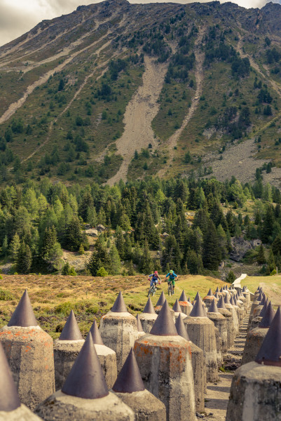
During this biketour you pass Bunkers and Anti-Tank Barriers
This Alpine system of fortifications that today appears like a bizarre work of art, is open to rediscovery. Of special interest, is Bunker No. 20 at Resia/Reschen, near the source of the Adige River. This is the barrier at Plamort, in a swampland above the village of Resia/Reschen and is designated as a natural monument. Guided tours are conducted all year round and must be arranged in advance with the Tourism Office, by telephone: +39 0473 633101.