 in the Pfalz: Position on map")

Route description
Your tour starts at the centre of Meisenheim, at Rapportier square. Start southbound on Untergasse, which you follow to Schlosskirche church. Continue towards Glan river, which you cross onto a hiking path.
The path leads you to Juchhe viewing point, which you should definitely ascend to enjoy the beautiful view over the surrounding reagion. Continue past Gustav-Merck square, where you can take a break for a barbecue, and walk on to the allotment area. Cross it, getting back to river Glan, which you cross once more.
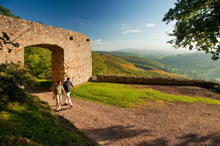
Shortly after, you get to an old Roman road, which leads you up to Ringwall, a circular castle on Marialskopf mountain. Continue on small forest roads, downhill through the dense forest. Eventually, you get to a small staircase, which leads you right into the centre of Lauterecken. Enjoy the town, and take a rest after your tour.
Interesting facts
- You're traveling a distance of 14 km on this moderate trail. The average length of all hikes in the Rhineland-Palatinate is 49 km.
- From Meisenheim to Lauterecke (Pfaelzer alpine path) is among the 10 best rated Hikes in Germany.
- The trail is one of the dog friendly hikes in the region.
- Sturdy hiking boots are recommended on this track. There are places to buy beverages and food along the track. However it’s always recommended to bring enough water and food along with you.
Highlights of the tour
The many well-kept buildings along the way as well as the historic old town of meisenheim take visitors back to bygone days, and invite you to stay and enjoy.
Variations
At the end of the tour, you can decide whether you want to go back on foot, or if you would rather take a bus.
Equipment
You should wear sturdy shoes and weatherproof clothing. Furthermore, we recommend taking some provisions, as there are not many opportunities to buy food everywhere along the way.
Getting here
By car:
Follow motorway A61 to Gau-Bickelheim, then continue on B420 to Meisenheim. Alternatively, take motorway A62, leaving the road at exit Kusel. From there, take B420 to Meisenheim.
You can park your car at the city centre of Meisenheim, and either walk back from lauterecken or take a bus.
Public Transportation:
Alternatively, you can take the train to Lauterecken, and then change onto a bus to Meisenheim.