
Route description
The stunning Lavanttaler Höhenweg (“Lavant Valley high-level path”) encompasses some 140 kilometres of walking through the picturesque lower and central Lavant Valley. Over the course of seven one-day stages, hikers have to scale around 4,500 vertical metres of terrain for a total walking time of some 46 hours. The tour starts in the market town of Lavamünd, which is also the lowest point on the route at just 348 metres above sea level. The highest point is the Koralpe at 2,140 metres, a peak which offers one-off panoramic views of the surrounding mountains. The Lavanttaler Höhenweg can be walked in both directions.
Safety information
Never stray off the marked walking paths! Particularly in wet conditions, there’s a real danger of slipping here. Always keep dogs on a lead to avoid scaring cattle. If you’re walking in large groups or with children, please adjust the time required and length of the stages accordingly.
Stage 1: From Lavamünd to Stiftshütte
Route: 21.2 kilometres
Walking time: approx. 7 hours
The first stage starts at Gasthof Hüttenwirt in Lavamünd. This is a great place to get a good meal before you begin the route. After around 21 kilometres you’ll reach the Stiftshütte, where you can spend the night. This first leg encompasses some 1,350 vertical metres of ascent with a total walking time of around seven hours.
Stage 2: From the Stiftshütte to the Weinebene/Gösler Hütte
Route: 19.6 kilometres
Walking time: approx. 6.5 hours
From the Stiftshütte, the route leads up and over the 2,140 metre Koralpe to Weinebene. The Koralpe is the highest point on the route and offers unparalleled views over the Lavant Valley. When you reach the Weinebene after around six and a half hours of walking, you can spend the night in the Gösler Hütte.
Stage 3: From the Weinebene to Theißenegg
Route: 20.5 kilometres
Walking time: approx. 6.5 hours
On the third day, you scale the Weberkogel and Renneiskogel and then head onwards to Theißenegg, also known as the “village of flowers”. It takes around six and a half hours of walking to reach the village, where you can spend the night.
Stage 4: From Theißenegg to the Naturfreundehaus Klippitztörl
Route: 23.2 kilometres
Walking time: approx. 8 hours
The fourth stage initially heads for Twimberg. This village at 604 metres above sea level is in the bottom of the valley between the Koralpe and Saualpe. The route then takes in the health resort town of Prebl as well as the 1,357-metre “Bischofeck” before arriving at the Klippitztörl after some eight hours of walking. This peak stands at 1,760 metres and is the most northerly point on the route. You can recover from the trials of the day and enjoy a good night’s sleep in the Naturfreundehaus.
Stage 5: From the Klippitztörl to the Saualpe/Wolfsberger Hütte
Route: 13.3 kilometres
Walking time: approx. 4.5 hours
The fifth leg is a little shorter than the preceding stages. The path leads over the 1,917 metre Geierkogel before heading along the gentle crest of the Saualpe. As you continue on towards Forstalpe, you can enjoy peerless panoramic views of the surrounding region. From the Forstalpe, continue on over the Gertrusk and Ladinger Spitz. At 2,079 metres, this is the highest point on the Saualpe. Take a break here and enjoy the view of the mysterious “Meeraugen” mountain lakes. The last leg of the stage takes you onwards to the Wolfsberger Hütte, your destination for the day.
Stage 6: From the Wolfsberger Hütte to the Griffner Berg
Route: 17.2 kilometres
Walking time: approx. 5.5 hours
Today’s stage takes the path over the Kostmannkogel to the mountain village of St. Leonhard an der Saualpe. From here, head up the hill to the 704-metre Griffner Berg. After around five and a half hours of walking, you’ll reach Pension Töfferl, where you can spend the night.
Stage 7: From the Griffner Berg to Lavamünd
Route: 23.12 kilometres
Walking time: approx. 8 hours
The last section demands considerable fitness and stamina. You have to scale the three St. Pauler peaks Langer Berg, Zwölferkogel and Martinikogel before looping back to the starting point of the tour – Gasthof Hüttenwirt in Lavamünd after a good eight hours on foot.
Where to eat
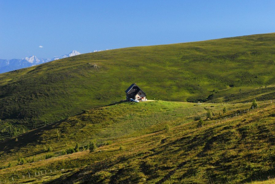
Along the Lavanttaler Höhenweg route, there are numerous mountain huts like the Stiftshütte, Gösler Hütte, Naturfreundehaus Klippitztörl and Wolfsberger Hütte which are ideal sources of meals and accommodation. However, you should ensure that you have a little food and drinking water with you at all times.
Interesting facts
- With an overall length of 138 km the hike is among the 3 longest hikes in Austria available on TouriSpo.
- Lavanttaler Höhenweg is among the 10 best rated Hikes in Austria.
- Elevated between 356 m and 2,048 m, the hike is among the 3 highest elevated hikes in Carinthia. You're facing an uphill climb of 7514 vertical meters on this hike. This is quite much. You should be fit to do this track. This makes the hike one of the 3 hikes with the most ascent in Austria.
- Hiking boots are not required, but the hike might be more enjoyable with sturdy footwear (especially in wet conditions). If you get hungry along the way, there are places to rest and get food. Nevertheless it’s recommended to also have enough water and food in your backpack when hiking or biking.
Highlights of the tour
The Lavanttaler Höhenweg is particularly interesting from a geological perspective. The Koralpe and Saualpe are the best-preserved remains of a mountain range older than the modern day Alps. As the Alps were being folded, several parts of these ancient mountains were transformed, changing the character of the rock. The ore-bearing blocks of gneiss, granite and mica slate surround coal-bearing layers along the bottom of the valley. The St. Pauler mountains, in contrast, are built on top of the igneous rock of the Palaeozoic period and are made of limestone and dolomite from the Mesozoic period.
Equipment
- Walking boots
- Weather-proof clothing
- Food and drinking water
- Mobile phone with emergency numbers saved
- Medical pack
- Pen-knife
- Lighter
- Walking map
- Tour description
- Reserve clothing
Getting here
By car: If you’re travelling to the starting point by car, take motorway A2 from Graz or Klagenfurt and exit at the Wolfsberg Nord or Süd exit. From here, you can follow signs for Lavamünd.