


Description

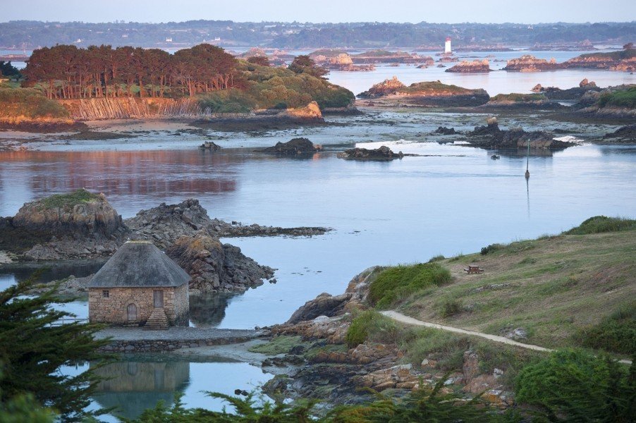
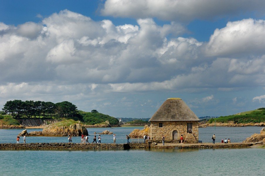
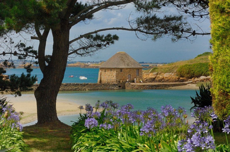
On the north coast of Brittany, you’ll discover the island of Île de Bréhat, surrounded by countless cliffs and 86 small islets. The main island of Bréhat (Breton: Enez Vriad) is 3.5 kilometers long and 1.5 kilometers wide, separated from the mainland only by a narrow strait. It’s divided into a north and south island, connected by the Pont Vauban bridge. Known as the “Island of Flowers and Pink Rocks” (L’île des fleurs et des rochers roses), Île de Bréhat earns its nickname well: the southern part features charming manors, idyllic landscapes, and lush vegetation, while the north is marked by rugged, wild cliffs and sparse housing.
A true natural paradise
Palm trees, eucalyptus, agaves, hydrangeas, mimosas – thanks to a special microclimate, Île de Bréhat boasts a diverse, almost Mediterranean flora. Rightfully called the “flower island,” it is bathed in the warm Gulf Stream and enjoys a mild climate nearly year-round, resulting in exotic blooms from spring through late autumn.
The island’s symbol is the African lily (Agapanthus africanus), brought from South Africa by seafarers. From June to September, its blue-violet blossoms adorn the island. The largest collection can be admired at the Pepinière de l'île de Bréhat, a local nursery. In addition to the typical blue variants, many other colors can be found. The nursery also sells seeds and plants and offers tips for successful cultivation.
Sights on the island
Upon arriving, you’ll first encounter the market square of Le Bourg, where small shops invite you to browse and local artists showcase their work along the street. Relax in a cozy café and take in the lively atmosphere!
Visible from afar is the Chapelle Saint-Michel, a small chapel from 1651 located on a rocky hilltop and accessible via 40 steps. From there, you’ll enjoy a panoramic view of the surroundings. Inside, you'll find a statue of Saint Michael with his flaming sword and a painted map of the island on the wall.
At the northern tip of the island, a visit to Phare Le Paon is worthwhile. This lighthouse, built in 1949, stands atop red granite cliffs. From the platform at its base, you'll be treated to spectacular views of the rugged northern coastline and the English Channel.
Exploring Île de Bréhat
Since cars are not allowed on the island, you can explore it on foot or by bike, which can be rented at the harbor. Biking is especially recommended for discovering the northern island. A map of the island’s hiking and cycling routes is available at the Syndicat d’Initiative office on the Le Bourg market square.
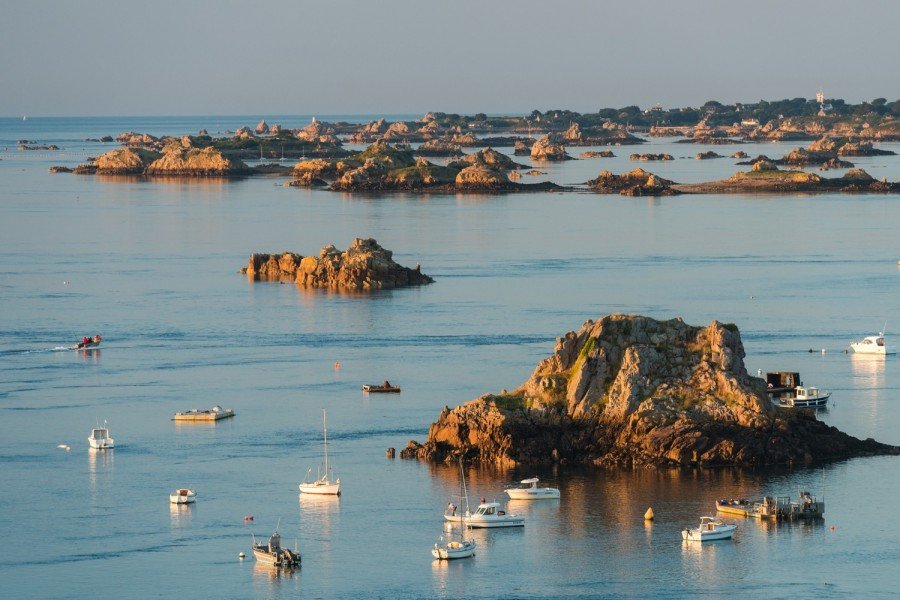
You can also enjoy beautiful views of the archipelago from the water. Boat tours are offered to explore the many surrounding islets and to admire the island’s diverse coastal scenery.
For swimming, the southern beach of the island is ideal. Its sunny orientation is a rarity on Brittany’s north coast. The waters around Île de Bréhat are also perfect for sailing or diving adventures.
Historical Information
The island of Bréhat was of strategic importance in the Middle Ages. In the Guerre de la Ligue, the War of Succession, the Bretons, French, English and Spanish fought over the archipelago in the English Channel. The castle, which was repeatedly razed to the ground, was finally demolished under Henri IV.
Interesting facts
- Île de Bréhat - Flower Island is among the 10 best rated Tourist Attractions in France.
How to get there
Île de Bréhat is just a few kilometers from the coast of Brittany near Paimpol.
By ferry:
You can easily reach the island of flowers by boat. Excursion boats depart regularly from the Pointe de l'Arcouest headland to Port-Clos on the south side of the island. Depending on the water level, the boats use one of the three piers. The crossing takes around 15 minutes. From there, you can explore the island on foot or by bike. Cars are not allowed here.