

Route description
Discover the Breton coastline on the Sentir des Douaniers
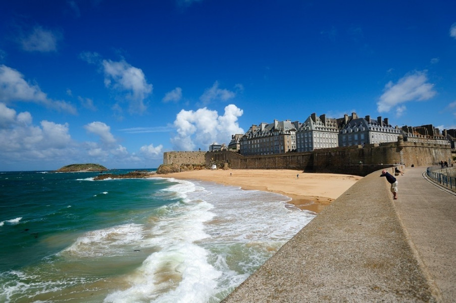
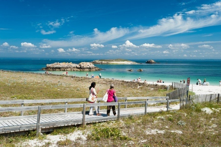
This hiking path is called Sentir des Douaniers or Grande Randonnée 34, and has a length of more than 1,300 kilometers alongside the Breton coastline. The Sentir des Douaniers consists of many small paths all the way from the gate of Brittany, namely Mont-Saint-Michel up to the Golfe du Morbihan in the south and offers hiking fun for everyone. You'll be hiking from bay to bay and are able to discover the beautiful coastal area beside the Atlantic Ocean. There are many things to discover: You will find the pink granite coast, the rugged cliffs of the Corazon peninsula and the majestic lighthouses rising high above the coastline of Brittany. There are numerous historic villages on the way such as the old Corsair city Saint-Malo by the Côte d’Émeraude, translated “Emerald's Coast” in English. Moreover, there is the city Cancale, which is known for its special oysters. Meanwhile, the paths lead your way beside menhirs and the heath, alongside beaches and the wild untamed ocean whilst noticing the delicate smell of a fresh sea breeze in the air. Furthermore, culinary highlights of Brittany are not coming in short on your adventures on the Sentir des Douaniers as well.
Multifaceted nature along the along the coast
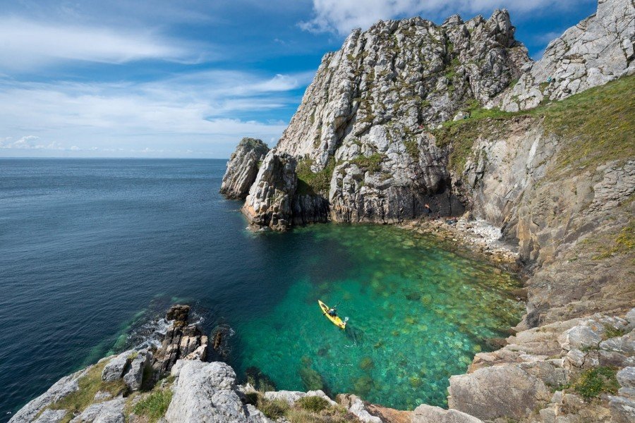
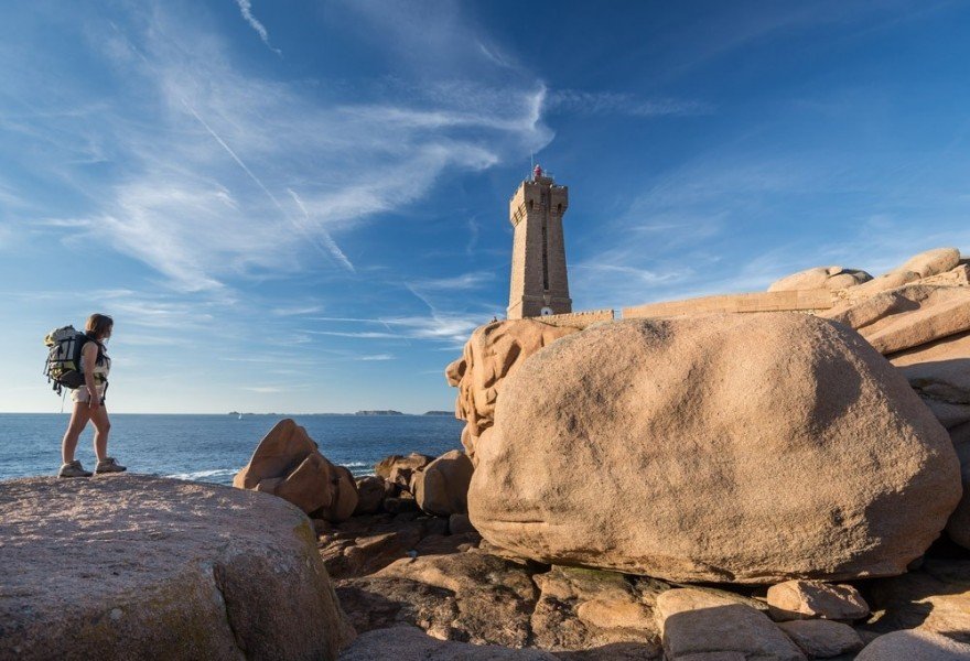
The Sentir des Douaniers goes beside numerous striking partly even mysterious areas. The charm of more than 800 little or larger islands by the Brittany boarder is especially hard to resist. The wild cliffs from Kerlouan to the Crozon peninsula in the west of the Brittany and to Ploudalmézeau alone tell numerous legends and sayings just from a look at them. The most visited nature sight in the whole of Brittany are the Cap Fréhel and the Sept Îles before the Perros-Guirec island group. These are the oldest natural reserves of France and are located alongside the Côte d’Émeraude. Equally impressing is the previously mentioned Côte de Granit Rose, the pink granite coast. Dive deep into a pink ocean of stones and rock faces here that was created over 300 million years ago. Furthermore, bizarre stone sculptures such as one by the port of Ploumanac’h or one named “Napoleons hat” will captivate your interest in no time! Not far from Ploumanac’h, the Chateau de Costaérès rises high over an island across the Brittany shore. This Gothic castle is one of many
Chateaus you can visit in the region. In the southern part of the Brittany you will be hiking beside rivers with yellow groom, rustic tide mills and Breton farmer's houses that are placed colorfully in a sea of hydrangeas. Moreover, the colony of artists Pont-Aven greets you here. Then, the hiking trails alongside the Côte des Mégalithes are particularly exciting with humongous bricks from stone for example by the town Quiberon. Meanwhile, the natural spectacles of the coast are additionally impressive: There are massive tides in the region, where you can walk on a sandy ground towards an island at low tide, just where high waves of the ocean had broke a few hours before.
The story of the Sentier des Douaniers
The Sentir des Douaniers got its name from the so called Gabelous, the officers of customs of the Ancien Régime. These Sentier des Douaniers or Gabelous protected the path and the areas close by from smugglers and plunderers man by man from the 17th up until the 20th century. Many years later, namely in 2008, the hiking path was officially announced as the Grande Randonnée 34 and is one of the longest hiking trails in the whole of France as of today.
Practical tips and interesting facts
The Sentier des Douaniers is signposted well and provides the hikers with red and white striped marks on the sides. Numerous parts of the trail have rather gentle gradients and are therefore very family friendly to hike. For all the water fanatics, it is also possible to discover parts of the trail from the water with a boat. It is beneficiary to hike on the Sentier des Douaniers between the months of May and September since the weather can be pretty rough in the winter months around the Breton coast. Nevertheless, it should be very pleasing weather in the summer, which makes it perfect to enjoy your hiking experience in Brittany.
Where to eat
You will pass numerous charming towns and villages on your way on the Sentier des Douanier and are able to get to try the culinary highlights of Breton food here and there in one of the towns. Furthermore, there are plenty of options to stay over night in the region.
Interesting facts
- With an overall length of 1,696 km the hike is currently the longest hike in France available on TouriSpo.
- The Sentir des Douaniers is among the 3 best rated Hikes in France.
- The hike is one of the family friendly trails in the region. What’s even better: You can also bring the family’s best friend on this dog friendly hike. (See all dog friendly hikes in Brittany.)
- You shouldn’t forget to bring your hiking boots. There are some sections on the trail where sturdy footwear is required. There are places to buy beverages and food along the track. However it’s always recommended to bring enough water and food along with you.
Video
Variations

Everyone who wants to hike the GR34 from start to finish needs to to plan to take some time off for about three months. Because of the enormous length of the trail you should choose little sections you want to hike of the trail beforehand. All those who want to take a day trip on the Sentier des Douaniers can chose to hike to Saint-Malo (17 kilometers – a decent destination for one day of hiking) for example, alongside the Golfe du Morbihan from Penvins to Arzon (one day, 18 kilometers), or the section from Bénodet to Pont-Aven for two days of hiking. A rather easy three day tour is the one to the South from Concarneau up until the picturesque Pont-Aven. It is especially applicable to hike this tour with children since the daily hikes are not too long.
Equipment
Make sure to bring sturdy shoes and clothes for all possible weather conditions as it may rain. Moreover, it is always nice to bring a swim suit for a relaxing stroll in the ocean during the summer months.
Getting here
You may get to a starting point on the Sentier des Douaniers with numerous trains from all directions or on the roads with a car. However, it will be more flexible to get to some of the sections of the trail by car.