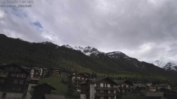
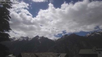
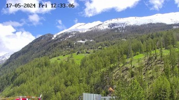
Hike Europaweg Zermatt - Grächen with Suspension Bridge in Zermatt: Position on map

Webcams around the Hike Europaweg Zermatt - Grächen with Suspension Bridge (Zermatt)

Europaweg Zermatt - Grächen with Suspension Bridge
Advertisement
Saas-Fee: View from Hannig top station
Elevation: 2,335 m
The webcam opens a beautiful view from the top station of Hannig over Saas-Fee in the Swiss canton Valais.
35 minutes ago
Panorama Hotel Zermatterhof
Elevation: 1,622 m
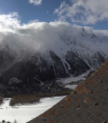
The webcam is located on the roof of the Grand Hotel Zermatterhof in Zermatt, Switzerland.
16 minutes ago
Täsch - Panorama
Elevation: 1,454 m
The webcam shows the village Täsch near Zermatt in Switzerland.
16 minutes ago
Grächen - View Suspension Bridge Charles Kuonen
Elevation: 2,062 m
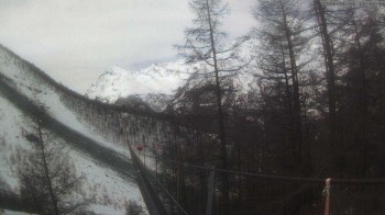
Webcam located at the suspension bridge Charles Kuonen in Grächen, Switzerland.
17 minutes ago
Rothorn in Zermatt
Elevation: 3,059 m
This webcam shows the view from Unterrothorn in Zermatt. You can see Restaurant Rothorn as well as the surrounding mountains. Rothorn mountain...
35 minutes ago
Matterhorn Glacier Paradise in Zermatt
Elevation: 3,778 m
View from Matterhorn Glacier Paradise viewing platform. Here at the peak of Klein Matterhorn you get a unique view of the Alps of the Valais.
35 minutes ago
Saas-Fee (Mittelallalin)
Elevation: 3,451 m
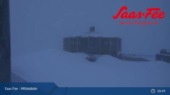
This webcam on Mittelallalin, a minor summit below Allalinhorn in Saas-Fee shows the local restaurant. From there you have a great view of the...
39 minutes ago
Egga - Grächen
Elevation: 1,641 m
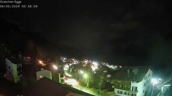
The webcam is located in Egga in the north of Grächen and is looking south.
16 minutes ago
Grächen - south
Elevation: 1,664 m
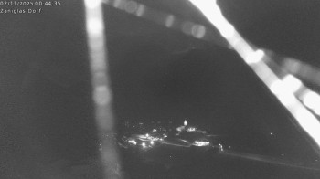
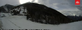
View from the south-east of Grchen up towards Mt. Seetalhorn.
16 minutes ago
Saas Fee - Glacier
Elevation: 2,851 m
Located at the Längfluh mountain hut the webcam is looking east towards the glacier of Saas Fee.
7 minutes ago
Saas Fee - Längfluh south
Elevation: 2,881 m
The webcam at the mountain hut Längfluh near Saas Fee is looking south towards Mt. Allalinhorn.
9 minutes ago
Längfluh - View towards Saas-Grund
Elevation: 2,881 m
Enjoy the view from the mountain hut Längfluh looking north towards Saas-Grund.
temporarily unavailable
St. Niklaus Village
Elevation: 1,098 m
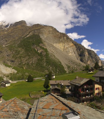
Your view of the village of St. Niklaus, which is located south-west of Grächen.
16 minutes ago
Visperterminen - Chair lift
Elevation: 1,396 m
The webcam is located at the base station of the chair lift in Visperterminen in the Canton of Valais.
16 minutes ago
Gornergrat Kulm Zermatt
Elevation: 3,095 m
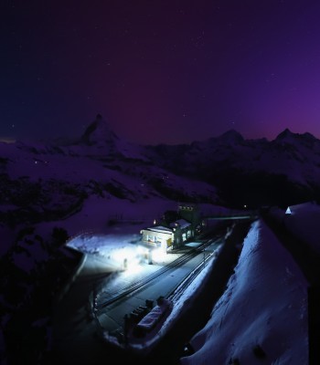
Panorama view from the top of the Gornergrat-Bahn.
5 minutes ago
Riffelberg Panorama Zermatt
Elevation: 2,570 m
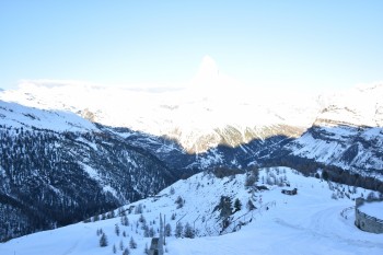
This webcam shows the view from Riffelberg to the Matterhorn.
4 minutes ago
Grächen - South-West: Weisshorn
Elevation: 1,635 m
Enjoy the view to Weisshorn from Grächen in the Canton of Valais in Switzerland.
13 minutes ago
Randa, Oberes Mattertal
Elevation: 1,415 m
Have a look at Randa in Switzerland, you can spot Breithorn and Mettelhorn in the back
6 minutes ago
Golfplatz Täsch/ Randa
Elevation: 1,417 m
Have a look towards Klein Matterhorn and Breithorn
temporarily unavailable
Zermatt - Spiss
Elevation: 1,597 m
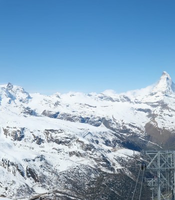
Spot Zermatt in Switzerland, in the background Klein Matterhorn and Matterhorn
4 minutes ago
Zermatt Village
Elevation: 1,617 m
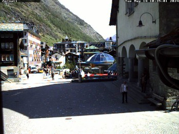
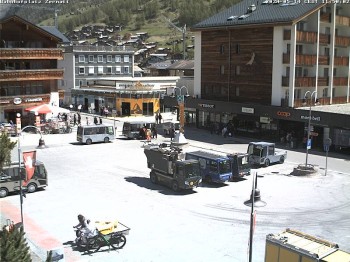
Have a look at the centre of Zermatt, Switzerland.
52 minutes ago
Heliport Zermatt
Elevation: 1,631 m
View from the heliport Zermatt.
6 minutes ago
Fluhalp
Elevation: 2,609 m
10 minutes ago
Sunnega
Elevation: 2,257 m
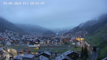
Panorama view from Sunnegga/ Zermatt.
4 minutes ago
Panoramic view from Rothorn
Elevation: 3,059 m
View of mountain restaurant Rothorn.
5 minutes ago
Panoramic view Hannig Mountain
Elevation: 2,300 m
Webcam located at Hannig Mountain in Saas-Fee.
1 minute ago
Längfluh Saas-Fee
Elevation: 2,849 m
Panoramic view of Fee Glacier from top station Längfluhbahn.
35 minutes ago
View Mountain Restaurant Mittelallalin
Elevation: 3,445 m
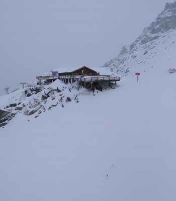
Panoramic view of mountain restaurant Mittelallalin in Saas-Fee, Switzerland.
1 minute ago
Kleinmatterhorn Zermatt
Elevation: 3,793 m
View from the Kleinmatterhorn to Italy.
5 minutes ago
Panoramic view, Grächen in Valais
Elevation: 950 m
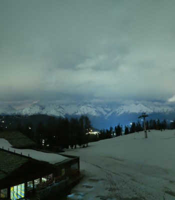
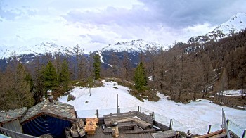
Here you have a panoramic view to Grächen in Valais
5 minutes ago
Grächen in Valais
Elevation: 1,740 m
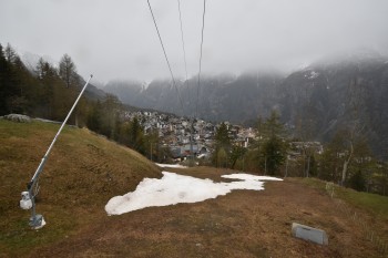
Here you can see the village Grächen with gondola "Hannigbahn"
2 minutes ago
north "Hannigalp", Grächen in Valais
Elevation: 2,104 m
Here you can see north "Hannigalp" in Grächen
5 minutes ago
Panoramic view from Riffelberg 2582m
Elevation: 2,581 m
Top of Riffelberg.
26 minutes ago
Findeln
Elevation: 2,144 m
This webcam shows Findeln in the Sunnegga ski resort.
56 minutes ago
Restaurant Ginals, Valais
Elevation: 2,048 m
Here you can see the outlook from Restaurant Ginals in Unterbäch
3 minutes ago
alp Moosalp, Bürchen
Elevation: 2,044 m
Here you can see the outlook from alp Moosalp
5 minutes ago
Seetalhorn
Elevation: 2,940 m
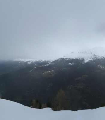
Mountain view from Seetalhorn (2864m)
5 minutes ago
Zermatt Matterhorn
Elevation: 2,759 m
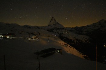
View of the Matterhorn in Zermatt, Switzerland.
5 minutes ago
Zermatt Railway station
Elevation: 1,613 m
Zermatt Railway station
59 minutes ago
Zermatt Church
Elevation: 1,623 m
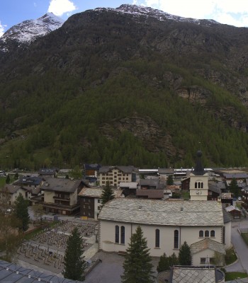
This webcam shows the church in Zermatt.
1 hour ago

Webcam is Missing

A webcam is missing? Do you know the source of another one?

All Webcams on the map

Webcam Information

  • 40 webcams are located near the Hike Europaweg Zermatt - Grächen with Suspension Bridge. The webcams fall into three groups, namely 6 live streaming webcams, 13 panoramic webcams und 21 further webcams.
  • The highest webcam (Kleinmatterhorn Zermatt) is situated 3793 metres above sea level, wheras the lowest webcam (Panoramic view, Grächen in Valais) is situated 950 metres above sea level.
  • According to its visits, the webcam Saas-Fee: View from Hannig top station is the most popular one in the vicinity.
Travel Deals & Tips
Advertisement
Advertisement
Advertisement
Advertisement
Login with Google+
  • Share your personal insider tip and create new entries
  • Explore fantastic outdoor destinations when and where you want
  • Find your dream destination or discover the world on the interactive map