Hike Mountain Huts Tour Windach Valley Ötztal: Position on map

Webcams around the Hike Mountain Huts Tour Windach Valley (Ötztal)

Mountain Huts Tour Windach Valley
Advertisement
Sölden - View Village
Elevation: 4481.6 ft
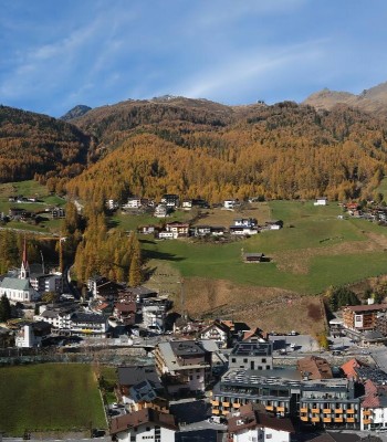
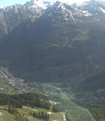
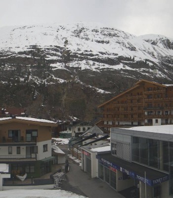
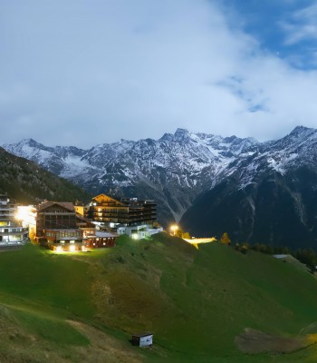
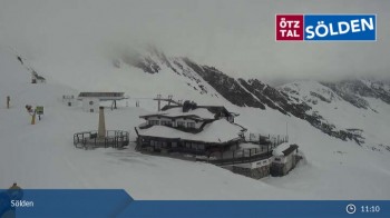
Have a look at the village of Sölden in Tyrol.
3 hours ago
Stubai Glacier - View Fernau Station
Elevation: 10052.5 ft
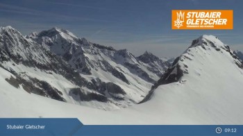
View from top station Fernau at Stubai Glacier.
1 hour ago
Stubai Glacier - View Top Station Murmele
Elevation: 8766.4 ft
View from Murmele top station at Stubai Glacier, Tyrol.
1 hour ago
Sölden - Schwarze Schneid Cable Car
Elevation: 9688.3 ft
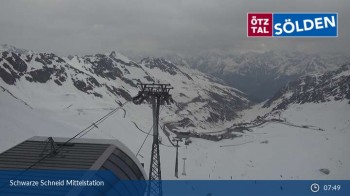
Enjoy the view of the Ötztal Alps from the middle station of the Schwarze Schneid gondola lift in Sölden.
1 hour ago
Giggijoch Top Station
Elevation: 7470.5 ft
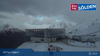
View from Giggijoch over the surrounding mountain-scape of the Sölden region.
1 hour ago
Gaislachkogel
Elevation: 7093.2 ft
This livecam shows the view from the Gaislachkogel over Sölden.
5 hours ago
Timmelsjoch - Top Mountain Crosspoint
Elevation: 7080.1 ft
Webcam located at Top Mountain Crosspoint at Timmelsjoch.
1 hour ago
Blick von Rabenstein auf das Timmelsjoch (Südtirol)
Elevation: 6161.4 ft
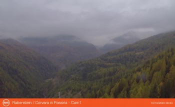
View of south tyrolean village Rabenstein in Passeier towards pass Timmelsjoch. The village is starting point for hikes in the natural park...
3 hours ago
Obergurgl - View Festkogel
Elevation: 9468.5 ft
Here you can see the view from Festkogel above Obergurgl in the Ötztal valley
4 hours ago
Panoramic view Hotel Edelweiss & Gurgl, Obergurgl
Elevation: 6273 ft
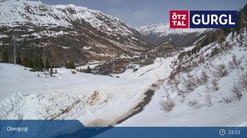
Panoramic view over the ski resort Obergurgl.
1 hour ago
Eisgrat Top Station
Elevation: 7503.3 ft
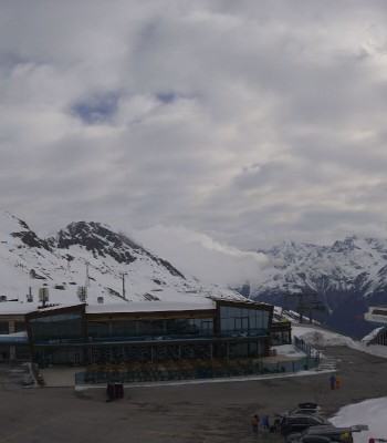
Here you can enjoy the view from the top station of the Eisgrat gondola
1 hour ago
Grünwald Resort
Elevation: 5052.5 ft
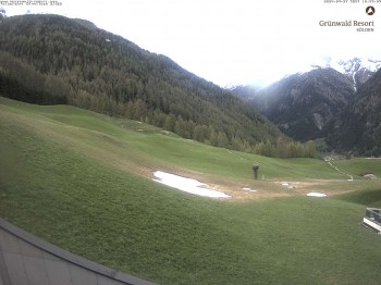
The Grünwald Resort is located 100 m top of Sölden.
3 hours ago
Glacier Arena Rettenbach
Elevation: 8822.2 ft
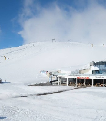
Bottom of the Rettenbachferner in Sölden.
5 hours ago
Tiefenbachgletscher Ötztal
Elevation: 9166.7 ft
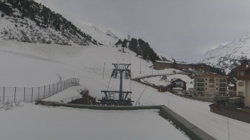
View from the parking at Tiefenbachgletscher to run 36 and 38.
5 hours ago
Ötztal Hochsölden
Elevation: 6827.4 ft
Outlook near Hochsölden to the Ötztal Alps.
5 hours ago
Rettenbach Glacier Sölden
Elevation: 9688.3 ft
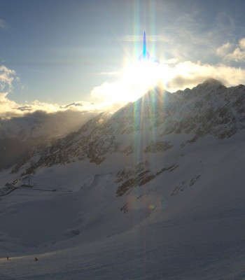
Outlook from the Rettenbach Glacier to the Ötztal Alps.
5 hours ago
Obergurgl (Ötztal valley)
Elevation: 6250 ft
Your view at the hotel Edelweiss & Gurgl
1 hour ago
Hochgurgl (Tyrol) Top Mountain Crosspoint
Elevation: 7080.1 ft
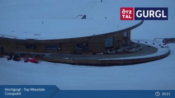
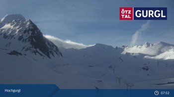
Have a look at the Top Mountain Crosspoint at the Hochgurgl in Ötztal, Tyrol (Austria).
1 hour ago
Sölden - Gaislachkogl
Elevation: 9901.6 ft
View from Gaislachkogel in Sölden.
1 hour ago
Gaisberg mountain near Obergurgl
Elevation: 6578.1 ft
Your view at Gaisberg mountain.
3 hours ago
Sölden - Seekogl
Elevation: 8536.7 ft
Sölden:View from Seekogel mountain.
1 hour ago
Hohe Mut Mountain, Obergurgl
Elevation: 8802.5 ft
Located at Hohe Mut mountain you can enjoy the panoramic view on the surrounding mountain landscape of Obergurgl.
4 hours ago
Hochgurgl at Ötztal valley
Elevation: 7857.6 ft
This webcam shows you the view at Hochgurgl, Ötztal valley. You can see the lifts Schermerbahn 3000, Wurmkogelbahn I and Topexpress Gurgl.
4 hours ago
Stubai glacier: Daunjoch chair lift
Elevation: 9842.5 ft
Enjoy the view from Daunjoch chair lift
1 hour ago

Webcam is Missing

A webcam is missing? Do you know the source of another one?

All Webcams on the map

Webcam Information

  • Around the Hike Mountain Huts Tour Windach Valley, there are 24 webcams. The webcams fall into three groups, namely 13 live streaming webcams, 8 panoramic webcams und 3 further webcams.
  • The highest webcam (Stubai Glacier - View Fernau Station) is situated 3064 metres above sea level, wheras the lowest webcam (Sölden - View Village) is situated 1366 metres above sea level.
  • According to its visits, the webcam Sölden - View Village is the most popular one in the vicinity.
Travel Deals & Tips
Advertisement
Advertisement
Advertisement
Advertisement
Login with Google+
  • Share your personal insider tip and create new entries
  • Explore fantastic outdoor destinations when and where you want
  • Find your dream destination or discover the world on the interactive map