

Route description
With its captivating heath landscape, Cape Frehel counts as one of the most beautiful natural monuments in Brittany. On this hiking tour you can explore the headland in the north of the region with its impressive steep cliffs, a unique natural landscape and the powerful fortress Fort La Latte.
By foot to Cape Fréhel
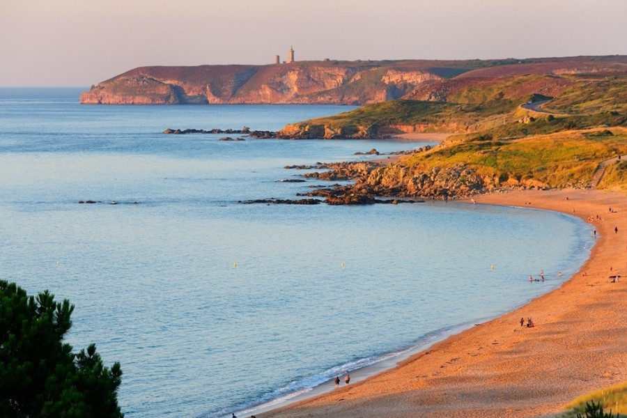
The starting point of your hike is in the center of Plévenon, a small community located directly at the cape. You leave the village westwards, through La Ville Hingant and towards the coast. Near the Plage de la Fosse you need to walk a small part of your way on the D34, before turning right onto the coastal path. Follow this path through an extraordinary natural landscape up to the lighthouses north at Cape Fréhel. You will be excited by the red sandstone cliffs, reaching up to 70 meters high.You can enjoy marvellous views over the sea and discover numerous, partly rare types of plants and birds. Once you have arrived at the lighthouses, and if it is between April and October, you have a chance to climb them. On a clear day, the view from the top reaches all the way to the Norman peninsula Le Manche.
An impressive fortress
Afterwards you continue following the coastal path to the south and enjoy the wonderful nature on your way. You can take a little break at the beach Les Fontaines, and a short while later will arrive at Fort La Latte. The impressive fortress served as a protection of the coast. The original fort from the 14th century had been extended to a huge fortress in the 17th century, which has actually been used as a setting for a movie. From April through to September, the castle opens its gates to visitors and invites you to do a small discovery tour. From here, you again have a wonderful panorama view of your surroundings. Continue still further along the coastal path up to Pointe de la Touche. Once arrived here, turn left in the direction La Ville Galopin. The way will lead you through the inside of the headland through La Ville Meunier, La Ville Besnard, Ker Avel and La Thébaudais, back to Plévenon.
Where to eat
If you pack a little lunch, you could make a picnic along your way. In any case pack enough to drink.
Interesting facts
- With an overall length of 18 km the hike is among the 3 longest hikes in France available on TouriSpo.
- From Plévenon to Cape Fréhel is among the 3 best rated Hikes in France.
- It’s ok to bring your best friend on this dog friendly hike. (See all dog friendly hikes in Brittany.)
- You shouldn’t forget to bring your hiking boots. There are some sections on the trail where sturdy footwear is required. If you get hungry along the way, there are places to rest and get food. Nevertheless it’s recommended to also have enough water and food in your backpack when hiking or biking.
Video
Highlights of the tour
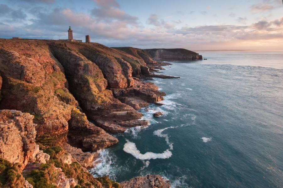
Most impressive about this hike is without question the unique natural landscape. Cape Fréhel impresses with its steep, red sandstone cliffs, black slate androsé coloured granite as well as with its colourful blooming heather and nesting birds hovering about. Also, the two lighthouses at the Cape and the powerful fortress are great highlights along the way.
Getting here
By car:
The D786 brings you to the north of Brittany. At Fréhel, turn onto the D117, which leads you directly to Plévenon. Alternatively, you could take the D34 about one kilometer to the east of Fréhel and follow the road until Plévenon. Next to the village school and opposite of the city hall, you will find a car park where you can leave your car and start your walk.