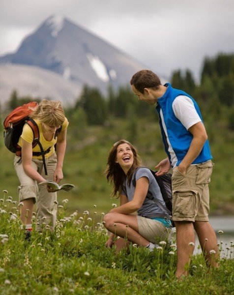
Route description
Mount over the Cory Pass
Starting at the Fireside Picnic Area, follow the hiking trail from the beginning for about one kilometer, until the first crossing with the Cory Pass. From the crossing, you manage the majority of the altitude of the way within the next 4.5 kilometers, hiking over the mountain pass. It partly has you walking beyond the treeline, inviting you for smaller stops along the way to take a breath, and to enjoy the beautiful landscape surrounding you. However, you should be careful along the pass during the colder season of the year, as it is known to be especially windy.
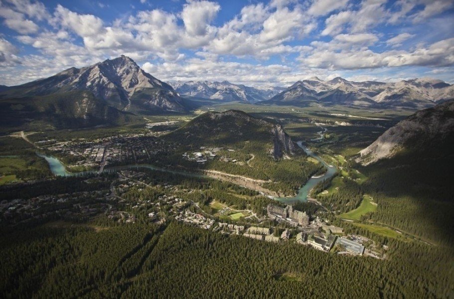
View from the highest point
Once you have reached the highest point, take a break to enjoy the breathtaking view over the valley. It is for sure one of the most beautiful views in all of the Canadian Rockies. A special highlight is looking over the southside of Mount Louis. After this little break, walk another 3.5 km over the rebble with narrow pathways, until you reach the beginning of the Edith Pass.
A hill giant at the finish
To finish the loop, descend on the north part of the Cory Pass and walk around Mount Edith. The mountain with its 2554 m height literally is the peak of your journey. When you have circled it once, you can confidently - with these beautiful scenic images in your head, or on camera - make your way back to the starting point.
 
Interesting facts
- You're traveling a distance of 13 km on this strenuous trail. The average length of all hikes in Alberta is 19 km.
- Elevated between 1,428 m and 2,318 m, the hike is the highest elevated hikes in Canada. You're facing an uphill climb of 35913 vertical meters on this hike. This is quite much. You should be fit to do this track. This makes the Hike the one with the largest ascent in Canada.
- Taking your dog on this trail shouldn’t be a problem.
- Sturdy hiking boots are recommended on this track.
Highlights of the tour
The view from the top of Cory Pass is clearly the highlight of the tour, as well as the view of Mount Edith while you surround it.
Variations
If you do not want to walk the full loop, it is possible to walk only the path on the Cory Pass and return the same way. This is a very popular hike in the area, too.
Equipment
Wind-proof clothing is important as the Cory Pass often gets strong winds.
Getting here
By car
From Calgary
Starting in Calgary, follow the Bow Trail to the west out of town and take a right at the crossing with the Sarcee Trail. Continue on the Sarcee Trail. After a short while, change onto the Trans-Canada Highway direction Banff and follow the highway up to the exit to the Bow Valley Parkway (Highway 1A). After the exit, follow the road for about 0.5 km to the north. Then, turn right and follow the signs to the Fireside Picnic Area. You only drive 1 km to the end of the street and find the starting point of your hike near the bridge over the narrow river stream.
 
From Jasper
Should you commence your journey in Jasper, start off by taking the Connaught Drive westwards out of town. After a short while you cross the Yellowhead Highway to find yourself on Icefield Parkway. Follow the Parkway for the next 285 km. This will lead you through the Jasper as well as through parts of the Banff National Park. Take the exit to Bow Valley Parkway (Highway 1A) and follow the road northwards for about 0.5 km. Then take a right and follow the signs to the Fireside Picnic Area. You merely drive 1 km to the end of the road. The starting point of your hike is near the bridge over the narrow stream.
 
From Lethbridge
Coming from southern Lethbridge, take the Scenic Drive out of town and onto Crowsnest Highway (Highway 3). Follow the highway direction Calgary. After about 18 km, take a right and follow the signs to Monarch/Vulcan. This will take you to the Highway 23, which you do not leave until turning left to Claresholm. In Claresholm, take a left and follow the signs to Calgary/Nanton. You will now be on Queen Elisabeth Highway (Highway 2) that leads through Nanton and northwards along the Silver Lake. Keep right, to get to the Deerfoottrail. Leave the trail in Calgary and take the exit to Southland Drive. Drive on Southland Drive only for a short while, then turn onto Blackfoot Trail, which will lead you to the drive-up to Glenmore Trail. Follow Glenmore Trail through town for about 8 km and onto Sarcee Trail. Then, change onto the Trans-Canada highway direction Banff and stay on it until the exit at Bow Valley Parkway (Highway 1A). After the exit, follow the road for about 0.5 km northwards. Then, take a right and follow the signs to the Fireside Picnic Area. It is merely 1 km to the end of the road. The starting point of your hike is near the bridge over the narrow stream.