Contents
Route description
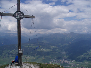
The Monte Serla/Sarlkofel is situated in the Nature Park Fanes Sennes Braies/Prags. From the summit you have a beatiful veaw over Dobbiaco/Toblach.
The hiking tour starts at Segheria/Saghäusern and takes on the path no. 16 A to the Malga Troger/Trogeralm. From the Malga/Alm the path no. 16 goes on the right side in the middle of the wood until the Passo Suis/Suisridl. From there the path no. 30 takes to the Sarl-Sattel/Forcella di Serla and forward at the left to the top (in a few places esposed).
Sturdy shoes necessary
Interesting facts
- You're traveling a distance of 6 km on this strenuous trail. The hike is therefore not too long. The average length of all hikes in South Tyrol is 12 km.
- Summer hiking tour: Segheria/Säge - Monte Serla/Sarlkofel is among the 10 best rated Hikes in Italy.
- You're facing an uphill climb of 1171 vertical meters on this hike. This makes the hike one of the 15 hikes with the most ascent in Italy. The high point of the hike is located at an elevation of 2,375 m.
- Sturdy hiking boots are recommended on this track.


