Route description
From the congress centre ARLBERG-well.com, which is the starting point, you'll head through the Dorfpark (village park) towards the west up to the roundabout. Here, you'll turn into the Arlbergstraße and continue until the Bundesstraße, which you must cross to get to the hotel Mooserkreuz. On the left-hand side of the Verwallweg you'll get to the Verwalltal (valley). You'll pass the Stiegeneckkapelle on the way to the bridge of the Arlenbach (stream). At the huge meadow you'll turn right at the first junction. The gravel path will take the biker via a slightly ascending slope to the Verwallsee (lake), to the Salzhütte and finally to the Konstanzer Hütte, where food and beverages will be served. From here, you'll turn right at the bridge to pass through Schönverwall. By keeping straight at the first crotch, you'll be passing the Schönverwallhütte. The tour will continue on the Trialweg, which crosses the Rosanna. On a day drift for approx. 45 minutes, the tour will lead steeply uphill to the Schneidseen, passing the Heilbronner Hütte. From here, you'll have the possibility to carry on towards the Paznauntal or the Montafontal. You'll get back to the Salzhütte on the same route. Turn right at the bridge, passing the Verwallsee southwards. The roadhouse Verwall is inviting for a stop before getting back on the road to St. Anton am Arlberg.
Interesting facts
- With an overall length of 40 km the bike trail is among the 10 longest bike Trails in Austria available on TouriSpo.
- There are places to buy beverages and food along the track. However it’s always recommended to bring enough water and food along with you.
Highlights of the tour
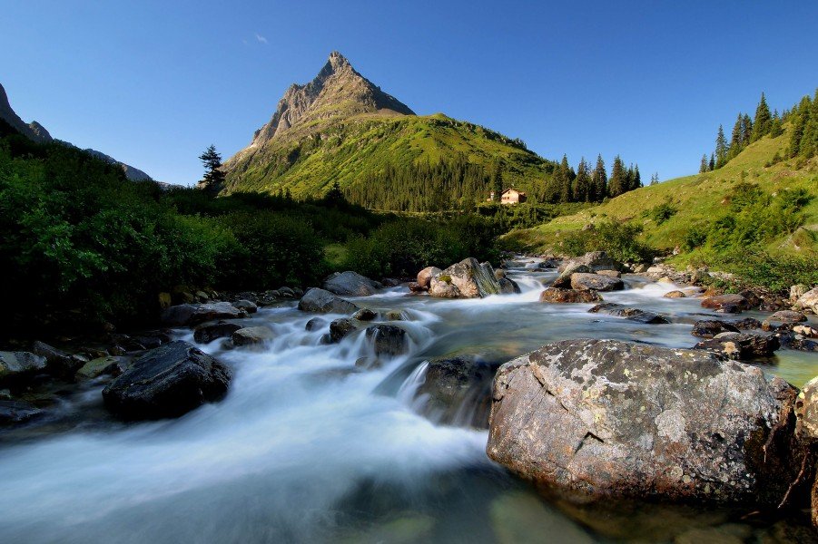
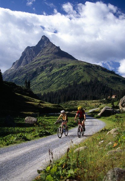
Having arrived at the destination, the Heilbronner Hütte, cyclists will be rewarded with the imposing location in the middle of Alpine mountainous landscapes. And what is more, the tour has quite something to offer landscape-wise. It leads directly to the beautiful mountain lakes Verwallsee and the Schneidseen.
Getting here
By car
From Salzburg or Munich you'll reach St. Anton am Arlberg via the S16 in the direction of Landeck. Take the exit at St. Anton am Arlberg and continue on the B197. From Stuttgart or Zurich you'll first head towards Feldkirch and Bludenz on the S16, then take the exit at Langen am Arlberg/ Klösterle in the direction of the Arlbergpass (B197). At the roundabout near the train station you'll change onto the Dorfstraße. You'll leave the next roundabout at the exit that will lead you onto the Hannes-Schneider-Weg, which is the way to the congress centre (Kongresszentrum). St. Anton can easily be reached by train, too. Being a rail jet station, many important international fast trains will stop here.
The tour starts in the centre of St. Anton am Arlberg at the congress centre ARLBERG-well.com, Hannes-Schneider-Weg 11.