Route description
Starting point Zanser Alm
The hike starts by the parking area at the Zanser Alm from where you will be walking steadily uphill on the Naturlehrpfad Zens path, marked with trail-number 6. Hike past the Berggasthof Zanser Schwaige before following the path beside the Zenobach stream through the forest. Cross the stream after a few kilometers and turn left onto the Adolf Munkel Weg marked with number 35. Beware, from now on the trail winds up the mountainsides. Make sure to switch paths by the junction shortly before reaching the Gschnagenhardt Alm and head to the right with trail-number 36 over the mountain crest.
By cottages and back to the valley
Furthermore, you will get to the Gschnagenhardt Alm and moreover to the Geisleralm cottage a little bit down the mountain. These mark ideal places to rest and enjoy the atmosphere of a traditional South Tyrol mountain pasture. Ignore the fork where trail 34 is passing and hike straight ahead until you reach yet another parting of the ways. Take the left trail marked with number 36 here which will get you further down the mountain. Then hike straight ahead at the next junction once more to cross the Schwarzenbach stream. Consequently, you will get to the Dusslerhütte cottage on 5856 ft (1785 m), where it is also possible to get something to eat or drink. Afterwards, this trail will get you back directly to the parking area at the Zanser Alm, the starting point of the hike.
Where to eat
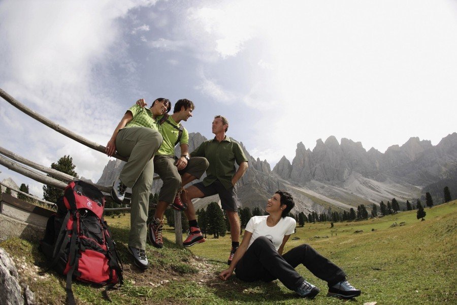
The first possibility to get something to eat will be at the Zanser Schwaige on 5528 ft (1685 m), where the Messner family operates a popular mountain pasture for hikers and tourists from everywhere. Enjoy culinary highlights from South Tyrol with homemade cheese and other “Schmankerl” (treats) from the kitchen. The Zanser Schwaige is open from May up until All Saint's Day (November 1st) and from Christmas until March.
Having past the Zanser Schwaige, a longer piece of the hike is to follow without any possibilities to get food. The next option will be at the Gschnagenhardt Alm, where you will be rewarded with a magnificent view. A few steps down the mountain you will reach the Geisleralm, where you can even stay overnight in a very cozy and traditional South Tyrol atmosphere. Moreover, the Dusslerhütte at 5856 ft (1785 m) is to follow as a last possibility to take a culinary rest before returning to the starting point of the hike.
Interesting facts
- You're traveling a distance of 9 km on this easy trail. The hike is therefore not too long. Average length of all hikes in South Tyrol is 12 km.
- Adolf Munkel Trail and the Villnösser Almen Pastures is among the 5 best rated Hikes in Italy.
- You're facing an uphill climb of 408 vertical meters on this hike. The high point of the hike is located at an elevation of 2,034 m.
- This easy hike is perfect for the whole family. The hike is also perfect if the kid’s wanna bring their dog on the trip. (See all dog friendly hikes in South Tyrol.)
- Sturdy hiking boots are recommended on this track. If you get hungry along the way, there are places to rest and get food. Nevertheless it’s recommended to also have enough water and food in your backpack when hiking or biking.
Highlights of the tour
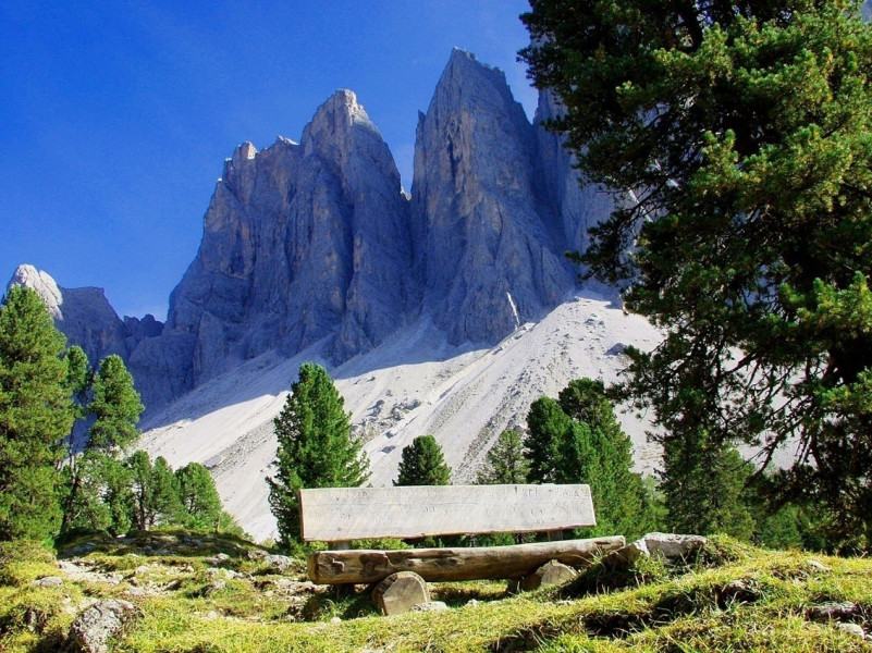
This tour has a great landscape to offer and you are able to see some of the atmospheric highlights of the Dolomites whilst hiking underneath the so called Geislernordwand with its impressive rock complexes. There are many sport climbing options at this wall with routes in many difficulties: Perfect conditions to enjoy outside climbing fun!
Meanwhile, you will notice some specialties of nature during the hike on these trails. Especially the Gschnagenhardt offers a geological highlight where it is possible to view many different rock layers that shaped the course of the Dolomites over millions of years and gave them its special spark. With such great images you shouldn't miss the Geislerkino (translated: “Geisler-cinema”), yet another viewing platform placed in a picturesque landscape.
Getting here
By car
From Brixen
Leave the city over the Via Dante to get to the SS12. Turn right shortly behind Schrambach in the direction “Strada Valentino” and cross the Brennerautobahn (A22). Follow the country road through the village of Villnöß and St. Magdalena until you reach the Berggasthof Zanser Alm.
From Bozen
Take the SS12 from Bozen and turn right in Klausen in the direction “Strado Valentino”. Follow the country road through the village of Villnöß and St. Magdalena until you reach the Berggasthof Zanser Alm.
From Bruneck
Leave the city in the direction of Sonnenburg and turn left onto the SP244, which you follow for the next 10 kilometers. Then, turn right onto the Strada Rina through the equally named village to reach the country road 174. Meanwhile, you will cross Ru and other little villages before reaching the SP 29 that you will follow for the next few kilometers. Lastly, depart from the SP 29 and drive towards Villnöß to reach the Zanser Alm through St. Magdalena.
There are parking spots available at the Zanser Alm.
With public transportation
The train operates regularly to Klausen from where you can take the Bus to the Zanserhütte.