

Route description
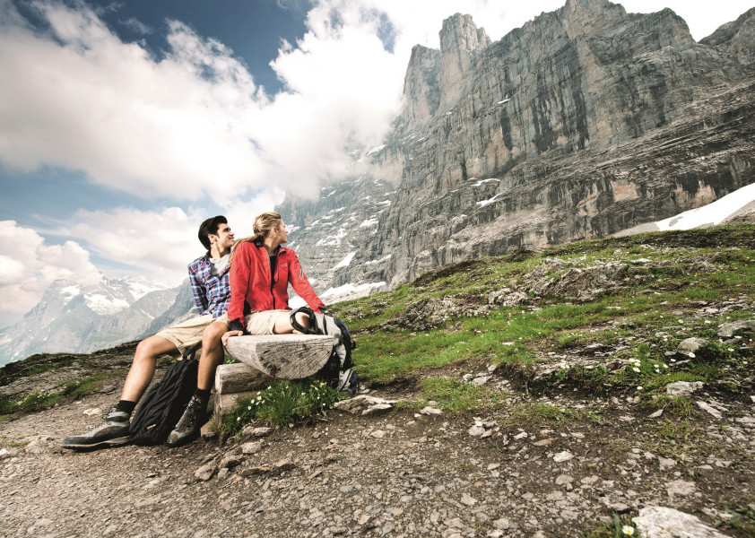
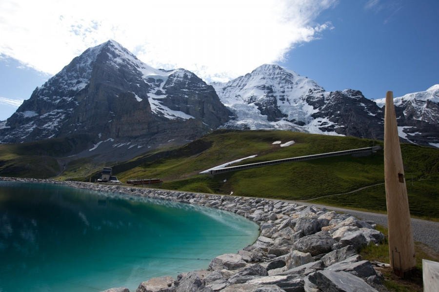
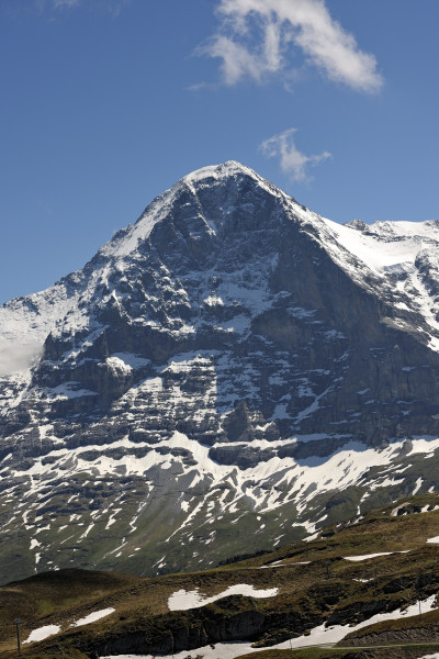
The trail leads from glacier Eigergletscher to Alpiglen and provides a stunning view on Eiger north face. With binoculars and good luck you will be able to see climbers on their way to the top. Eiger north face is a popular destination for climbers from all over the world. Thanks to Eiger Trail every mountain lover can get at least to the base of the famous wall.
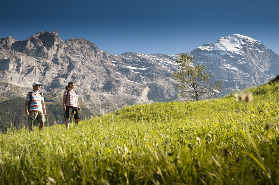
Hike over steep alpine meadows and screes along the base of the world's famous north face. The trail leads passed a beautiful waterfall to a restaurant and the mountain railway station Alpiglen. Also stunning is the sight up to Eiger north face behind „Kleiner Scheidegg“. But also the view on the lush grass of valley Grindelwaldtal.
Hamlets along the way: Eigergletscher – Wart – Im glatten Wang – Alpigen
Interesting facts
- With an overall length of 6 km the hike is among the 3 longest hikes in the Bernese Oberland available on TouriSpo.
- Eiger Trail is among the 5 best rated Hikes in Switzerland.
- Elevated between 2,267 m and 2,336 m, the hike is among the 3 highest elevated hikes in the Bernese Oberland. You're facing an uphill climb of 69 vertical meters on this hike. The track is therefore relatively flat.
- Sturdy hiking boots are recommended on this track. If you get hungry along the way, there are places to rest and get food. Nevertheless it’s recommended to also have enough water and food in your backpack when hiking or biking.
Highlights of the tour
Clear highlight is the proximity to the famous Eiger north face.
Variations
Eiger Trail can be expanded by two more sections.
Extension A: (Kleien Scheidegg to Eigergletscher)
This short and close to nature hike leads on a broad path in only 2,2km to glacier Eigergletscher. On a hike you can not get any closer to the famous triumvirate Eiger/Jungfrau/Mönch than this. Hiking through this breathtaking backdrop and clear mountain air is an unique experience.
The difference in altitude is 263m and it takes about 1 hour to hike.
Extension B: (Alpiglen via Bonern to Gletscherschlucht)
Extension B is a 5,6km hike on an exposed mountain trail along the base of Eigner. Well suited for trained hikers.
Difference in altitude is 46m and it takes about 4h to hike.
Equipment
Appropriate equipment is very important. Snow in this area melts very slowly and it could be snowing even in summer time.
Getting here
Starting point of the tour is Grindelwald, where you take the cable car up to station Eigergletscher.