
Route description
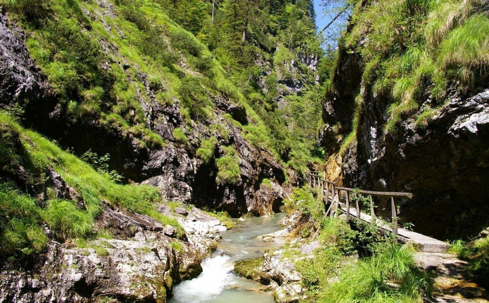
Through Weißbachschlucht
The tour starts right in front of Samerbrücke bridge near the town of Schneizlreuth. From there, the path leads you through the gorge Weißbachschlucht on relatively calm and idyllic ways. After you cross the gorge, you get to the town of Weißbach on the Alpine road. Follow the causeway along the river Weißbach.
Back over the Glacier
Follow this way until you reach the Salinen memorial, but don't pass the main road.You will reach the Weißbach falls, where you have to overcome a 5 minutes' ascent. Afterwards, you can do a little detour to the glacier garden near Inzell, or just keep left and go to the Zwing over the main road.
This tour is best hiked between May and October.
Interesting facts
- You're traveling a distance of 8 km on this easy trail. The hike is therefore not too long. Average length of all hikes in Bavaria is 49 km.
- Don’t hesitate to take your kids along on this easy hikes.
- Make sure to bring sturdy footwear on this track. Hiking boots are highly recommended. If you get hungry along the way, there are places to rest and get food. Nevertheless it’s recommended to also have enough water and food in your backpack when hiking or biking.
Videos
Highlights of the tour
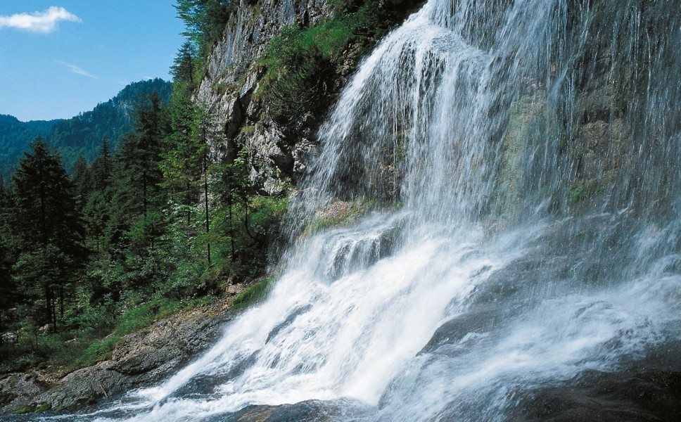
The Weißbach falls are a highlight of this tour.
Variations
If you still have some energy left, you can extend the hike and follow the sighs to Falkenstein. This extension is relatively plane and should take less than 2 hours. From here, there is also the opportunity to walk to the source of river Weißbach, which takes another 20 minutes from Zwing.
Equipment
You should wear sturdy shoes on this hike. It can get slippery, especially around the gorge, so be extra careful if you are with children.
Getting here
By car
You can easily get to the starting piont via B 305. Car parks are available at Café Zwing or near Samerbrücke.
Public transportation
From Café Zwing, RVO bus line 9535 takes you straight to the bridge Samerbrücke, where the hike begins. However, busses go mainly during the summer months.