Route description
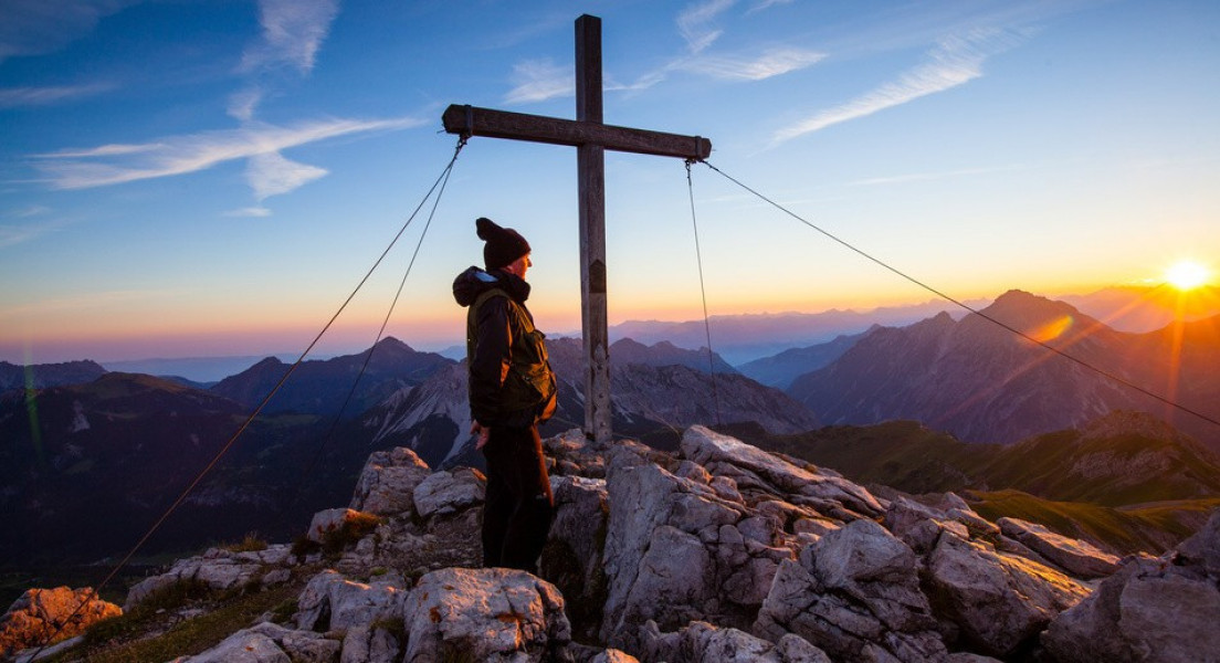
From Malbun walk towards saddle Sareiserjoch. Alternatively you can take the cable car to Sarais. Starting at the saddle the hike gets more challenging. On narrow trails hike up to Augstenberg and to its summit cross. At the top you will have a great view on the mountain chains Falkniskette and Schesaplanastock.
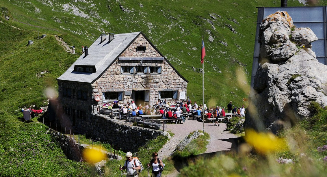
Now start descending to hut Pfälzerhütte via a ridge laced with flowers. Exposed parts are secured. You should stop at the hut of the Liechtenstein alpine club from where you can hike up to Naafkopf (2km/1,2mi). Walk back across broad meadows Weideborde of Alp Gritsch, through cave Tälehöhle and pass the beautiful flowers of Vaduzer-Täli, to Malbun.
Interesting facts
- You're traveling a distance of 12 km on this strenuous trail. Average length of all hikes in Liechtenstein is 16 km.
- Loop road to Augstenberg is among the 3 best rated Hikes in Liechtenstein.
- Elevated between 1,599 m and 2,359 m, the hike is among the 3 highest elevated hikes in Liechtenstein. You're facing an uphill climb of 924 vertical meters on this hike. This makes the hike one of the 5 hikes with the most ascent in Liechtenstein.
- Hiking boots are not required, but the hike might be more enjoyable with sturdy footwear (especially in wet conditions). If you get hungry along the way, there are places to rest and get food. Nevertheless it’s recommended to also have enough water and food in your backpack when hiking or biking.
Videos
Highlights of the tour
Since 1989 the entire alpine area in Liechtenstein has been a protective area for plants. On Fürstin-Gina path you can explore this manifold flora.
Getting here
By car:
From Switzerland: A13, exit Sevelen towards Vaduz, turn onto Zollstraße, drive towards Triesenberg, Steg and Malbun
From Austria: A14, exit Feldkirch towards Nendeln and Vaduz
Parking available in Malbun.
By public transport:
Alternatively take bus 21 from Vaduz.
Starting point is Malbun on a height of 1600m/5249ft in the liechtenstein alps.