Route description
History
The high mountain trail was opened in 1985 after a decade of a construction period. It was created through joining and extending several trails. By creating the natural park of the Texel group (Gruppo di Tessa) as a natural reserve and recreational space, the idea came up to create a circular hiking path as well. The numerous steep paths of the northern part still need to be joined together to offer the possibility of a complete hike. The mountain farmers and mountain pasture owners were also integrated into the project and nowadays benefit from tourism. This is why there are plenty of mountain huts and inns along the hiking path. The hiking area lives up to its motto “A bond of friendship from hut to hut, from community to community, and from valley to valley”.
Legs
If it takes you a long time to get here, it's worth to get here early in order to take one of the last funiculars (around 4pm) and to use the small time slot for a little hike up to the Leiteralm. It takes you approximately one hour to get there. This is a fantastic way to get going and get in the right mood for the entire hiking tour and already spend the first night in the mountains.
First leg: Hochmuth/ Leiteralm to Giggelberg (16km/ 10mi)
The first leg of the tour starts at the Gasthof Hochmuth (1400m/ 1530yd altitude) or the Leiteralm (1550m/ 1700yd altitude). Follow the Hans-Frieden-Weg (path no. 24) up to the mountain hut Hochgang on 1839m (2000yd) altitude, the highest point of the southern side. On the AVS Jugendsteig (youth trail), the hike continues downhill, passing the Tablanderalm on a height of 1722m (1900yd) altitude and Nassereithhütte (1523m/ 1670yd altitude). Ending up at the inn Berggasthaus Giggelberg (1565m/ 1710yd altitude), one first crosses the stream leading towards Partschnis, passing several mountain pastures.
Duration
Hochmuth – Leiteralm: 1 hour
Leiteralm – Hochganghaus: 1,5 hours
Hochganghaus – Nassereith: 2,5 hours
Nassereith – Giggelberg: 1,5 hours
Total duration: 6,5 hours
Second leg: Giggelberg to Katharinaberg (20km/ 12mi)
Initially, the second leg starts relatively quiet and rapidly becomes more challenging. It is recommended to have a large breakfast as you will need every single bit of energy to squeeze out of your body when hiking on this leg. Behind the Hochforcherhof (1555m/ 1700yd high), the path leads through the gorge to Lahnbach with indefinite steps taking you up and down. From the Pirchhof (1445m/ 1580yd) on, there are plenty of huts supplying hikers with food and drinks. When on a break, you will certainly notice the beauty of the Schnalstal with its snow covered peaks. From the Lindthof onwards, one enters the Schnalstal valley, passing Reinhold Messner's castle Juval, his residence and museum. Reinhold Messner is a famous mountaineer, adventurer, explorer and author from the Italian autonomous and German-speaking province of South Tyrol. After a certain time of relaxed hiking, one will finally reach Katharinaberg (1245m/ 1360yd altitude).
Duration
Giggelberg – Hochforch: 1 hour
Hochforch – Pirch – Grub: 2 hours
Grub – Gallmein – Innerforch – Lint: 1 hour
Lint – Unterperflhof – Katharinaberg: 2 hours
Total duration: 6 hours
Third leg: Katharinaberg to Stettiner Hütte (18km/ 11mi)
Starting at the Katharinatal valley one hikes through the Pfossental valley upwards on constantly steep forest and hiking paths. On the way to the Eishof, one will have the chance to enjoy the view on the beautiful mountain world of the high Alps. With a bit of luck one might spot a groundhog. At the Eishof, which is located on a height of 2069m/ 2260yd and thus being one of the highest sited huts in Tyrol, one should definitely eat sufficiently before going on a hike to the Eisjöchl. Once up here, one will be rewarded with a view to die for and also see the other mountains starting from 3000m (3280yd) altitude. Only 20m (22yd) of altitude higher, one will have finally reached the Stettiner Hütte, the final destination of the leg.
Duration
Katharinaberg – Vorderkaser: 3,5 hours
Vorderkaser – Eishof: 2 hours
Eishof – Eisjöchl – Stettiner Hütte: 3 hours
Total duration: 8,5 hours
Fourth leg: Stettiner Hütte to Matatz (30km/ 19mi)
From here the hiking tour leads downhill via serpentines to Pfelders, reaching an altitude of 1622m/ 1770yd. This is where one should withdraw some cash (if needed), as the only ATM (cash machine) on the entire Meran high mountain trail is located here. After another hour of hiking, one will have reached the communities of Innerhütt and Ausserhütt. The path continues up- and downhill towards Christl. If the weather is nice and clear, one may enjoy a wonderful view on the back parts of the Passeier Tal valley.
Duration
Stettin Hütte – Pfelders: 3 hours (4 hours way up)
Pfelders – Innerhütt: 1 hour
Innerhütt – Ulfas: 1,5 hours
Ulfas – Christl: 1,5 hours
Christl – Matatz: 1 hour
Total duration: 8 hours
Fifth leg: Matatz to Hochmuth (20km/ 12mi)
On wide hiking paths, one walks from Matatz through the Kalbenbach valley and then again up to Magdfeld. While overlooking the marvellous Passeier Tal valley, the way leads to the Longfallhof in the Spronsertal valley and finally to the Bergasthof Hochmuth again. This leg's pathways balance in between a spectrum of 200m/ 220yd altitude.
Duration
Matatz – Magdfeld: 1,75 hours
Madgfeld – Vernuer: 2 hours
Vernuer – Gfeis: 0,75 hours
Gfeis – Longfall: 1 hour
Longfall – Hochmuth: 1,5 hours
Total duration: 7 hours
Hiking the entire high mountain trail is especially recommendable from July to September.
Interesting facts
- With an overall length of 100 km the hike is among the 3 longest hikes in Italy available on TouriSpo.
- Meran High Mountain Trail is among the 15 best rated Hikes in Italy.
- Elevated between 798 m and 2,895 m, the hike is among the 5 highest elevated hikes in Italy. You're facing an uphill climb of 5030 vertical meters on this hike. This is quite much. You should be fit to do this track. This makes the hike one of the 3 hikes with the most ascent in Italy.
- Sturdy hiking boots are recommended on this track. There are places to buy beverages and food along the track. However it’s always recommended to bring enough water and food along with you.
Highlights of the tour
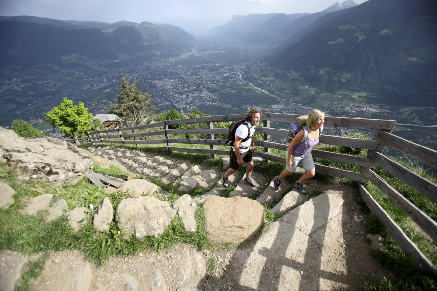
Especially on the sunny side, the longer southern leg, one may overlook the entire valley with its beautiful landscapes of the Meran basin, the Lower Vinschgau and the Passeier Tal valley. The north of the high alpine region offers plenty of photo motifs and places one can enjoy the purity of nature and just relax for a while.
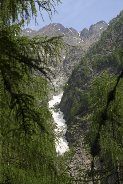
In the north, from the top of the Eisjöchl one can admirably take a look at the 3480m/ 3800yd high Hohe Wilde (Hochwilde), whereas in the south, one can spot the peaks of the Hohe Weiße (3,278m/ 3584yd) and Grafspitze (3,147m/ 3441yd).
Equipment
One must always bear in mind that hiking on the Meran high mountain trail is certainly no walk in the park. The Texel group (Gruppo di Tessa) is one of the most challenging hiking paths in the high alpine area. An appropriate alpine equipment is highly necessary. Apart from solid footwear, it is recommended to carry outdoor clothing with oneself, allowing hiking in any kind of weather condition. A warm jumper, gloves and a hat/ cap are useful too, as it can get very chilly here, even during the summer months at higher altitudes. Supportingly, hiking poles may particularly come handy with steep descents. Depending on the circumstances and the facilities of your overnight accommodation, a sleeping bag can give some extra warmth during cold nights and is thus also recommended to be brought along.
Getting here
By car:
The starting point in Dorf Tirol, located in the north of Meran, can easily be reached by car.
Coming from Germany, one must pay attention to buy a vignette to be allowed to use the Austrian motorways.
You will find parking facilities at the funicular Hochmuth. Small fees apply, but you are allowed to park your car here for the entire time being here.
Starting Point
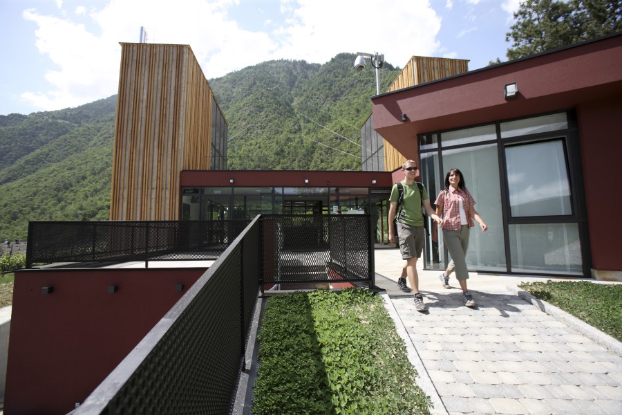
Berggasthof Hochmuth, easily reachable by funicular Hochmuth, coming from Dorf Tirol.
General Information
The Meran High Mountain Trail leads 100km (62mi) around the massif of the Texel group (Gruppo di Tessa, no. 24). Depending on experience and stamina, one should expect to spend 4 to 8 days for a complete hike. Generally, one can hike through within 6 days with each leg taking up to six hours of walking. The circular path can be subdivided into two parts: the challenging and high alpine northern part and the rather simple and southern part. The latter is perfectly suitable for hikers with less experience and is easy to manage (constantly on the same height along the alpine tree line; it is recommended to have sure-footedness and to have no fear of heights, of course).
It's possible to hike in both direction. Hiking clockwise is the preferred and more popular route among hikers, as the Eisjöchl, the highest point of the hiking tour, is way easier to reach this way. The ascent from Pfossental to Eisjöchl is easier to manage than hiking from Pfeldertal. As long as you feel fit enough, have strong and trained calves, there's no reason why you shouldn't hike the circular path anti-clockwise and thus try out the more difficult ascent starting in the Pfeldertal valley.
All legs can also be hiked as separate hiking tours. Especially towards the southern side, one may experience hiking variety on the way into the valley as some hiking paths have numerous ascents following descents and vice versa.