in the Meraner Land: Position on map")

Route description
Stage 1: Töllgraben to Kuens ( about 11km/6,8mi)
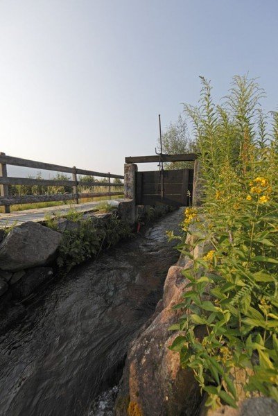
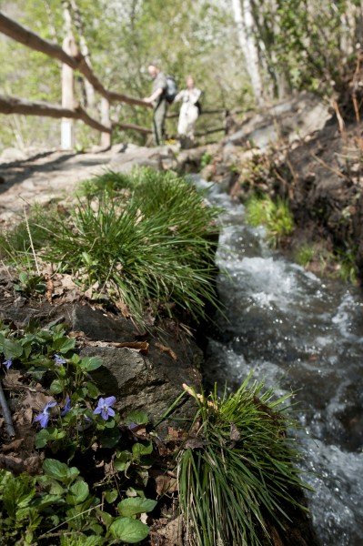
Hike via the irrigation channel in Algund approximately 6km/3,7mi along the southern slope of the mountain group Texel, towards Kuens. The first part of the channel in Algund dates back to the 13th century (the part from Töllerbach to Plars). Now continue to the steep road Ochsentod and start ascending towards Vellau. The next irrigation channel (Kuenser Waal) is approaching. But first you will have to hike up a steep path called Herrschaftsweg to get up to Kuenser Waal, where an incredible view across steep holts emerges. To spend the night we recommend the guest house and tractor museum Ungericht in Kuens. (Also accessible by car; parking available).
Duration: 3:45h
Metres in Altitude: 640
Stage 2: Kuens to Saltaus (about 8km/5mi)
To get on the next trail from Ungericht, walk slightly downhill. Riffian trail was created in the 15th century and leads passed Kuens and Riffian. The irrigation channel itself runs underground and ends at the guest house Rösselhof. At Rösselhof take the steep road until you get to Saltaus.
Duration: 2:15h
Metres in Altitude: 260
Stage 3: Saltaus to Naifal (about 11km/6,8mi)
In Saltaus cross the river Passer and continue on the other side of the Passeier valley. Take the trail Maiser towars Meran. This channel with a length of 9km/5,6mi is the longest irrigation channel within the region and is still operating today. You will only follow this trail for a couple of miles until you take a steep acent up to the channel trail Schenna. After the ascent the trail itself leads slightly downhill, which makes it enjoyable to hike on. The final destination of stage 3 is the parking Meran2000 in Naiftal.
Duration: 3:45h
Metres in Altitude: 420
Stage 4: Naiftal to Lana (about 13km/8,1mi)
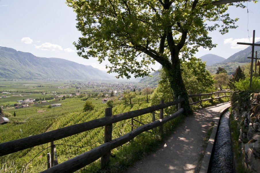
This stage does not include a „Waal“ (irrigation channel) but therefor an amazing view across the valley Etschtal, the mountain chain Mendel and the mountain groups Ortler and Texel. Passing mediterranean mixed forests and typical local orchards you will hike south. This trail is especially beautiful in autumn or spring, when the orchards bloom in wonderful colours. Eventually you will hike passed a parish church and reach Burgstall, the destination of stage 4. To actually get to Lana you would have to walk on a road for 3km/1,9mi, so we recommend to take the bus and start the next day in Lana.
Duration: 3:45h
Metres in Altitude: 260
Stage 5: Lana to Töll (about 13km/8,1mi)
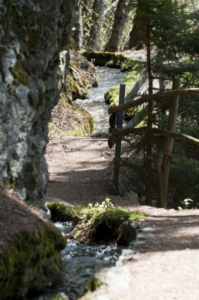
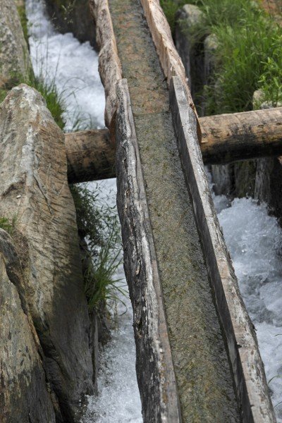
Starting in Niederlana walk towards the church, where the channel trail Brandis starts. Keep going until you reach Oberlana and switch onto the trail Tschermser. Follow the trail to the irrigation channel Marling, which is with a length of 12km the longest and probably the most impressive „Waal“ in South Tirol. The channel runs from Töll to Lana, through vinyards and orchards and passed massive cliffs. The impressive part about the channel is the partly obtained original construction as an open channel. The water runs through concrete and spectacular crag ditches into the yards. Follow the channel to Töll.
Duration: 4:00h
Metres of Altitude: 300
Stage 6: Töll to Rabland (about 6km/3,7mi)
At the junction in Töll get on the trail Peter-Mitterhofer- Trail, named after the inventor of the typewriter, a local of Töll, and hike to Partschnis. Now follow the next irrigation channel called Partschnis, which is still operating today. From up there you will have a great view across the mountain group Ortler and the Sarntaler alps. Afterwards take the channel trail Rablander to get to the destination of stage 6, namely the guest house Happichl in Rabland.
Duration: 2:15h
Metres in Altitude: 280
Stage 7: Rapland to Naturns (about 10km/6,2mi)
A panorama trail called Sonnenberg will guide you passed the slopes of Sonnenberg along to trail Wallburgweg. This trail will guide you along the former „Waal“ Naturnser Schnalswaal to Naturns.
Duration: 2:30 h
Metres of Altitude: 400
Stage 8: Naturns to Töll (11km/6,8mi)
Starting at the center of Naturns the trail leads across the valley to the mountain Nörderberg. On the other side of the valley Vinschgau the trail continues towards Töll, while leading above the steep slope Rittersteig, on Peter-Mitterhofer-trail and passed the slopes of the the mountain group Ortler.
Duration: 3:30 h
Metres of Altitude: 290
Interesting facts
- With an overall length of 80 km the hike is among the 3 longest hikes in Italy available on TouriSpo.
- This easy hike is perfect for the whole family. The hike is also perfect if the kid’s wanna bring their dog on the trip. (See all dog friendly hikes in South Tyrol.)
- Sturdy hiking boots are recommended on this track. If you get hungry along the way, there are places to rest and get food. Nevertheless it’s recommended to also have enough water and food in your backpack when hiking or biking.
Video
Highlights of the tour
You could use stage two as an opportunity to take a little detour to the pilgrimage church in Rifi. The baroque church is only 5min away from the channel trail Rifianer. The miraculous image of the Virgin Mary became a famous destination for many pilgrims. The same day also offers the opportunity to visit the prehistoric settlement „Burgstall“. Easily accessible in a couple of minutes from the steep road Rösslsteig shortly after passing Rifi.
Stage 5 also offers many opportunities for appealing detours. In Niederlana for a start the fruit tree museum of South Tirol is worth a visit. Also alluring is the castle Lebenberg, where you can get to via Tscherms. In addition there are the hut Waalerhütte, the bell Waalerschellen and the pilgrimage church of holy Felix situated along Marlinger channel trail. This trail is also equipped with many charts telling you about flora and fauna of the region.
At stage 6 on the Rabland trail you will pass Partschinser waterfalls. This waterfall falls down the mountain goup Texler starting at a height of over 97m/ 318ft. Partschins furthermore offers the typewriter museum about its inventor Peter Mitterhofer.
The last day is all about health and fitness. The Alpine-Well-Fit Parcour gives tips for your well-being and shows strengthening exercises and stretches.
Getting here
By car:
The starting point (Töll/Algund) is easy to reach by car from Bozen-Meran. Take A22 (fee required)
until you reach the exit „Bozen Süd“. Now take SS38 through the valley Etschtal till Meran. Keep following SS38 towards Töll. At the junction by the bridge keep towards Algund and continue until you reach the parking in Algund.
Alternatively you can take the bus from Meran (213, 235 or 237). Starting in Vinschgau take bus line 251 to Algund.
Also an option is the train „Vinschger Bahn“ to Töll.
Starting point is the parking by the bridge „Töllgraben-Brücke“, right at the trail „Algunder Waalweg“.
This trail is one of eleven trails, forming the whole tour. Passed irrigation channels called „Waale“ you will get to the hollow of Meran, hike through the valley Vinschgau and enjoy a beautiful landscape.
The tour can be done in eight stages. Suitable for everyone and thanks to many signs saying „Meraner Waalrunde“ easy to follow.