Route description

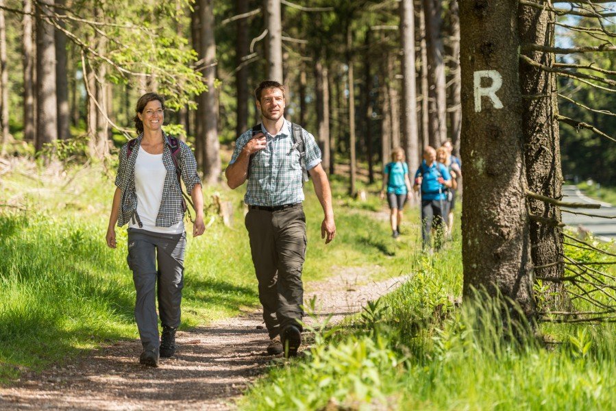
Rennsteig in the Thuringian Forest is one of Germany's best-known hiking trails. The ridgeway is almost 170km/105.6mi long and at 196m/643ft to 973m/3,192ft it leads from Hörschel to Blankenstein. It used to serve as border line between the principality of Saxe-Gotha-Coburg and Prussia, and still markes a linguistic border between Thuringian and Franconian dialects.
The entire Rennsteig trail can be achieved in around 45 hours. According to whether you are rather extreme, athletic, or unhurried, you can divide it into four, six or eight stages.
Where to eat
You should pack enough provisions and water for your hike. At the respective destinations of the stages, you should find food and accommodation without a problem. Merely Brennersgrün, the destination of the seventh leg, only features one accommodation facility. Alternatively, you can walk on to Lehenstein (another 3km/1.9mi).
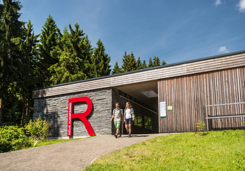
Six 'Rennsteig houses' along the trail provide additional service. The multifunctional buildings offer changing rooms, lockers, sanitary facilities, and shelter for sports equipment. You can charge your e-bike at the integrated charge bases.
Interesting facts
- With an overall length of 169 km the hike is among the 10 longest hikes in Germany available on TouriSpo.
- Rennsteig in Thuringian Forest is the the best rated hike in Germany.
- You're facing an uphill climb of 2970 vertical meters on this hike. This is quite much. You should be fit to do this track. This makes the hike one of the 10 hikes with the most ascent in Germany. The hike takes you to an elevation of 964 m.
- You can easily take your dog on this trail.
- You shouldn’t forget to bring your hiking boots. There are some sections on the trail where sturdy footwear is required. If you get hungry along the way, there are places to rest and get food. Nevertheless it’s recommended to also have enough water and food in your backpack when hiking or biking.
Videos
Variations
Off the actual trail, Rennsteig also boasts a wide offer of activities. There are 40 so-called Rennsteig ladders. These ways to and from Rennsteig trail are a good opportunity to leave the track and explore the surroundings.
Equipment
Sturdy shoes are recommended. Rennsteig is only partially accessible and suitable for strollers.
Getting here
By car
From Erfurt, you can get to hörschel via motorway A4. Leave the road at exit Eisenach-West and follow the signs pointing to Stedtfeld/Hörschel.
Coming from the south (Bamberg direction), follow motorway A73 to Eisfeld-Nord. From there, continue on B281 towards Neuhaus. This start is stage 6 of 8. Alternatively, you can drive on to Hörschel and start your tour there.
Public transportation
You can go to Hörschel from Eisenbach or to Blankenstein from Saalfeld by train. RennsteigShuttle gets you from Erfurt to Rennsteig train station in Ilmenau-Manebach-Stützerbach on Saturdays, Sundays, and holidays.
Due to poor connections, traveling to the starting point by bus or train is relatively inconvenient and time-consuming.