Route description

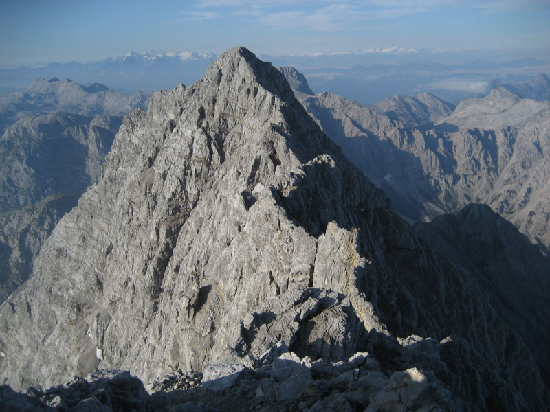
The crossing of Watzmann is one of the most spectacular peak crossings in the East Alps. However, you need a good level of fitness as well as climbing equipment (or at least carabiners), in order to belay on the steel rope on the ridge. At 2,713m/8,900ft, Watzmann is the second highest mountain massive in Germany. The 3km/1.8mi ridge over the three peaks of the massive (Hocheck 2,651m/8,698ft - Mittelspitze 2,713m/8,900ft - Südspitze 2,712m/8,898ft).
Day 1: Ascent to Biwakhütte on Hocheck (2,651m/8,698ft) or Watzmannhaus (1,930m/6,332ft)
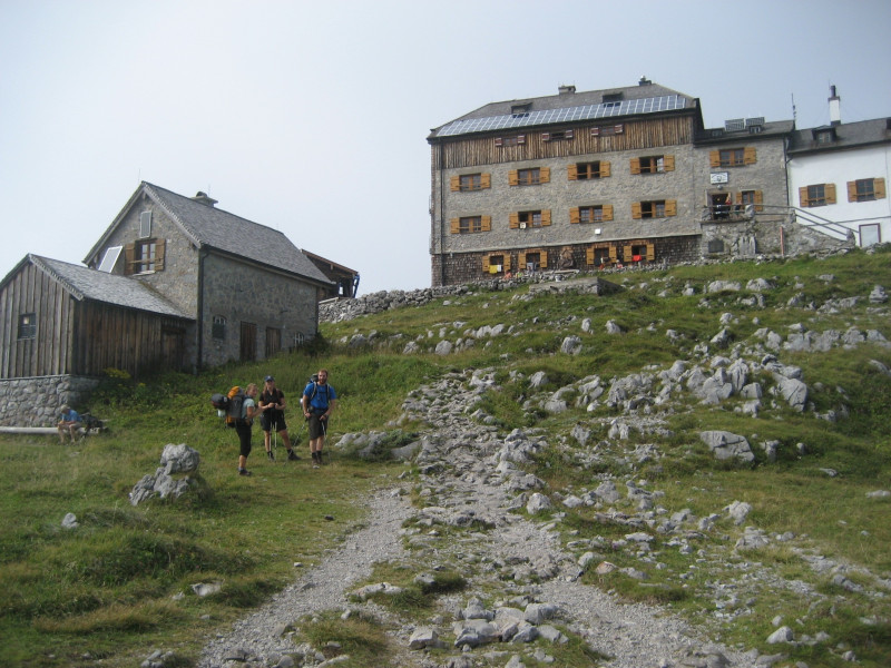
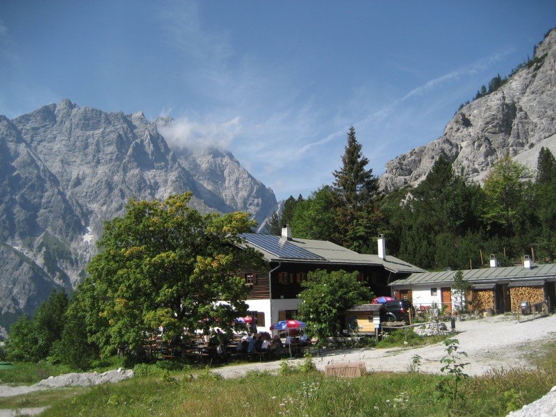
The first day tour goes to the Alp Association's hut Watzmannhaus at 1,930m/6,332ft. You should absolutely book accommodation for the night here in advance. If you want even more of a challenge, you can go even higher, climbing up to Biwakhütte on Hocheck. However, you should reach the peak in a timely manner, as spaces at the hut are limited. This ascent is only recommended in very good weather, as you might have to sleep outdoors if the hut is full.
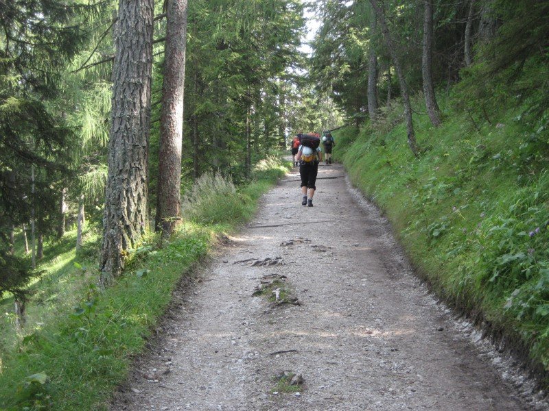
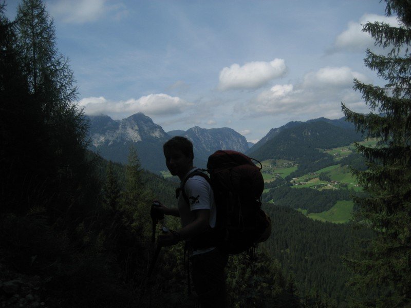
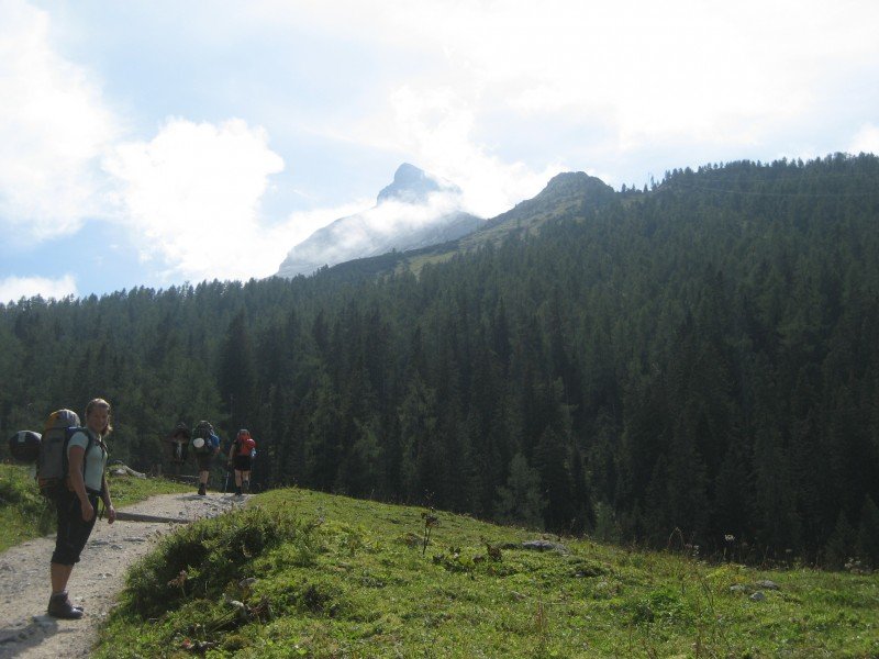
From the car park Wimbachbrücke, follow the signs to Watzmannhaus on trail 441. The path ascents quite steeply right at the beginning, and goes through dense forests. However, you will also pass some places with nice views of the Berchtesgaden Alps. The trail goes to Stuben-Alm, and on to Mitterkaser Alm. From here, the track becomes a narrow steep path, the forest becomes lighter, and you can already see Hocheck and Watzmannhaus steeply above you. You should get to Watzmannhaus after around 3.5 hours. Take a rest here. If you want to continue to Biwakhütte on Hocheck, just follow the signs to Hochkar through the well behind Watzmannhaus. Calculate around 2 more hours from Watzmannhaus to Biwakhütte. The way tothe peak becomes ever steeper, and requires surefootedness. At the peak, you are rewarded with great views from lake Chiemsee in the north to Großglockner in the south.
Day 2: Peak Crossing - Descent over Südspitze - Back through Wimbachgries
Hocheck - Mittelspitze (30 minutes)
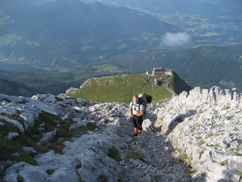
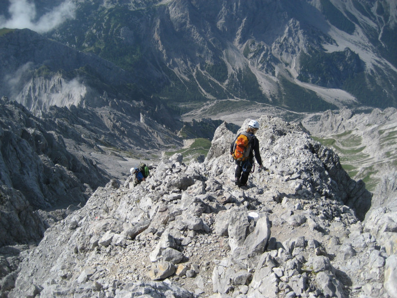
If you spent the night at Watzmannhaus, start to Hocheck really early. If you have already done that bit on the first day, you can sleep in a little longer. Right on Hockeck, you enter Zackengrat (climbing path - difficulty A/B). You should absolutely wear your helmet and climbing equipment here. Some easy climbs get you to Mittelspitze, the hightest point of the crossing. The 3km/1.8mi ridge offers a great view of lake Königssee and St. Bartholomew church to the east, and Wimbachgries and Hochkalter mountain to the west.
Mittelspitze - Südspitze (1.5 - 2 hours)
Soutwestbound, the ridge goes downhill, secured by a tightrope. In the east, you can now see the famous Watzmann east face. Along the ridge, climb on to Südspitze, from where you get a great view of the Lofer Mountains.
Descent to Wembachgrieshütte (3 hours)
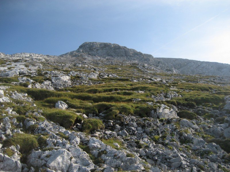
Descending from Südspitze is the most demanding part of the crossing. Smaller rock slips caused by other hikers are possible, so you should keep your helmet on. We recommend doing the crossing only in good weather conditions. Finding your way down from Südspitze is quite difficult when it is foggy. Over secured stone steps as well as rock ledges with gravel, you descend very steeply down to the debris fields of the upper part of Schönfeld. After you have crossed the meadow on Schönfeld, the terrain becomes steeper and rocky again.
From Wimbachgrieshütte back to Car Park Wimbachbrücke (2 hours)
After the descent, indulge in a well-deserved meal at Wimachgrieshütte. The way back through Wimbach valley is more comfortable walk, but features beautiful views of Watzmann's west face and the ridge you have just crossed.
Where to eat
There are only 2 places to eat during this two-day tour, Watzmannhaus and Wimbachgrieshütte. Hence, you should make sure to bring enough water and food.
Interesting facts
- With an overall length of 23 km the hike is among the 10 longest hikes in Bavaria available on TouriSpo.
- Elevated between 644 m and 2,592 m, the hike is the highest elevated hikes in Germany. You're facing an uphill climb of 2006 vertical meters on this hike. This is quite much. You should be fit to do this track. This makes the hike one of the 15 hikes with the most ascent in Germany.
- Sturdy hiking boots are recommended on this track. If you get hungry along the way, there are places to rest and get food. Nevertheless it’s recommended to also have enough water and food in your backpack when hiking or biking.
Video
Highlights of the tour
- View of Hochkalter
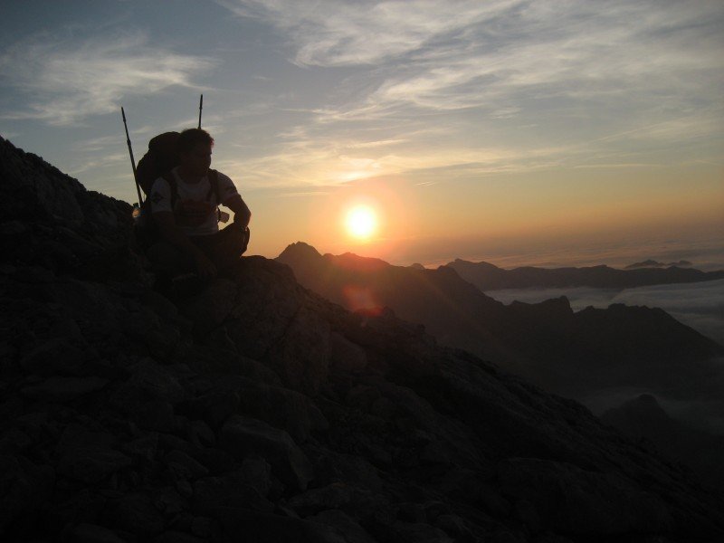
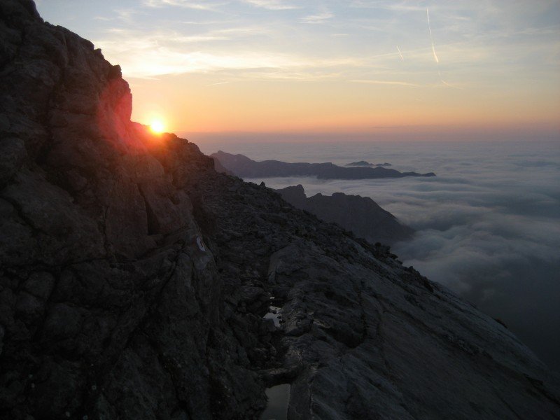
- Stay at Biwakhütte on Hocheck with a beautiful sun set in good weather
- Ridge between Hocheck and Watzmann-Südspitze
- View of Großglockner and Lofer Mountains in the South
Equipment
- Helmet
- Climbing equipment or carabiners
- Container for 2 litres of water
- Sleeping bag and camping mat
Getting here
From Munich
Motorway A8 Munich - Salzburg. Exit at Siegsdorf. From there, follow the signs to Berchtesgaden on B306 via Weißbach. Car park Wimbachbrücke is located on the right-hand side, approx. 1km after you enter Ramsau. This is where the crossing begins.
From Salzburg
Follow B160 and B305 via Neu-Anif and Berchtesgaden to Ramsau, and go to car park Wimbachbrücke.