Route description

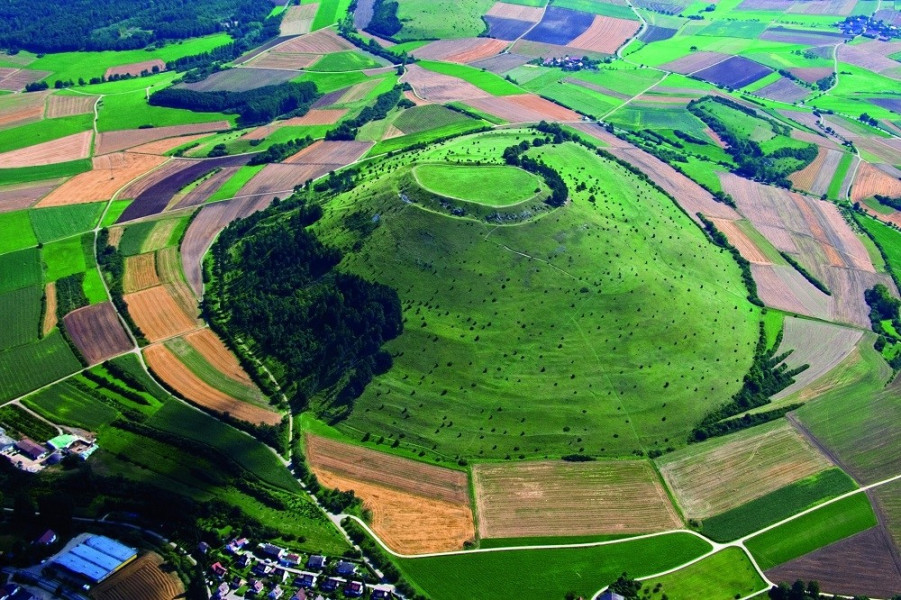
Albsteig trail, also known as HW1 or Swabian Alb Nordrandweg, between Donauwörth and Tuttlingen, follows mainly natural paths at the Albtrauf, the northern slope of the Swabian Alb. The route passes impressive landscapes, geological sensations, proud castles, fairytale palaces, and mysterious dripstole caves. From various viewing balconies, hikers get stunning panoramic views of the surrounding region.
- Stage 1: From Donauwörth to Mönchsdeggingen
- Stage 2: From Mönchsdeggingen to Bopfingen
- Stage 3: From Bopfingen to Aalen-Unterkochen
- Stage 4: From Aalen-Unterkochen to Heubach
- Stage 5: From Heubach to Gingen/Fils
- Stage 6: From Gingen/Fils to Bläsiberg
- Stage 7: From Bläsiberg to Owen
- Stage 8: From Owen to Bad Urauch
- Stage 9: From Bad Urach to Lichtenstein/Stahleck
- Stage 10: From Stahleck to Genkingen
- Stage 11: From Genkingen to Talheim
- Stage 12: From Talheim to Jungingen
- Stage 13: From Jungingen to Burgfelden
- Stage 14: From Burgfelden to Gosheim
- Stage 15: From Gosheim to Tuttlingen
Where to eat
There are a few towns and villages along the way, where you can find opportunities to get food. Numerous pubs and hiking inns at or near the path also offer possibilities to grab a bite. Nevertheless, you should always carry sufficient water as well as some provisions.
Video
Highlights of the tour
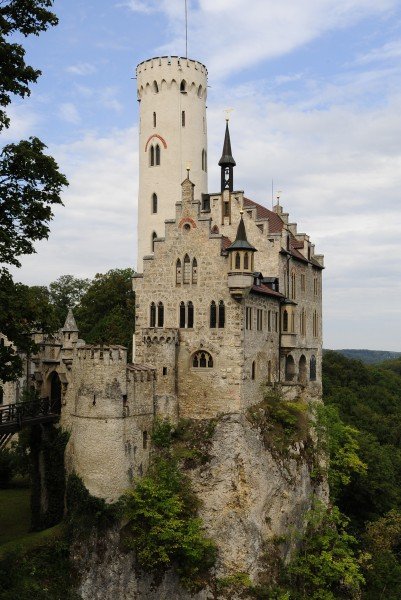
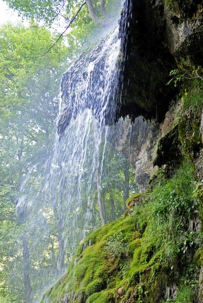
This long-distance trail features beautiful panoramic views. Furthermore, the path leads past highlights such as Castle Teck, Urach waterfall, Lichtenstein Palace, and Nebelhöhle cave.
Variations
The 15 stages pointed out here are for ambitious and experienced hikers; unhurried walkers can divide the trail into 20-25 stages.
Equipment
- Ankle-high hiking boots
- Perhaps hiking sticks
- A map or GPS to use along with the signs on the way
- Provisions
- Drinks
- Rain clothes
- Stamina and a safe step
Getting here
By car
From Ulm or Günzburg, take motorway A7. From Augsburg, go via A8, and from Ingolstadt use A9. When you leave the motorway, take B16, B2 or B25 to get to Donauwörth.
Public transportation
Donauwörth is well connected to the railway network. Direct trains from Munich, Stuttgart, Regensburg, and other places call here.