Route description

Easy Start Through Reschbach Valley
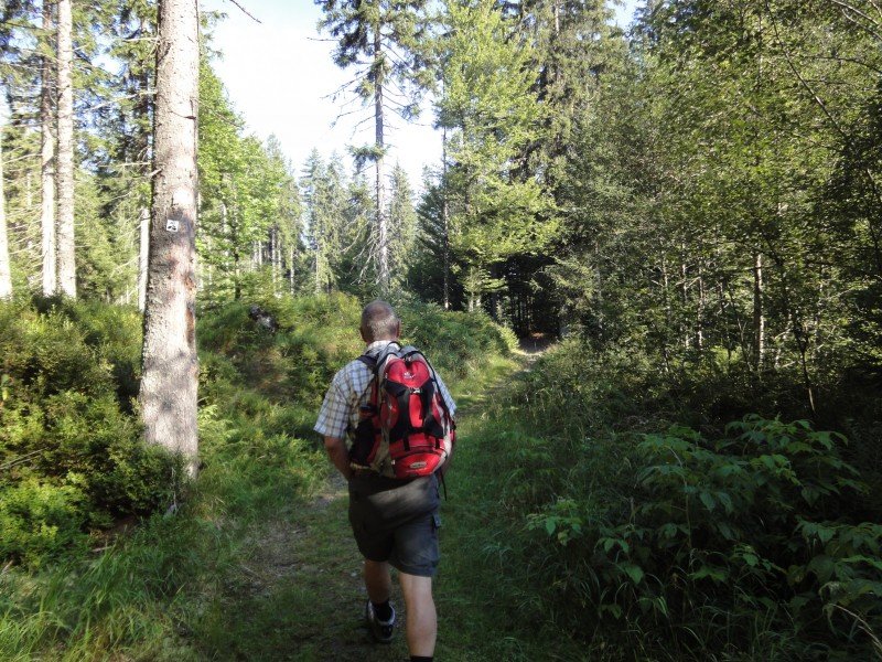
The tour up Lusen mountain starts at Reschbach stream. The first few kilometres lead along the rushing stream, barely ascending through the dense forest. Spruces dominate at first, with more and more broadleaf coming as you proceed. The national park around Lusen is among the most beautiful Bavarian geotopes, and offers a diverse arrey of plants.
Lusensteig Gets Steeper
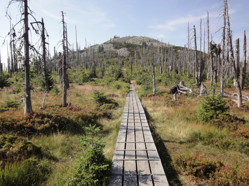
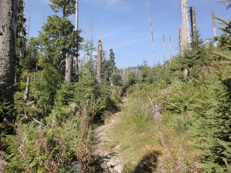
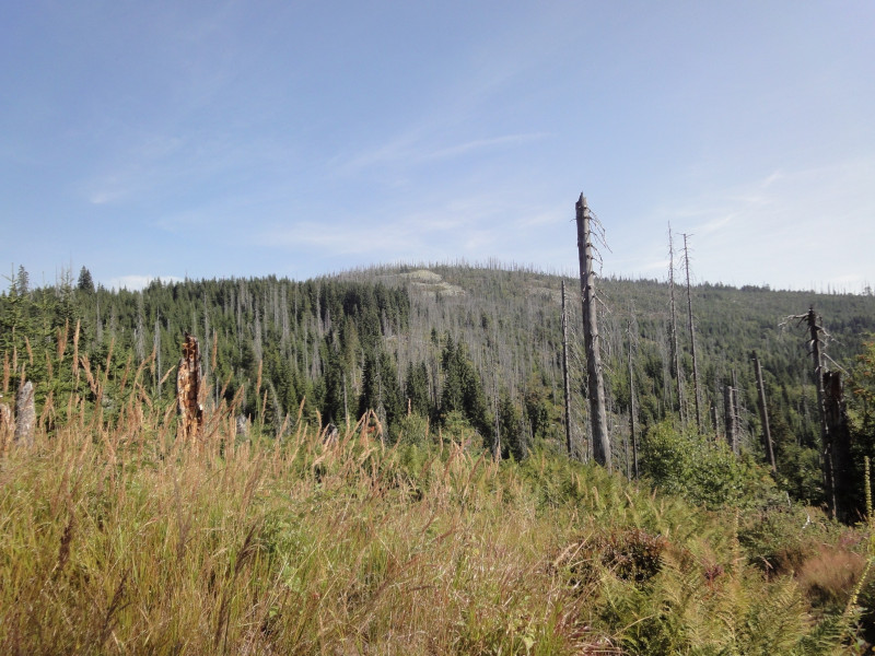
You are looking at a vertical ascent of almost 550m/1,804ft in total to get to the summit of Lusen. The path becomes ever more narrow, while the forest gets thinner. At the upper section, you can find the so-called dead wood. The dead trees, damaged by wind, snow, and bark beetle open up the view over the surrounding peaks. In the south, you can see the Dreisessel massif; towards the east you can glimpse the Czech side of the German-Czech border mountains, Sumava National Park. The granite blocks of Siebensteinfelsen can also be seen.
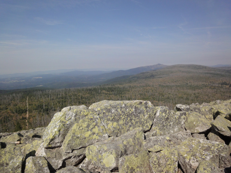
Granite Sea at Lusen Summit
Before you get to the tree-free summit area with its granite blocks, the path gets steeper and leads along wild ferns and dead roots. The so-called granite sea is unique in the Bavarian Forest, and makes the summit of Lusen oneof the most imposing mountains here. According to an old legend, the large granite blocks on Lusen were piled up by the devil in order to hide a gold treasure.
Here you can find Lusenschutzhaus mountain hut, the first opportunity to stop and grab a bite. Enjoy the beautiful view. In good weather, you can see further than the Danube basin, in Fön conditions you can even glimps the Berchtesgaden Alps.
Descent to Tummelplatz Square
From Lusen summit, you continue along Winterwanderweg (winter hiking trail). After a few steps, follow the signs to the left towards Tummelplatz. After about 1 hour, you get to Tummelplatz square, a sort of upland pasture amidst the forests of the national park. The administration has a small hut here, and you can sit on a little wooden bench to eat your provisions. The arnica signs now lead you away from Goldsteig, on which you descended, and you get back to where you started, Reschbachtal valley.
Where to eat
Lusenschutzhaus is serviced on weekends and during holidays year-round. Look it up online before you start your hike. Otherwise, you should bring provisions.
Interesting facts
- You're traveling a distance of 13 km on this moderate trail. The average length of all hikes in Bavaria is 49 km.
- You're facing an uphill climb of 593 vertical meters on this hike. The highest point of the track is 1,361 m above sea level.
- Don’t hesitate to take your kids along on this moderate hikes.
- Make sure to bring sturdy footwear on this track. Hiking boots are highly recommended. There are places to buy beverages and food along the track. However it’s always recommended to bring enough water and food along with you.
Videos
Highlights of the tour
- The 'dead forest' in the upper sections opens up beautiful views over the Bavarian and Bohemian Forest.
- The granite sea at the peak makes Lusen mountain so unique.
- In Fön conditions, you can see as far as the Alps from Lusenschutzhaus.
Variations
At Tummelplatz square, you can extend the hike to the viewing point on Hohlstein mountain (1,196m/3,924ft).
Getting here
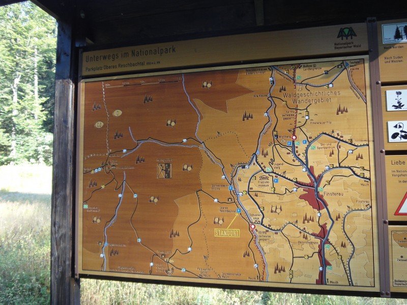
Finsterau, the entrance to this hike, is located north of Freyung in the Bavarian Forest National Park. From Freyung, follow B533 towards Grafenau, and turn towards Mauth after only 1km/.6mi). From Mauth on, continue on the main road to Finsterau. Follow the signs pointing left towards Freilichtmuseum Finsterau. Drive past the open-air museum to car park Oberes Reschbachtal.