Route description

While the first part of the hike is relatively easy, you should not underestimate the effort it takes, as there is a long distance and a high vertical drop to overcome.
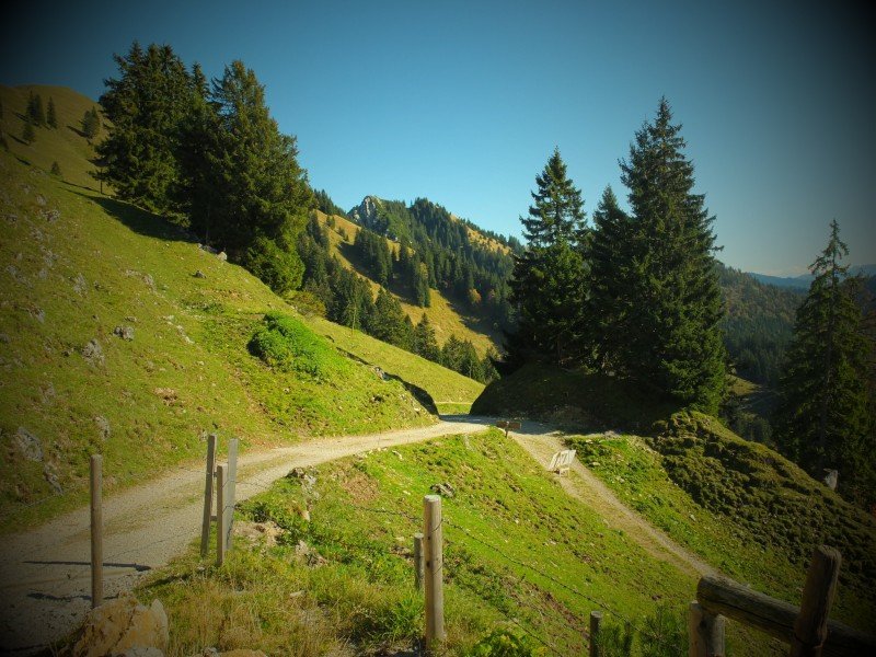
From the Car Park to Agergschwendt Alp
At the end of the car park, a narrow wood walk leads you to the forest path. The way is well signposted, so you cannot go wrong. Follow the way until you get to Agerschwendt alp at a large clearing. On weekends, the alp offers nice meals and invites you to a first rest.
To Hochgernhaus
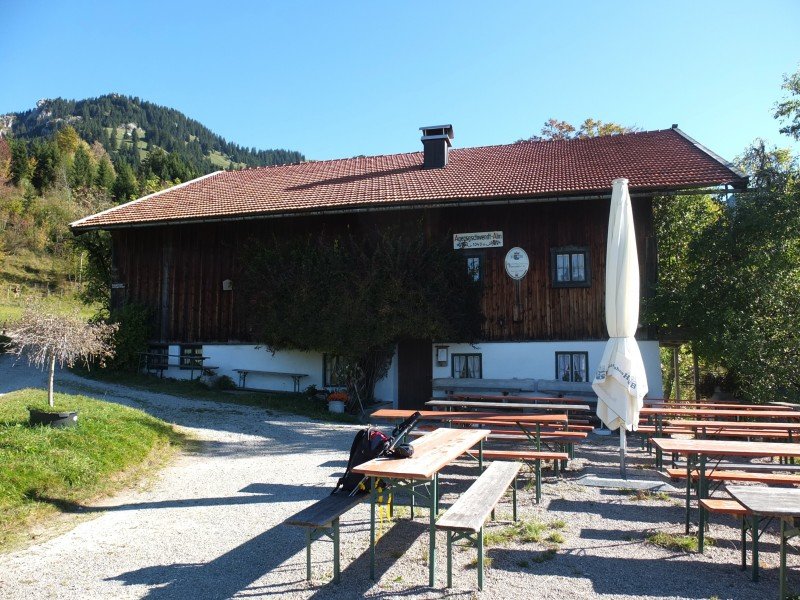
The path continues after Agergschwendt alp. It gets a bit more narrow, but is still relatively easy to walk. Through many turns, the path winds up the mountain until you get a first glimps of the beautiful Chiemgau view. Before you reach Hochgernhaus, you pass Enzianhütte and Moar alp, only a few steps apart.
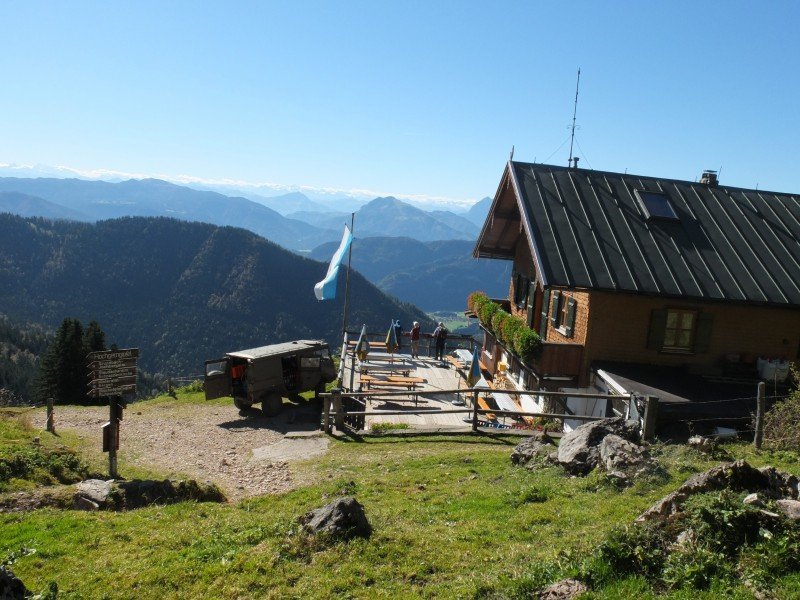
From Hochgernhaus to the Peak
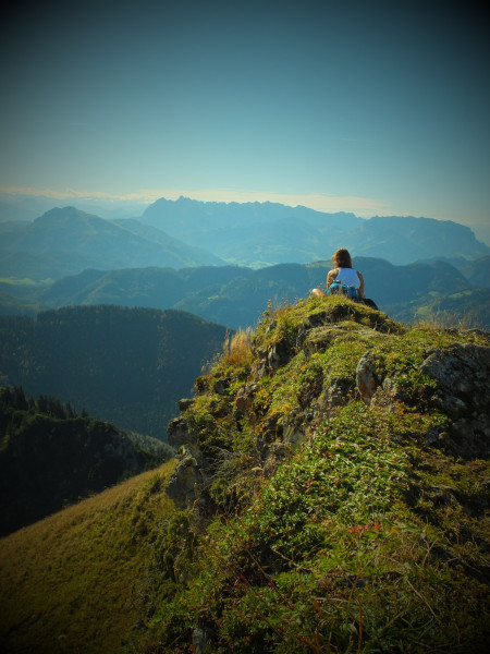
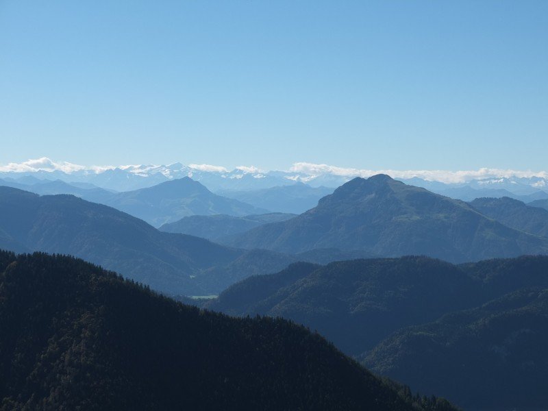
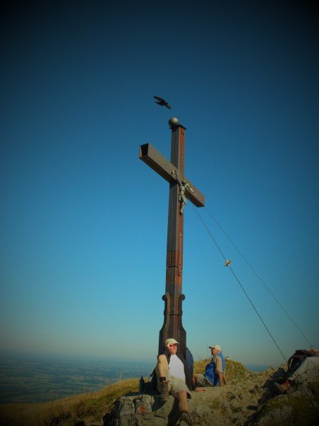
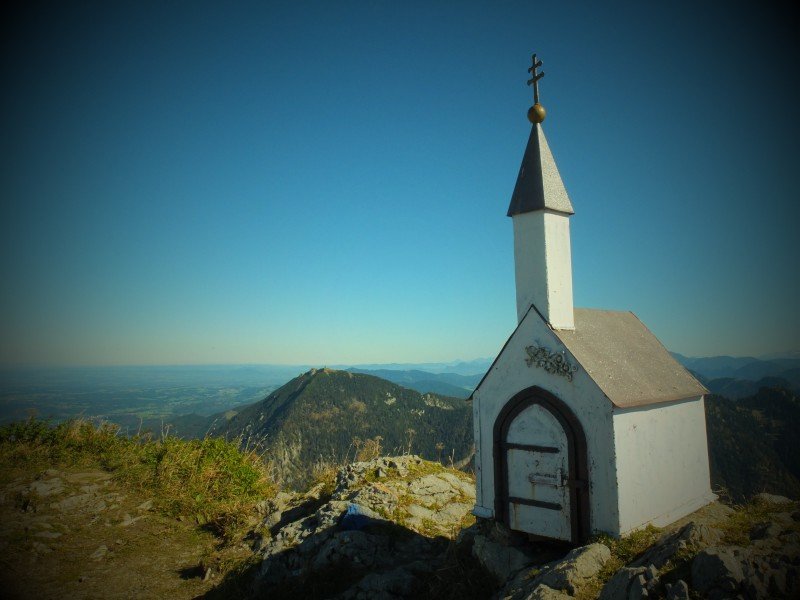
A hiking path leads on from Hochgernhaus. First you ascend continuously until you reach a high plane, and then continue relatively plain. On the way, you enjoy a great view of lake Chiemsee. Continue more steeply up to the summit. You can either go straight to the summit, or walk a few steps to the tiny miniature church. It is only about one metre high, and is home to the summit book. From here as well as from the summit cross, you enjoy a breathtaking view.
Where to eat
- Agergschwendtalm
- Moar Alm
- Enzianhütte
- Hochgernhaus
Interesting facts
- You're traveling a distance of 16 km on this moderate trail. The average length of all hikes in Bavaria is 49 km.
- Elevated between 603 m and 1,734 m, the hike is among the 10 highest elevated hikes in Germany. You're facing an uphill climb of 1149 vertical meters on this hike.
- The trail is one of the dog friendly hikes in the region. (See all dog friendly hikes in Bavaria.)
- Sturdy hiking boots are recommended on this track. There are places to buy beverages and food along the track. However it’s always recommended to bring enough water and food along with you.
Highlights of the tour

The great view over the mountain-scape and lake Chiemsee makes up for the effort.
The miniature church is also worth a visit.
Equipment
Sturdy shoes
Getting here
On motorway A8, exit at Bernau or Grabenstätt, and continue on B305 until Marquardtstein. The castle road leads you all the way to the car park.