Hike From Agergschwendtalm to Mount Hochgern in Chiemgau: Position on map

Webcams around the Hike From Agergschwendtalm to Mount Hochgern (Chiemgau)

From Agergschwendtalm to Mount Hochgern
Advertisement
Moserberg Mountain Kössen
Elevation: 726 m
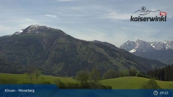
From Moserberg mountain in Kössen, this webcam overlooks the surrounding Alpine landscape.
7 hours ago
Grabenstätt - View to lake Chiemsee
Elevation: 539 m
Have a look at the municipality of Grabenstätt and lake Chiemsee in the background.
5 days ago
Oed - Marquartstein - View to the east
Elevation: 581 m
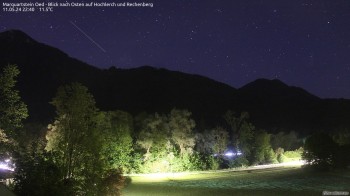
Enjoy the view from Oed in the south of Marquartstein (Chiemgau) to Hochlerch and Rechenberg.
1 hour ago
Unterwoessen - Gliding School
Elevation: 558 m
View of flying field in Unterwoesse. The webcam is located at the rooftop of gliding school.
51 minutes ago
View Oberwoessen
Elevation: 653 m
View over the roofs of Oberwoessen, Chiemgau.
temporarily unavailable
Unterwoessen
Elevation: 553 m
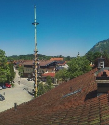
View over the roofs ob Unterwoessen, upper bavaria.
temporarily unavailable
Chiemsee: Chiemgauhof
Elevation: 516 m
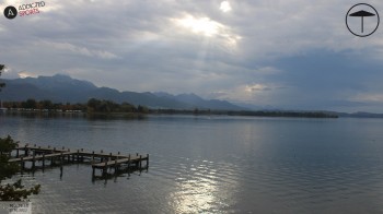
Check out the view from the Hotel Chiemgauhof in Übersee towards the famous lake Chiemsee in Bavaria.
temporarily unavailable
Reit im Winkl, Chiemgau
Elevation: 714 m
Panorama view of the small village Reit im Winkl and the Alps of Chiemgau.
7 hours ago
Golf course Reit im Winkl-Kössen
Elevation: 787 m
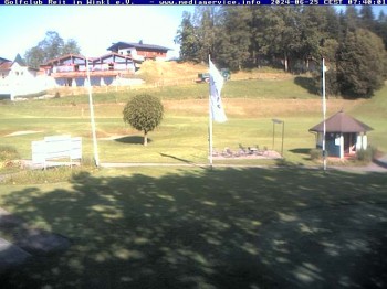
You can see Reit im Winkl/Koessen golf course in the Kaiserwinkl Region.
6 hours ago
Mountain restaurant "Steinberg Alm"
Elevation: 999 m
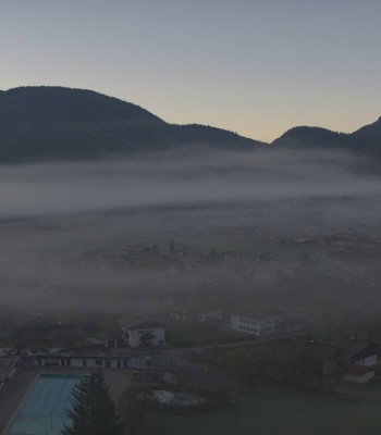
The webcam shows the Miesenbacher valley from the mountain inn Steinberg Alm.
54 minutes ago
Chiemgau Alps: Marquartstein
Elevation: 1,007 m
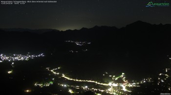
Located at Marquartstein you look in an easterly direction on Hochlerch and Rechenberg mountain.
1 hour ago
Hochfelln mountain (Chiemgau)
Elevation: 1,624 m
Outlook at Hochfelln mountain
temporarily unavailable
Dry Toboggan in Marquartstein
Elevation: 654 m
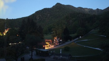
Here you can see the dry toboggan at Märchenpark Marquartstein in Chiemgau.
1 hour ago
Blindau / Reit im Winkl
Elevation: 694 m
The Webcam shows you the lifts Benz Eck in Blindau, a district of Reit im Winkl
temporarily unavailable
View of Reit im Winkl
Elevation: 696 m
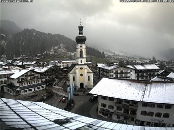
Have a look at the center of Reit im Winkl with the catholic church St. Pankratius
temporarily unavailable

Webcam is Missing

A webcam is missing? Do you know the source of another one?

All Webcams on the map

Webcam Information

  • There are 15 webcams in close proximity of the Hike From Agergschwendtalm to Mount Hochgern. The webcams fall into three groups, namely one live streaming webcam, 4 panoramic webcams und 10 further webcams.
  • The highest webcam (Hochfelln mountain (Chiemgau)) is located at an altitude of 1624 metres, while the lowest one (Chiemsee: Chiemgauhof) is situated at an altitude of 516 metres.
  • Most popular and most viewed/visited webcam: Moserberg Mountain Kössen.
Travel Deals & Tips
Advertisement
Advertisement
Advertisement
Login with Google+
  • Share your personal insider tip and create new entries
  • Explore fantastic outdoor destinations when and where you want
  • Find your dream destination or discover the world on the interactive map