Route description
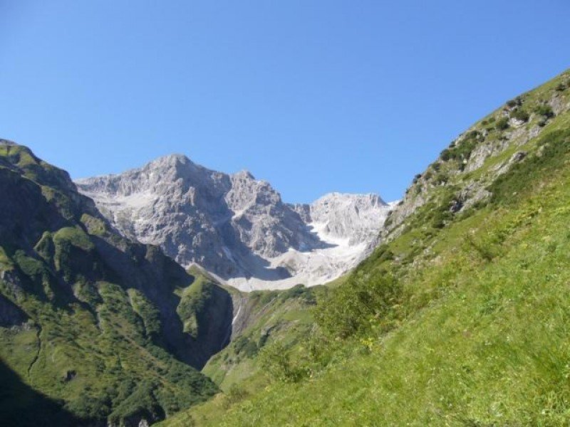
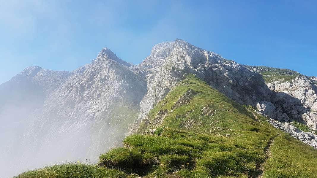
This challenging tour leads from Schröcken to the 2.145 m high "Fürggele". Via the Biberacher hut you get back to Schröcken. In addition to unique views, the hike is especially exciting for those who are interested in history. Part ot the route was also travelled by the "Walser", who inhalbited the area around Schröcken.
From Schröcken to "Fürggele"
You start in Schröcken at the hotel Mohnenfluh and follow the road to the "Alpe Felle". After about 300 meters you will reach a narrow path that leads up in a serpentine manner to the right. Follow this and continue on the right hand side uphill to the waterfalls. Over three peaks you get to the last stepper ascent before you reach the highest point of the tour, the 2.145 m high "Fürggele".
To the "Biberacher Hütte"
From here it goes over moderate ascents and descents, past Hochberg and Rothorn, towards Litahütte. On the way you can already take a look at your next stage destination, the 1.846 meter high "Biberacher Hütte". If you have reached this, you can reward yourself there with a cozy stop.
Back to Schröcken
Then you follow the road downhil to Landsteg. There is a bus stop. You have the option to take the bus back to Schröcken or to follow the path to the right along the Bregenzerache on foot.
Where to eat
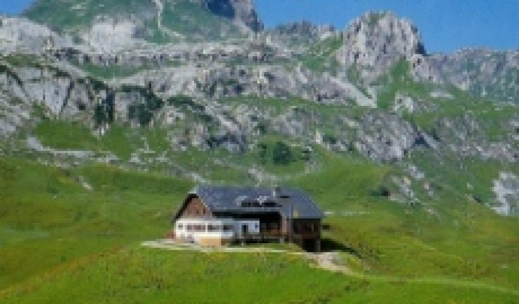
The "biberacher Hütte" is open from mid-June until eary October.
For the day tour you sould take some provisions and enough water with you.
Overnight stays must be reserved in advance at the hut.
Interesting facts
- With an overall length of 15 km the hike is among the 3 longest hikes in Vorarlberg available on TouriSpo.
- Elevated between 1,088 m and 2,136 m, the hike is among the 5 highest elevated hikes in Vorarlberg. You're facing an uphill climb of 989 vertical meters on this hike. This makes the hike one of the 3 hikes with the most ascent in Vorarlberg.
- Sturdy hiking boots are recommended on this track. If you get hungry along the way, there are places to rest and get food. Nevertheless it’s recommended to also have enough water and food in your backpack when hiking or biking.
Highlights of the tour
The challenging tour is especially worthwhile in terms of landscape. At over 2.000 m high you can enjoy unique views. For the ascent to the "fürggele" you need a good level of fitness.
Variations
At the end of the tour, at Schröcken-Landsteg, you can either take the bus back to Schröcken or walk back to the village center.
Equipment
Good hiking shoes and weatherproof clothing are necessary.
Changing clothes is recommended.
Please bring enough provisions with you.
Getting here
By public transport:
Bus number 40a, bus stop: Gasthof Tannberg
By car:
Via the L200: Follow the street to the village center of Schröcken (church).
You can park at the hotel Mohnenfluh (next to the church).