
Route description
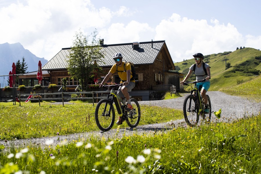
Start of your Biketour
For the 24,5 km long bike tour you start at the Hochtannbergpass. From there you follow the freight road towards Salobersattel. At the next junction you turn right towards Auenfelder Hütte and cycle down the narrow path to the hut. The Auenfelder Hütte invites you to a break.
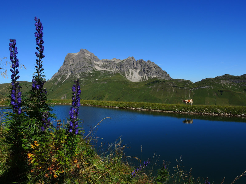
View of the Karhorn
After your stop, the path conitues to the Auenfeldsattel. You cycle through the picturesque Auenfeld on a freight route. On a narrow path you cycle left uphill to the "Gaisbühelalpe". When you get there, you can enjoy an unique view of the Karhorn. Now you have managed the first challenging part of the tour.
Local specialities
After taking a last look at the Karhorn, you drive via Oberlech to Lech and follow the main road for two kilometers towards Warth. During the drive you pass the Bodenalpe. Here you can taste local specialities.
Bürstegg
For the next station you follow the main road another 500 m. At the bus stop "Bürstegg" you turn left. The path to Bürstegg is really challenging. It only climbs slightly and becomes steeper and steeper. From Bürstegg the path leads in direction Wannenkopf and ends at the Steffisalp-Express mountain station.
Unique panoramic views
After you have passed the turnstile, you continue your ride to "Spitziger Stein". There you can see the reservoir and a unique panoramic view of the mountains.
The highest point of the tour - Saloberkopf
Then you continue to the Hochalp Hütte. Here you can take a break before the last climb of your tour awaits you. You cycle uphill towards Saloberkopf. From there the cycle path leads only downhill to the parking lot at the Hochtannberpass.
Where to eat
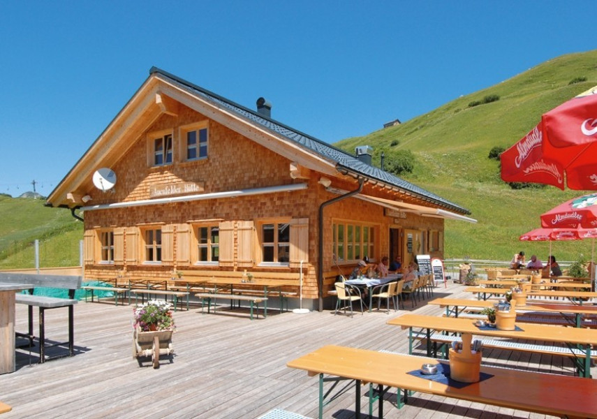
Auenfelder Hütte
Bodenalpe
Hochalp Hütte
Interesting facts
- With an overall length of 25 km the bike trail is among the 3 longest bike Trails in Vorarlberg available on TouriSpo.
- Elevated between 1,431 m and 1,954 m, the bike trail is among the 10 highest elevated bike Trails in Austria. You're facing an uphill climb of 733 vertical meters on this bike trail.
- If you get hungry along the way, there are places to rest and get food. Nevertheless it’s recommended to also have enough water and food in your backpack when hiking or biking.
Highlights of the tour
At an altitude of almost 2.000 metres, the picturesque reservoir is located at the "Spitziger Stein" with an unique mountain panorama. From the reservoir you need 20 minutes walk to the Steffisalp-Express.
Between the Auenfeldsattel and the Gaisbühelalpe the cycle path runs along intersecting fields.