Route description

Starting and finishing point of your tour is Schröcken. Pedestrian safety, dizziness and mountain experience are urgently needed for this hike trail!
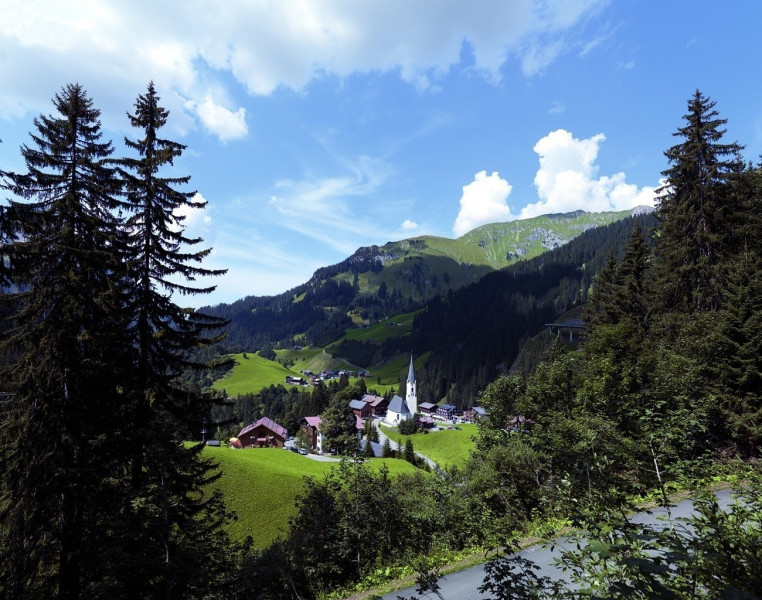
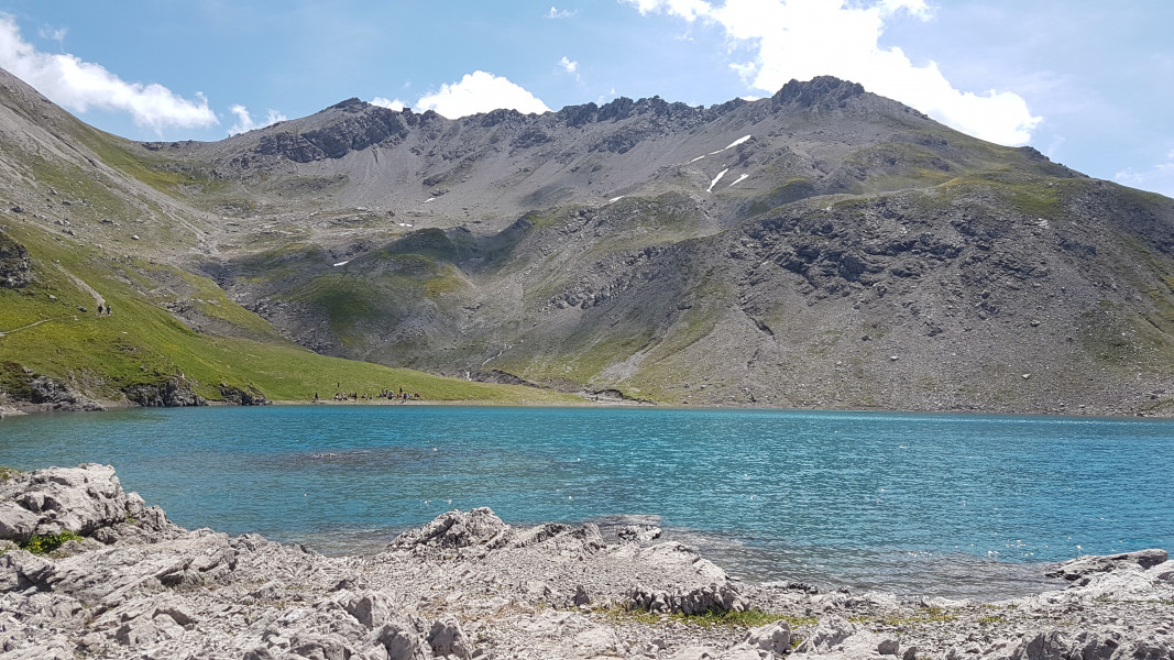
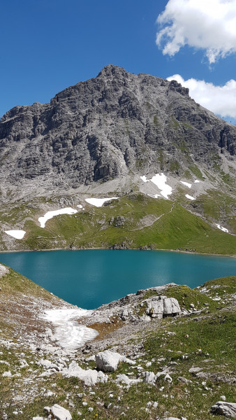
Let’s go! On the highest mountain in the Bregenzerwald – the Braunarlspitze. The challenging and long mountain tour starts in Schröcken-Heimboden. At the beginning, the goods trail leads right from the Hotel Mohnenfluh to the Fellealpe. Passing the cultivated alpine pasture, the path becomes narrower and narrower. When crossing some small mountain streams you can cool your arms a little. At the fork in the path after approx. 1,5 h walk, follow the sign for Fürggele. In front of the rock entrance, you can see the Hochberg directly in front of you and enjoy the beautiful view at an altitude of 2.145 m. The hiking poles should now be stowed in the backpack, from now on you need both hands free to move up on the partly rope-secured rock. After some exposed places, the last piece leads over loose slate rock. It’s done! At the summit cross you can watch blisslully the spectacle of the clouds in the wind. The descent takes place on the south side to the Butzensee. Already from a distance you can see the blue mountain lake with the massive Mohnenfluh summit in the background – a sight that remains in your memory! Via the Jägersteig the path leads back to the Fellealpe and back to the starting point.
Where to eat
For this tour, sufficient provisions and especially drinking water must be taken with you. There are no refreshments on the way.
Interesting facts
- With an overall length of 15 km the hike is among the 3 longest hikes in Vorarlberg available on TouriSpo.
- You're facing an uphill climb of 1449 vertical meters on this hike. This makes the Hike the one with the largest ascent in Vorarlberg. The high point of the hike is located at an elevation of 1,649 m.
- Sturdy hiking boots are recommended on this track.
Highlights of the tour
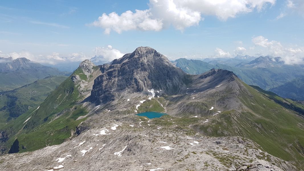
Probably the biggest highlight for every mountaineer who has climbed the Braunarlspitze is the arrival at the summit. The incredible panorama and the refreshingly cool mountain air at over 2.600 m makes all effort forgotten.
The descent via the Jägersteig is challenging, but exciting to go. If you are lucky, you might see a couple of Capricorns.
The view of the turquoise blue Butzensee with the massive Mohnenfluh peak will ramain in your memory. On hot summer days you can cool down and refresh yourself in the lake.
Equipment
For the round trip it is very important that you leave only with good physical condition. Suitable mountain clothing and very good, waterproof footwear are recommended.