

Route description
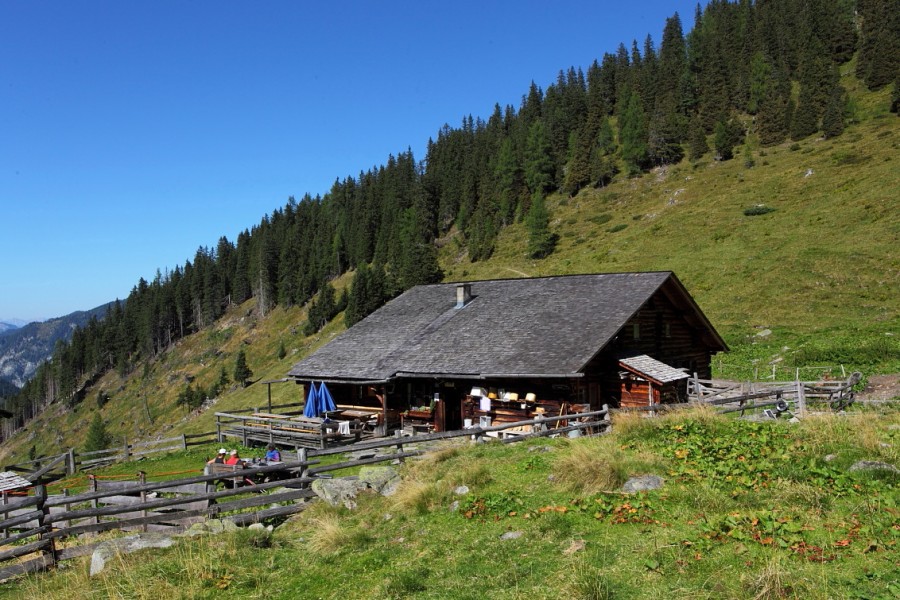
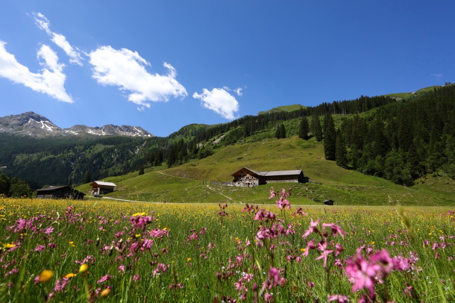
From the centre of Hüttschlag a forest path will lead through the high forest. But you can also walk along the newly built hiking path through the forest. Just before you leave this one, you'll discover a chapel on the right-hand side. This is a place for gratitude and appreciation, encouraging hikers to stop and go into themselves. After that, the way comfortably leads along the stream up to the Hub-Grundalm. Here, the Sennleute will indulge you with home-made delicacies. Hereafter, you'll be passing the Aschauhütte. This is the Heimalm of the Hühnerkaralm. In the autumn, when the grass is high, the Sennleute move from the Hochalm to the Heimalm. Partially, the way leads steeper through the forest to the Hühnerkaralm. Having arrived at the top, you'll be served self-produced delicacies, among which you'll find the indispensable Austrian Jause, consisting of bread, butter, cheese, meat toppings or bacon. To digest all that food you'll be handed a shot of self-distilled schnapps after the meal. In the valley, the Hubalm area is known for its abundance of game. During a hiking tour, you might come across a deer or roe. Especially during the autumn you'll hear the deers roaring.
Interesting facts
- You're traveling a distance of 11 km on this moderate trail. Average length of all hikes in Salzburg is 15 km.
- You're facing an uphill climb of 670 vertical meters on this hike. The high point of the hike is located at an elevation of 1,700 m.
- Sturdy hiking boots are recommended on this track. If you get hungry along the way, there are places to rest and get food. Nevertheless it’s recommended to also have enough water and food in your backpack when hiking or biking.
Highlights of the tour
Especially during the autumn you might witness a deer crossing your way.
Equipment
Hiking footwear with slip-proof profile soles, map (Tappeiner no. 311)