 in the Black Forest: Position on map")

Route description
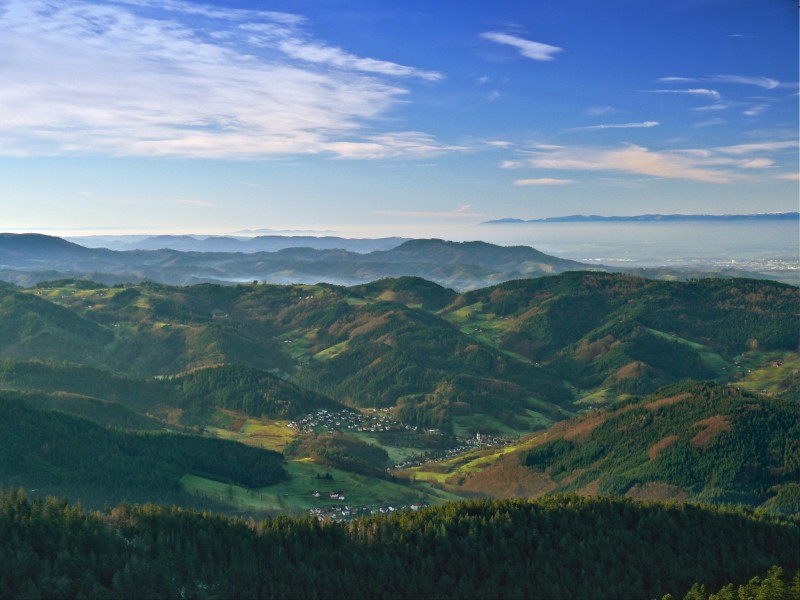
The Westweg is one of the most well-known long-distance hiking trails in Germany, stretching over about 290 kilometers through the impressive Black Forest. It is divided into a Western and an Eastern variant. The Western variant traverses all the scenic facets of the Black Forest. From the deep coniferous forests in the north, across vast high plateaus in the center, to the highest peaks in the south, such as Feldberg (1,493 m), Belchen, and Blauen. The trail is marked with the distinctive red diamond and offers impressive natural experiences, cultural highlights, and physical challenges at every stage. Overall, the trail is divided into 12 stages.
Across the Black Forest
The journey begins in Pforzheim, where the trail winds through dense forests and quiet valleys of the Northern Black Forest, reaching Dobel. From there, it continues deep into the Black Forest, passing dark fir forests and stunning viewpoints, reaching the historic Forbach with its famous wooden bridge. Through the Grindenschwarzwald, the trail climbs up, passing moors and steep paths, accompanied by the rugged climate of the higher elevations.
Crossing the main ridge of the Northern Black Forest, hikers reach the Hornisgrinde, enjoy Mummelsee, and finally reach Alexanderschanze. The trail then leads through quiet forests, past the mystical Glaswaldsee, and through impressive rocky landscapes. Over the Brandenkopf with a wide view of the Kinzig Valley, hikers continue into the upper Kinzig Valley and finally reach Hausach, the gateway to the Central Black Forest.
The Toughest for Last
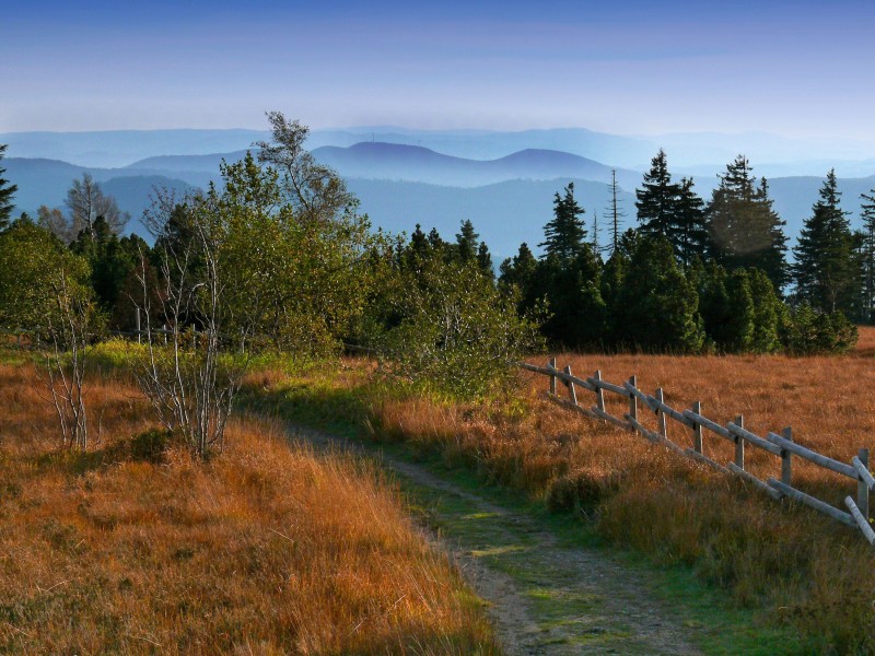
From the Kinzig Valley, the Westweg climbs steeply and reaches a scenic highlight at Karlstein on the way to Schonach. Gentle high plateaus, vast forests, and the view from Brend characterize this calm yet captivating stage. The western route begins here, leading over scenic ridges, and ends at the picturesque Titisee.
The king’s stage leads over Feldberg, the highest peak in the Black Forest, and rewards hikers with an almost alpine panorama. Through sunny ridges and quiet forests, the route crosses Belchen and Blauen before descending to the foot of the Black Forest at Kandern. The final stage takes hikers through the tri-border region, past the Rötteln castle ruins, through vineyards and urban greenery, all the way to Basel.
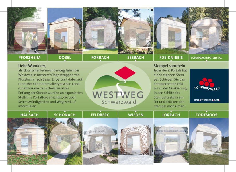
The 12 Stages at a Glance
| Stage | Distance | Duration |
|---|---|---|
| Stage 1: Pforzheim - Dobel | 26,1 kilometers | 7:00 h |
| Stage 2: Dobel - Forbach | 22,4 kilometers | 6:30 h |
| Stage 3: Forbach - Unterstmatt | 19,6 kilometers | 6:00 h |
| Stage 4: Unterstmatt - Alexanderschanze | 27,8 kilometers | 8:30 h |
| Stage 5: Alexanderschanze - Hark | 17,1 kilometers | 5:00 h |
| Stage 6: Hark - Hausach | 15,6 kilometers | 4:43 h |
| Stage 7: Hausach - Wilhelmshöhe | 21,4 kilometers | 7:30 h |
| Stage 8: Wilhelmshöhe (Schonach) - Kalte Herberge | 22,42 kilometers | 6:30 h |
| Stage 9: Kalte Herberge - Hinterzarten | 25,9 kilometers | 7:30 h |
| Stage 10: Hinterzarten - Wiedener Eck | 26,5 kilometers | 8:30 h |
| Stage 11: Wiedener Eck - Kandern | 32 kilometers | 8:00 h |
| Stage 12: Kandern - Basel | 26,1 kilometers | 7:30 h |
Where to eat
The trail mostly runs away from towns, so the number of dining options and hotels along the way is limited. However, there are some accommodation options in nearby villages. You can obtain more detailed information from the Black Forest Association.
Interesting facts
- With an overall length of 288 km the hike is among the 5 longest hikes in Germany available on TouriSpo.
- Elevated between 234 m and 1,487 m, the hike is among the 15 highest elevated hikes in Germany. You're facing an uphill climb of 7889 vertical meters on this hike. This is quite much. You should be fit to do this track. This makes the hike one of the 5 hikes with the most ascent in Germany.
- You shouldn’t forget to bring your hiking boots. There are some sections on the trail where sturdy footwear is required. If you get hungry along the way, there are places to rest and get food. Nevertheless it’s recommended to also have enough water and food in your backpack when hiking or biking.
Videos
Highlights of the tour
From the historic wooden bridge in Forbach, across the moorland plateaus of the Grindenschwarzwald, to the legendary Glaswaldsee, the trail offers several highlights. It passes over Black Forest peaks such as the Hornisgrinde, Belchen, and Feldberg. Breathtaking panoramas, quiet forests, and cultural landmarks like the Rötteln castle ruins make this trail a wonderful hike.
Equipment
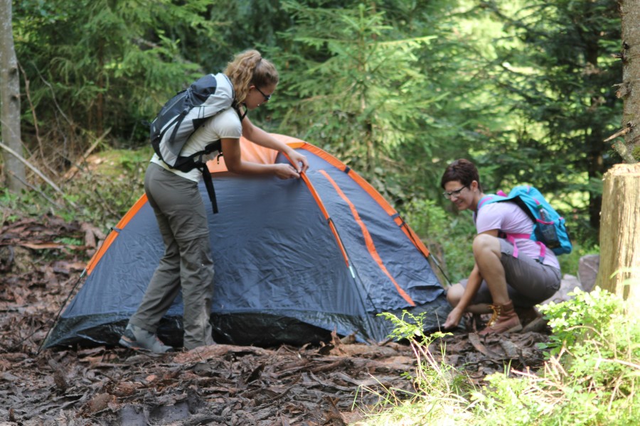
Those who prefer not to stay in one of the remote dining spots should bring equipment for independent camping.
Getting here
By Car
There are several parking options in Pforzheim. However, there isn't a single starting point, so various parking lots can be used.
By Public Transport
Pforzheim's main train station is centrally located and accessible by several long-distance trains. It is also reachable by the S5, S6, RE 1, RB 74, and MEX 17a lines.